Curated OER
Where in the World Is ...?
Learners move themselves around a "world" map on the classroom floor, using lines of latitude and longitude to locate specific spots. They determine the locations of 11 countries where Peace Corps Volunteers are serving and identify in...
Curated OER
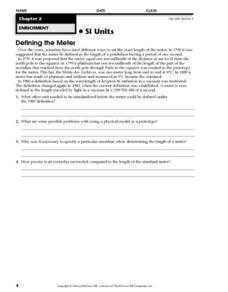
Defining the Meter
In this length worksheet, learners read about the history of a meter. Students also answer 4 comprehension questions about the reading.
Curated OER
Investigating Latitude and Longitude
Students examine the lines of latitude and longitude on a map, and explain why these lines might be useful. In this lesson students also explore websites that provide information to improve their understanding of how and why latitude and...
Curated OER
Latitude and Longitude
Learners demonstrate how to locate places on a map using a grid. In this map skills lesson, students are introduced to latitude and longitude lines. Learners define these terms and view a large map of a state. Students come up to the map...
Curated OER
Philanthropy in Your Community
Students brainstorm how an action to benefit others is a type of philanthropy. They
identify the commonwealth approach to philanthropy,
plan and carry out a philanthropic action in their community and
reflect how their action qualifies...
Curated OER
Compass Rose
Students describe the movement of the Earth as it relates to the sun. They construct a permanent compass rose and use it to find directions.
Curated OER
Finding the Way
Students identify and research navigational tools used in deep sea explorations. They are introduced to a compass, the Global Positioning System and sonar technology and then describe their uses in underwater exploration.
Curated OER
Our 50 States
Students identify the location of the 50 states using an interactive map. They practice geography skills by playing a fun game. Pupils become familiar with the state abbreviations for the US states. Students become familiar with the...
Curated OER
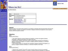
Where Are We?
Students use Cartesian coordinates or degrees of latitude and longitude to locate important locations within their specific countries. They Use a grid to apply the concept of latitude and longitude, or positive and negative Cartesian...
Curated OER
Giving Students a Little Latitude
Students use a world outline map to locate places using coordinates of latitude and longitude. They answer questions about places based on their knowledge of the map and on their research and make up more questions of this sort for each...
Curated OER
Degrees and Minutes
In this latitude and longitude worksheet, students place 9 cities on a map using the latitude and longitude of each. Once cities are placed in the correct location, students complete 2 short answer follow-up questions.
Curated OER
Early Explorers
Fifth graders investigate the routes taken by the early explorers. In this explorers instructional activity, 5th graders use interactive notebooks, discussion and maps to discover the routes taken. Students get into pairs and label maps,...
Curated OER
I'm Still Scared: The War Years
Students read the story I'm Still Scared: The War Years, complete discussion questions, and activities about the book. In this war book lesson plan, students keep journals, write about being frightened, have a war veteran visit their...
Curated OER
Sky Time: On the Astronomical Meaning of the Day, Year and Seasons
Young scholars simulate the movement of the Earth using their body motion. In this earth science lesson, students explain how this causes seasonal changes on Earth.
Curated OER
The Mathematical Dynamics of Celestial Navigation and Astronavigation
Young scholars explore the different methods used in celestial Navigation and astronavigation. In this math lesson, students construct a sextant and demonstrate how it works.
Curated OER
Nebraska Crossword
In this crossword puzzle worksheet, students read the phrases associated with Nebraska. Students complete the puzzle with 10 words about Nebraska.
Curated OER
Globe Lesson 6 - Longitude - Grade 6+
In this longitude worksheet, middle schoolers read a 3-paragraph review of longitude and respond to 13 short answer questions.
Curated OER
What Time Is It? (Latitude and Longitude)
Pupils practice latitude and longitude by identifying locations by degrees, use meanings of a.m. and p.m. appropriately, become familiar with 24-hour (universal) clock, and calculate time at different degrees longitude.
Curated OER
Making a Globe
Students participate in a creative project where they construct globes. They label specific places on the globe that helps them learn how to read an actual globe.
Curated OER
Learning About the Globe
Students examine the following terms to increase their geography skills: globe, equator, prime median, Western Hemisphere, Eastern Hemisphere, Northern Hemisphere, Southern Hemisphere, Pacific Ocean, Atlantic Ocean, and The United States.
Curated OER
Globe Lesson 4 - Intermediate Directions
Students explore the concept of intermediate directions. In this geography skills lesson, students use map skills in order to identify intermediate directions as they complete a map activity.
Curated OER
The Global Grid System-World Map Activity
Students demonstrate how to use the global grid system. In this map skills activity, students use a world map to locate various locations. Students identify locations based on the global grid system. Students complete a worksheet as an...
Curated OER
Lesson Plan on Latitude and Longitude
Sixth graders identify at least ten places on the world map using given longitude and latitude points. They identify the longitude and latitude of ten places on the world map.
Curated OER
Geology Word List
In this science worksheet, students review the vocabulary words for the separate categories related to the concept of geology.
Other popular searches
- Prime Meridian
- Prime Meridian and Equator
- Parallels and Meridians
- Label Equator Prime Meridian
- Equator Prime Meridian
- Map Skills Prime Meridian
- Equator, Prime Meridian
- Meridian and Prime Meridian
- The Prime Meridian
- Meridan and Prime Meridian
- Magellan Gaps Meridian Gold
- Magellan Gpss Meridian Gold


