Curated OER
Distances Between Houses
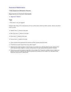
This resource sneaks in the math so your learners will be adding and subtracting positive and negatives on a number line while thinking they are mapping out houses. The activity starts by putting houses the appropriate distance away from...
Curated OER
The Path of the Black Death
Young scholars analyze maps, firsthand accounts, and archival documents to trace the path and aftermath of the Black Death. Connections between the plague and changes adopted by the ruling class are explored in this lesson.
California Academy of Science
Earthquakes and Tectonic Plates
Here is a comprehensive package in which middle schoolers learn about types of seismic waves, triangulation, and tectonic plate boundaries. Complete vocabulary, colorful maps, and a worksheet are included via links on the webpage. You...
Curated OER
Religions of the World
In this world religions map worksheet, learners note the 12 regions of the world and the religious beliefs practiced by the majority of people in those regions.
Curated OER
Salt of the Earth: A Caddo Industry in Arkansas
Middle schoolers explore the history of the Caddo Salt Industry found in Arkansas. Along with learning about how salt deposits formed in Arkansas, learners study the process of salt production and how valuable salt is as a natural...
Mr. Head's 6th Grade Classroom
Absolute Location
How do we know where we are in the world? A presentation for middle schoolers explains absolute location and other geography terms such as relative location. It also gives scholars the opportunity to practice finding absolute location on...
Curated OER
Ooooh, The Oud
Young scholars listen to a performance of the instrument, oud. After watching a video, they discover how many parts of the world it is used in and locate the countries on a map. They compare and contrast the oud with other instruments...
Curated OER
Iraq, Where's That?
Young scholars identify the Middle Eastern countries on the map and the oil-producing countries of OPEC in the region. They examine whether the presence of important producing oil fields qualifies as a characteristic of this region.
Curated OER
Roman Empire: Physical Framework - Location, Borders, Dimensions
Students relate the classical world to the modern world. In this map skills lesson, students turn a blank map into a colorful complete map by following step-by-step directions. This lesson allows students to connect our current geography...
Curated OER
Sub-Saharan Africa: Physical Geography
In this geography skills worksheet, students respond to 22 short answer and map skills questions about the location and geographic features of sub-Saharan Africa.
National First Ladies' Library
Terrorism and Tolerance
Students define the concepts of terrorism and tolerance using various resources. They examine the concept of stereotype, consider stereotypes often applied to Arabs, Middle Easterners, and Muslims, and attempt to discredit these...
Curated OER
EU and Turkey
Should Turkey be admitted to the European Union? Before debating this question, class members research the background and stated purpose of the EU, read articles of Turkey's bid to become a member of the EU, and the concerns other...
Curated OER
River to the Sea
Students investigate the function of wathersheds and weather while they follow Lewis and Clark on their jouney west. They also create a map using acurate measurements and build a model watershed.
Curated OER
The Path of the Black Death
Students are able to show on a map how the Black Death moved through Europe. They summarize the direct effects of the Black Death in Europe. Students cite evidence from firsthand accounts in developing an argument that connections can,...
Curated OER
Marco Polo Takes A Trip
Students identify Marco Polo and discuss why he took his trip, indicate on map routes Marco Polo took to China and back, describe challenges of traveling along Silk Road, list several interesting aspects of 13th Century Chinese culture,...
Curated OER
The Economic Differences Between the North and the South Prior to the Civil War
Seventh graders identify and explain the economic differences between the North and the South incorporating photographs and a Venn Diagram to interpret the two sides. They complete a KWL and T-chart to assist them with their task for the...
Delegation of the European Union to the United States
The Geography of Europe
What is the European Union? Where is it? Why is it? To begin a study of the EU, class members examine the physical geography of Europe and the size and population density of 28-member countries in comparison to non-member countries like...
Curated OER
How 9/11 Shaped U.S. Foreign Policy
Students discuss the U.S. foreign policy and the components they consider important. They read and discuss President George W. Bush's speech of November 10, 2001. Students locate and mark countries President Bush identified in his speech...
Curated OER
Children's Crusade
In this geography activity, students read an excerpt about the Crusaders compromised of two of children. They use the map given to determine how far apart each army marched before reaching the Mediterranean Sea. In addition, students...
Curated OER
Under the Sea
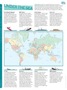
In this ship wreck worksheet, students read the information beneath each famous wrecked ship. Students then draw a line from the picture of the ship to the point on the map where it currently rests under the sea..
Curated OER
Ramadan (Islamic Holiday)
Learners recognize that different groups of people have celebrations unique to them. They identify countries on a map where Islam is a dominant religion. They demonstrate their understanding of fasting and abstinence.
Curated OER
Sports Franchises: The Demographic Dimension
Students examine how U.S. population patterns have changed over time. Using the growth of major league baseball to illustrate these patterns, students create maps, examine regional migration patterns, and make predictions for the future.
Curated OER
Religious Crusades
In this religious Crusades activity, students respond to 2 questions that require them to write paragraphs about the effects of the Crusades. Students also examine a map of the wars and respond to short answer questions.
Curated OER
What the Empire Lost: The Ottoman Empire
In this Ottoman Empire activity, students read a 1-page selection about the decline of the empire, examine the provided map on the topic, and then respond to 5 short answer questions about the information presented.
Other popular searches
- Blank Middle East Maps
- Maps of the Middle East
- Middle East Maps Trade
- Ancient Middle East Maps
- Medieval Middle East Maps
- Middle East Maps Puzzles
- Maps Middle East


