Curated OER
Seasons Worksheet #3
A diagram outlining the geocentric view of the sun's path across the sky tops this earth science worksheet. Learners label the zenith and determine the latitude from which this view is taken. It is a compact worksheet, but it may be...
Curated OER
Understanding Topographic Maps
Underclassmen create a cone-shaped landform and then draw a contour map for it. Then they examine a quadrangle (which was easily located with an online search), and relate it to what they experienced. The accompanying worksheet is...
Curated OER
Orienteering - Lesson 4 - Distance and Height
Pretend that you've been dropped onto a mountain, in the middle of nowhere, and all you have to find your way is a topographical map and a compass. Could you find your way to the nearest town? Orienteering teaches the skills of map...
Curated OER
U.S. History: What Happened Here?
Students apply the global positioning system to create maps of local historical sites. By collaborating with local historical groups, they research events and relate them to broader, national history. In addition to writing essays...
Curated OER
Globe Skills Lesson 5
In this map skills worksheet, learners read a text selection about locations during the American Revolution and then respond to 8 fill in the blank questions.
Curated OER
Rubber Duckies and Ocean Currents
Students explore marine life by conducting a rubber duck experiment. In this water currents lesson plan, students practice identifying latitude and longitude coordinates on a map and define the currents of major oceans. Students discuss...
Curated OER
The Atmosphere
Here is a suitable set of slides to use when teaching about the layers of the atmosphere, climate, global winds, and types of clouds. These slides will support a few different lectures. You will probably want to replace the diagrams with...
Curated OER
Map Coordinate Bingo
Students play a bingo-type game to locate cities by coordinates. They explain the use of orientation on a map and identify cities in the western hemisphere. They compare road maps, shutttle images, and a CIR image and obtain an...
Curated OER
Geometry: Mountain Rescue Mission
Fifth graders improve their skills using map coordinates by playing a mountain rescue game. In pairs, they roll dice to determine their moves up a mountain. The team that reaches the rescue site in the shortest distance on the grid...
Curated OER
Chuuk Introduction (Middle School)
Students pretend they are visiting a relative in the Chuuk nation of Micronesia. Using their knowledge of the 4th of July, they compare and contrast the holiday to the Chuuk's independence day. They create travelogues that outline...
Curated OER
Five Themes of Geography and Current Events
Basically, pupils look for a current world event from a reputable source and identify the five themes of geography within it. Throughout the school year, they keep a notebook of these current events. A grading guideline is outlined, and...
Curated OER
Globe Skills Lesson 8 Dust Bowl Travelers
Students develop their globe and map skills, In this geography lesson, students examine the Dust Bowl as they complete an activity that requires them to plot latitude and longitude.
Curated OER
Beach Sands of the World
Students examine a variety of sand samples from throughout the world. On an index card, they write the characteristics of the sand and draw what the grains look like to use during the activity. Using a map, they practice plotting...
Curated OER
Location of Cities 201
Students work in pairs to locate the ancient cities on a world atlas using the longitude and latitude measurements. They examine the physical and human futures that explain their locations.
Curated OER
Identifying Ozone Variations over Different Locations
Students analyze ozone data. In this atmosphere lesson, students will use a NASA resource to gather data for different regions of the Earth. Students will then create a graph for their data and answer related questions.
Curated OER
Glaciers Worksheet #1
The landscape impacted by glacier activity is drawn at the top of this worksheet. Ten multiple choice questions follow, some relating to the diagram, and some about the quality of soil left by glaciation. It is not often that you come...
Curated OER
Baseball Challenge - Basic Geography Skills
A fabulous presentation/activity based on geography. The author has designed a "baseball game" where batters advance to the next base if they correctly answer a multiple choice question about geography. Geographic terms are used, along...
Curated OER
Japan: Land of the Rising Sun
Students locate Japan on a globe, name the major physical features, and describe the physical environment. They survey the differences and similarities between the life and culture of Japanese young people and American young people.
Curated OER
Humongous Vegetables
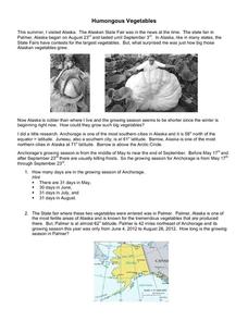
Humongous vegetables can inspire and awaken your mathematicians to the large math concepts in our Common Core standards. What is the secret to growing such gargantuan garden objects in Alaska? In the state that is closest to the North...
University of Colorado
Phases of Charon
Pluto, although no longer considered a planet, has five moons. Pluto's moon, Charon, is the focus of a resource that describes how the moon is viewed from the surface of Pluto. Photos help individuals see how Charon would look at...
Curated OER
Plotting Earthquakes
Young scholars plot earthquakes on a map. In this lesson on earthquakes, students will explore recent earthquake activity in California and Nevada. Young scholars will plot fault lines and earthquake occurrences on a map.
Curated OER
Early Russian History
While not heavy in text, the vivid images, maps, and key information in this slide show, are sure to hold an audience. They'll view images of geography, buildings, and people who are apart of early Russian History. Use the presentation...
Stanford University
Solstice and Equinox Season Model
How can December 21 be the shortest day of the year when all days are 24 hours long? Pupils see how to build a model showing the differences between winter and summer solstices and equinoxes. Using this model, classes can then discuss...
Curated OER
(S-1B) Global Climate, Global Wind Flow
Students discuss how the horizontal transport of heat from equatorial regions polewards drives global wind systems.


