Curated OER
Images of Katrina
Students use maps and online data to find specific geographic areas. In hurricane Katrina lesson plan students use aerial photographic imagery to see some impacts of hurricane Katrina.
Curated OER
Do You Need a Map?
Students explain ways marine navigation is important in modern society. For this map study lesson students use a retrieval tool to obtain real-time information on weather forecasts.
Curated OER
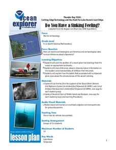
Do You Have a Sinking Feeling?
Learners explore how marine archaeologists use data to draw inferences about shipwrecks. In this marine archeology lesson students plot the position of a vessel, draw inferences about a shipwreck and explain the possible circumstances...
Curated OER
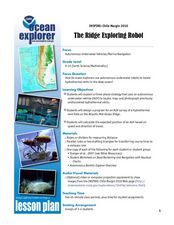
The Ridge Exploring Robot
Students study about an autonomous underwater vehicle and explain the strategies that it uses to locate and map hydrothermal vents. For this marine navigation lesson students design a program for an AUV survey.
Curated OER
Seals, Corals, and Dollars...
Students explore the interdependence of animals and their habitat. In this Hawaiian ecology lesson, students work in groups to research the necessity of preserving precious coral as a habitat for monk seals. Students prepare and share...
Curated OER
Lost at Sea: The Search for Longitude
Young scholars research and chart the shortest course to circumnavigate the globe.
Curated OER
Route Reconstruction
Students trace sailing route of Spanish and Portuguese exploration ships. They calculate and compare distances that different explorers traveled. Students calculate how long it would take to travel an explorer's route using different...
Curated OER
Mapping the Ocean Floor
Students study the bottom structure of underwater habitats and how they can be mapped.
Curated OER
Hawaiian Bowl!
Students describe the movement of tectonic plates in the Hawaiian archipelago region. They describe how a combination of hotspot activity and tectonic plate movement could produce the arrangement of seamounts obse
Curated OER
Lights in the Deep
Young scholars describe, compare, and contrast bioluminescence, fluorescence, phosphorescence, and chemiluminescence. They explain the role of three major components of bioluminescent systems. They ex
Curated OER
Seals, Corals and Dollars
Students described the ecological relationships between Hawaiian monk seals and deep-water precious corals. They describe and explain at least two different viewpoints on how monk seals and precious coral resources
Curated OER
Currents: Bad for Divers; Good for Corals
Students describe, compare, and contrast major forces that drive ocean currents. They discuss the general effects of topography on current velocity. They discuss how velocity affects the ability
Curated OER
Law of the Sea/ Don't Rock the Boat
Students read Ronald Reagan's December 27, 1988 proclamation about US territorial waters. They discuss its contents to decipher exactly what it means and to complete a worksheet answering questions about the proclamation.
Curated OER
Conversions at Sea
Students demonstrate problem solving skills. Students complete word problems requiring unit conversions. They convert both metric and standard units. Students must determine necessary information to solve problems.
Curated OER
Plotting Wind Speed and Altitude
Students construct, read and interpret tables, charts and graphs. They draw inferences and develop convincing arguments that are based on data analysis. They create a graph displaying altitude versus wind speed.
Curated OER
Teaching About Trade in the Ancient Mediterranean
Sixth graders examine the trade routes in the Mediterranean of the Ancient world. In groups, they view slides of artifacts while answering questions on a worksheet. After watching a video, they discuss how each object was found and...
Curated OER
How Many?
In this measurement worksheet, students complete a 12 question multiple choice online interactive assessment about standard modern and ancient measurement.
Curated OER
Wind
Students complete activities to study wind intensity. In this wind study lesson, students discuss wind speed and direction. Students then build a kite and windsock to help them study wind intensity. Students learn to use a wind meter for...
Other popular searches
- Nautical Charts
- Nautical Equipment
- Nautical Miles
- Nautical Flags
- Nautical Navigation
- Nautical Art Themes
- Cruise Ship Nautical Terms
- Nautical Profiles
- Nautical Charting
- Nautical Expressions


