Curated OER
My Community
Students identify how their school has changed. In this local community lesson, students listen to a brief history of their town and school and interview someone that graduated from their school. Students then create a map of their...
Curated OER
Locating Points Using Cartesian Coordinates
Students discover coordinates as they explore Chicago. In this math lesson plan, students give the coordinates of a point, plot a point, and use the coordinate system in locating places on a map.
Curated OER
Discovering the Local Community
Third graders create a mini-atlas of the human and physical characteristics of their local community, which includes landforms, climate, vegetation, population, and economics. They use nonfiction map-related resources to obtain ...
Curated OER
The Solar Neighborhood within 17 Light Years!
In this distance between stars worksheet, students plot the distance between the sun and 11 other stars on a 2 dimensional grid using a protractor and a ruler. They determine the distances between various stars and they find the shortest...
Curated OER
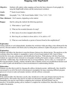
Mapping With MapPoint
The class is engaged through a discussion of mapping. They determine what they believe makes a good map and what the essential elements of a map are. Students work independently to complete a worksheet on mapping. They follow clear...
Curated OER
Math: A Geometric Neighborhood
Students, as a final project, draw a picture of their ideal neighborhood on a sunny day. In addition to the sun, their drawings include homes, trees, streets, and selected objects. Each object in their drawing has a written description...
Curated OER
Murals in my Neighborhood
Students use rubrics to grade murals in their city. In this mural design lesson, students learn about the design of murals and explore their city to find murals. Students grade the murals based on design and representation of the city...
Curated OER
Does Conflict Shape Nations? The Middle East
Students locate settlements and observe patterns in the size and distribution of cities using maps, graphics, and other information. They explain the processes that have caused cities to grow.
Curated OER
4-H Citizenship Activity Page
Using this activity to explore citizenship, learners evaluate the importance of positive participation in their community, neighborhood and country. The 15 questions in this worksheet relate to jobs in the community.
Curated OER
Building a School Model: An Academic Challenge
First and second graders explore aspects of design. They discuss and design the ideal classroom building complete with window and door placement. Additionally, students observe and note features found in neighboring classrooms as...
Schools Linking Network & Lifeworlds Learning
How Do We All Live Together?
Explore the concepts of community and point of view with these activities complementing the children's book Voices in the Park by Anthony Browne. Following a class reading of the story, ask students to either draw a map of the...
Curated OER
From There To Here...
Students find out where some of the products in hour homes come from, then become aware of our local trash, landfills and incinerators. They chart and graph data and use maps for different purposes.
Curated OER
1880s Agricultural Nation: Foods and Families on the Move
Students complete activities to learn about the agriculture during the 1880s. In this agricultural history lesson plan, students discuss the brainstorm questions about their neighborhood and its agricultural history. Students research to...
NOAA
Why is Hawaii's Ocean Important?
Studying the oceans? Focus on Hawaii's ocean with a resource packed with activity-based worksheets. Everything from products that come from the ocean to the abundance of plants and animals that call the ocean their home, Hawaii's ocean...
Curated OER
Finding Your Spot in the World
Young scholars learn the concept of movement by locating their house and the houses of their ancestors.
Curated OER
The People and Places Around Us
Students investigate the different kinds of habitats for humans, animals, and things. They illustrate the interior and exterior views of their homes. Finally they create a map key and a block map of their school neighborhood.
Curated OER
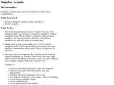
Number Scouts
Students become aware of numbers within their communities. They search for numbers in their neighborhood.
Curated OER
Finding Your Spot in the World
Students investigate a world map, a United States map, a state map, a county map and a city map. They locate each student's house on the city map and put a length of yarn from their house to a country of one of their ancestors.
Curated OER
Any Town, USA
Students launch an investigation of their home town by creating a mental map and examining the livability factors from their perspective. After completing their map, students write a brief description of their town
Curated OER
Natural Features as a Resource
Students research how people use land and water features to meet their basic needs. In this natural features lesson, students review land and water features. Students discuss how the land is used to meet needs using a landscape picture...
Curated OER
Sense of Place
Students identify the major folk regions of Louisiana and the relationship between folklife, geography, and ecology. They give deeper thought to what makes their own community unique, what their sense of place actually is. Students...
Curated OER
Sky 3: Modeling Shadows
Learners will construct models to demonstrate their understanding of shadows. Many questions and suggestions for variants on the activities are presented to allow you to tailor this lesson to your particular needs. It is best to make the...
Curated OER
An Erosion Survey
In this erosion worksheet, students draw a map of their school ground or neighborhood, mark examples of weathering and erosion, and list the examples on spaces provided. A chart with examples of different types of weathering and erosion...
Curated OER
HISTORICAL AND SOCIAL SCIENCES ANALYSIS
Students examine a variety of maps and documents to identify physical and cultural features of neighborhoods, cities, states, and countries, to explain the historical migration of people, expansion and disintegration of empires, and the...


