Curated OER
How Deep is the Ocean
Students predict and then analyze the layout of the tectonic plates that form the ocean's floor using mapping skills and Inquiry based problem solving, They compare the depth of various regions in the ocean with the geologic age to...
Curated OER
United States Map- Land Elevation
Students explore a physical map. In this map skills lesson, students discuss examples of elevation and investigate the symbols used to identify elevation on a map. Students use the map to identify various land elevations.
Curated OER
Sunken Slave Ship
Students investigate shipwrecks. In this marine archaeology lesson, students create the site of a shipwreck by using a tub filled with sand and items from a "ship". Students excavate the site and analyze the findings.
NOAA
Technology II
Ping, ping, ping. The last installment of a 23-part NOAA Enrichment in Marine sciences and Oceanography (NEMO) program explores technology use in marine studies, such as sonar. Activity involves simulating sonar techniques to identify a...
Curated OER
Oceanography
Fifth graders study the topography of the ocean floor. They determine its ever changing nature as they examine currents and trade winds. They write paragraph describing how the winds might affect land formations after the discussion of...
Curated OER
TOPSY TURVY MAPS
Eighth graders use the data analyzer and motion detector to collect data and measure distances. They create topographic maps drawn to scale of a given setup and relate the concepts to the creation of historical ocean maps.
Curated OER
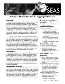
Mapping the Unknown
High schoolers explain how early maps of the ocean bottom were made. They describe and execute a method for producing a low-resolution map of a surface that cannot be seen or touched. Students analyze the data from a mapping activity and...
Curated OER
The Rocks Under Illinois
The goal of this fine geology lesson is to have learners create a map that shows how the rock layers are arranged far underground where they can't be seen. The ambitious lesson plan requires high schoolers to learn the law of...
Curated OER
Oceans of the World
Second graders demonstrate their ability to find the five oceans on a globe and on a world map and relate their knowledge of mountains and other physical characteristics of land masses to the physical characteristics of the ocean floor.
Curated OER
If I Can't See It, How Do I Know It's There?
Students build a model ocean using a variety of materials representing the various levels of the ocean. They collect data about the ocean floor in a partner activity. They practice working with topographical mapping grids.
Curated OER
Plate Tectonics: Fifth Grade Lesson Plans and Activities
Fifth graders continue their investigation of the plate tectonics cycle with an exploration of the movement of Earth's crust. During the lab, young geologists conduct an experiment to discover the result of different types of stress...
Curated OER
The Distance Between Us and Them: Sea Floor Spreading in the Atlantic Ocean
Learners examine how geologists determine rates of sea floor spreading between two tectonic plates. They apply mathematical concepts such as the calculation and use of velocities and conversion from one set of units to another.
Curated OER
Oceanography
Fourth graders define new vocabulary associated with oceanography. They locate and label the four oceans. They also identify features of the ocean floor.
Curated OER
Continents and Oceans on the Move
Students create an awareness of the vast percentage of water covering the earth. They relate similarities/differences between topographical maps and other maps of various time periods. Students examine how to use a topographical map.
Curated OER
Studying Seafloor Spreading on Land
For this seafloor spreading worksheet, students review the processes taking place along the mid-ocean ridges. This worksheet has 3 short answer questions.
Curated OER
Science Review for Grade 5 (5.2)
In this science review for grade 5 (5.2) worksheet, 5th graders answer 25 earth science questions in a standardized test format, including reading maps and diagrams.
Curated OER
Top to Bottom
Marine science classes read about the 2005 North Atlantic Stepping Stones Expedition and review climate change. They use maps to locate the seamount chains. In collaborative groups, they research how climate change may be altering the...
Curated OER
Creature From The Deep
Students become familiar with oceanography terms by writing an oceanography horror story.
Curated OER
Plate Tectonics: Sixth Grade Lesson Plans and Activities
Here is a set of pre-lab, lab, and post-lab lesson plans on plate tectonics. After completing the previous labs on volcanoes and earthquakes, sixth graders use the gained knowledge to explore plate boundaries and the movement of Earth's...
NOAA
A Moving Crust
Young scientists piece together the geological puzzle that is the earth in the third and final instructional activity of this earth science series. With the help of numerous multimedia resources and a series of engaging hands-on...
Curated OER
Oceans Away
Students explore oceans. In this science lesson plan, students locate oceans, seas and continents of the world, identify ocean-related occupations, and complete activities pertaining to food chains as well as pollution.
Curated OER
Water, Water Everywhere, and Nary a Drop to Drink!
Students sing the continent song and locate oceans between the continents on a map. They read "They Earth is Mostly Ocean" and copy notes into their journals. They watch a demonstration of water and saltwater evaporated to see what is...
Curated OER
Plate Tectonics Day 3 Sea Floor Spreading: Evidence for Continental Drift
Young scholars are introduced to Sea Floor Spreading and how it provides evidence for Hess's and Deitz's theory of Continental Drift. They use paleomagnetic data to calculate the rate of Sea Floor Spreading.
NOAA
Community Ecology and Sampling
Seamounts in the Coral and Tasman Seas are home to more than 850 different species. Groups explore hydrothermal vents, researching the organisms found there and their energy source. They also learn about seamounts, exploring their unique...


