Curated OER
The Physical World: Continents and Oceans
For this world map worksheet, study the map of the continents and oceans. Students label each of the 12 sections of the world map.
Curated OER
Introduction to the United States Map
Students explore the United States using a map. In this map lesson, students discover how to use a United States map and a globe to locate places.
Curated OER
Map Keys
Third graders examine maps and map keys. In this locating map features instructional activity, 3rd graders use crayons, markers and colored pencils to label maps. Students work in partners to read map keys and locate given places and...
Curated OER
Exploring Earth Through Maps and Technology
In this maps worksheet, students read 3 pages of detailed information about maps, latitude, longitude, topography, satellites and global positioning. Students then answer 10 questions. There is also a research project assignment available.
Curated OER
Memorable Maps
Students draw an assigned map from memory about the United States or any other region they are studying. For this maps lesson plan, students draw a map from their memory at the beginning of the year, and do the same assignment at the end...
Curated OER
The Interconnectedness of Ancient Peoples Map Study
Seventh graders begin this lesson by viewing various maps of the Ancient World. As a class, they take notes on the changes of different areas in Europe and Asia as their teacher lectures to them. They answer questions about the...
Curated OER
Boundaries and People
Students map watersheds to find their boundaries. In this watershed activity students map and then give their "watershed address." Students show the trail from stream, larger stream to oceans. Students describe the boundaries of the...
NOAA
Why is Hawaii's Ocean Important?
Studying the oceans? Focus on Hawaii's ocean with a resource packed with activity-based worksheets. Everything from products that come from the ocean to the abundance of plants and animals that call the ocean their home, Hawaii's ocean...
PBS
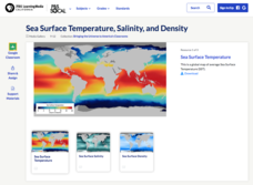
Sea Surface Temperature, Salinity, and Density
Earth's vast ocean is full of mysteries! Science scholars discover the big-picture properties that influence its characteristics at different latitudes using a lesson from PBS's Weather and Climate series. After completing a background...
Curated OER
Mapping the Ocean Floor
Students construct and interpret a line graph of ocean floor depth and a bar graph comparing the height/depth of several well-known natural and man-made objects and places. In addition, they calculate the depth of two points using sonar...
Curated OER
Trade in the Indian Ocean: Should China End Zheng He's Treasure Voyages?
Students examine the amount of trade that occurs in the Indian Ocean. Using China as an example, they discuss the reasons why it ended its treasure voyages in the area and predict what would have happened if the voyages continued. They...
Curated OER
Mapping Ancient Coastlines
Most of this lesson is spent working on the "Bathymetry Worksheet." It includes a graph of the changes in sea level over the past 150,000 years and a bathymetric map of changes in an imaginary coastline over time. Participants answer...
K-State Research and Extensions
Water
How are maps like fish? They both have scales. The chapter includes six different activities at three different levels. Scholars complete activities using natural resources, learn how to read a map, see how to make a compass rosette,...
Curated OER
Lesson Plan #3 ~ Ocean Currents
Sixth graders experiment to understand the ocean's currents. In this ocean current lesson plan, 6th graders complete an experiment with two bottles of water and an index card to discover information about the ocean current. Students...
Curated OER
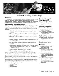
Reading Contour Maps
Young scholars examine contour maps and bathymetry maps and discover how to interpret a contour map of the East Pacific Rise. Students look at a map as a class and answer questions together before working independently on a map of the...
Curated OER
Map of Arctic Region
In this Arctic region geography learning exercise, students examine a map of the Arctic and color it. The latitude and longitude lines are shown as well as the labeled countries and oceans. The map shows an overhead view looking down on...
Curated OER
Map Skills
In this map skills worksheet, students research and label the states in Australia and add in the major cities, oceans and seas.
Curated OER
Continents and Oceans on the Move
Students create an awareness of the vast percentage of water covering the earth. They relate similarities/differences between topographical maps and other maps of various time periods. Students examine how to use a topographical map.
Curated OER
Mapping Japan
In this Japan activity, learners label cities, islands, seas, and more. Students label 11 different areas of the country of Japan.
Curated OER
Where in the World? Oceans & Continents
For this geography worksheet, students answer 6 questions using a coded map as a reference, then students identify labeled geographic features.
Curated OER
Mapping Brazil
In this Brazil instructional activity, learners label cities, oceans, and surrounding countries around Brazil. Students label and color 10 places.
Curated OER
Understanding a Geological Map
Middle schoolers identify different types of maps and observe a geological map. In this geology lesson plan students create a replica map of a geological area that includes a key.
Curated OER
Mapping and Personifying Nations
Eleventh graders analyze the geography, actions, and relationships of countries involved in World War II. They create a map of Europe, Northern Africa, and the Pacific, and analyze and evaluate their self-made map of Europe and the...
Curated OER
2nd Grade - Act. 22: The World Game
Second graders play World Game to become more familiar with continents, oceans, countries and states.


