Curated OER
James and the Giant Peach Plot Analysis
It's all about the plot, main events, and story mapping with this lesson. As the class reads the novel James and the Giant Peach, they create an excitement graph that actually charts key events and moments of excitement. After creating...
Curated OER
Cartography Project
A lesson involving mapping, the use of a compass, writing and following directions, and exploring the first two themes of geography is here for you. Learners create original maps that show the routes they take through their own...
Channel Islands Film
Island Rotation: Lesson Plan 1
How do scientists provide evidence to support the theories they put forth? What clues do they put together to create these theories? After watching West of the West's documentary Island Rotation class members engage in a series of...
Curated OER
The Mekong River
Junior geographers explore the region through which the Mekong flows, its pathway, the landscape, how people depend on the Mekong, and future uncertainties. They apply the five themes of geography to examine the region. They create a...
Curated OER
Literature Study Guide: To Kill a Mockingbird
Teaching tools designed to support student-centered literature study. Geared toward homeschoolers reading Harper Lee's book To Kill a Mockingbird, I would use these in my classroom. The materials are applicable to any text: graphic...
Foreign Policy Research Institute
Exploring Korea
A thorough and fun lesson on Korea! In groups of four (Social Chair, Historian, Translator, Travel Agent) class members research North and South Korea to determine a good location for an overseas institute for studying abroad. Once this...
Illustrative Mathematics
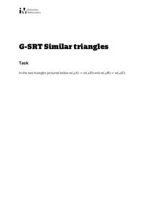
Similar Triangles
Proving triangles are similar is often an exercise in applying one of the many theorems young geometers memorize, like the AA similarity criteria. But proving that the criteria themselves are valid from basic principles is a great...
Curated OER
Draw A Coastline
Students identify, locate and draw at least ten different geographical features on a map. Using the map, they must make it to scale and include their own legend and compass rose. They share their map with the class and answer questions.
Curated OER
Planet Earth
Students explore and analyze data from different maps in order to explain geographic diversity among the continents. Student groups research continents' physical features and examine how they contribute to quality of life for inhabitants.
Curated OER
Building A Model of the East Pacific Rise
Students describe the physical attributes of the East Pacific Rise. After locating the region on a map, students work in groups do define each layer of the structure in order to begin their build. Students build their model according to...
Curated OER
Community Map of The Giver
Students read "The Giver" after finishing the unit on inventions and inventors. Using the information in the novel, they develop a geographic map illustrating the community in the story. They identify human and physical features and...
Curated OER
Cave Activity: Mapping Fractures
Students tour a cave and observe fractures in the cave's ceiling. They record characteristics of the fracture. They locate three major passages in the cave and ten major fractures.
Curated OER
Orienteering Scavenger Hunt
Students take a reading with a compass and use the compass to reach multiple checkpoints in a scavenger hunt activity.
Curated OER
1668 Map of Newark Activity
Eleventh graders read a map for historical information, decipher a map legend and symbols, and expand their knowledge of a historic time.
Curated OER
Media Center Map Skills
Student demonstrates the ability to locate, retrieve, and handle media and equipment by utilizing the library media center floor plan, symbols, and guides. They then use systems of classification to identify, locate, and retrieve materials.
Curated OER
Survey of the Louisiana Purchase in 1815
Students explore the survey of the Louisiana Purchase by creating their own surveying and mapping techniques such as natural maps, pace maps, and orienting. Other students then try to follow the maps.
Curated OER
Essential Elements of Habitat
First graders compare their local area with the Belize landscape. They construct maps of the school area, adding descriptive information. They write haiku poems about their favorite outside places.
Curated OER
Glaciers Worksheet #2
A map of the Hudson River Valley is exhibited here. Arrows representing glacial striations are spread across the map for learners to analyze. They answer five multiple choice questions in response. The worksheet is a compact review of...
Curated OER
Orientation of the Earth in Space
Students hypothesize the location of the sun in the sky at diferent times of day and at different latitudes. They perform several experiments to provide evidence for their hypothesis. Experiments including observing the sun's position at...
Curated OER
Terrabagga Activity Using a Magnetometer
Clever! Earth science learners construct a model of a planet containing a magnetic core. The planet, Terrabagga, is made out of a paper grocery bag, magnets, a dead D battery, and rubber bands. Pictures of each step of the construction...
Province of Manitoba
The Outdoors Camping and Survival Skills
Equip young campers with the tips and strategies for a safe trip to the outdoors with a series of lessons. They learn how to start fires with and without firewood, keep warm in snowy weather, and purify water to make it safe for drinking.
Curated OER
Building a Topographic Model
Learners explore Mount Shasta and various locations on Mars to examine ways geographical data can be represented. They study topographic maps and translating data from 2-Dimensions to 3-Dimensions.
Curated OER
Rescue!
Learners explore movement and position concepts. They follow directions using left , right, up, down, North, South, East and West. Students draw and follow a path on a grid to show a route followed. They label and follow legends on a map.
Curated OER
"it's All in the Cellar"
Seventh graders examine the process of constructing a site plan map at archaeological sites. They discuss the process of mapping techniques and calculation of percentages, create a plan site map of a cellar at Jamestown, and calculate...


