Star Wars in the Classroom
Star Wars Geography Unit
What kind of animals live on an ice planet like Hoth? How would the habitat on Tatooine allow different organisms to thrive? Connect social studies, science, and Star Wars in one engaging activity that focuses on the ecosystems of the...
Curated OER
America the Beautiful
Students analyze the physical geography of the United States and how we have adapted to or altered the land to create the country we know today. Students complete maps with physical features, states and cities of interest.
Curated OER
Point Me to Puerto Rico
Students research the physical features and geography of Puerto Rico as well as locate it on a world map and identify its major characteristics. Pictures and postcards are shown to each class for a visual connection to Puerto Rico as...
Curated OER
Australia: the Land Down Under
Students give a solid history and geographic explanation of the country of Australia and explain why it is important. They use some creativity in designing their own island, by using the physical features of this particular country.
Curated OER
Alaska's Physical Systems and History
Students read about Alaska's physical systems and determine how Alaska's physical makeup has impacted its history. They create timelines of their particular physical system.
Curated OER
Discovering Places & Regions
Fifth graders research physical and cultural features of a place. They practice skills in gathering information from various sources, using tools such as graphic organizers, word processing, multimedia, and use of the Internet.
Curated OER
I Love the Mountains
First graders discuss and define different landforms. They read the book "Our Land", sing a landform song and perform it with motions and then complete a worksheet.
Curated OER
South America Layered
Seventh graders create an overlay map of South America. They show the relationships between population, landforms and economies with their maps.
Curated OER
Regional Landforms and Native People
Third graders study the Native American tribes of Maidu and Miwok by studying Internet artifacts, culture, language, music, storytelling, architecture, food, clothing, crafts and geology.
Curated OER
The Geography - Writing Connection
Students examine and describe the four physical systems of the Earth. Using two of the systems, they practice their writing skills and use vocabulary associated with the different types of landforms. They predict the types of shelters...
Curated OER
Geography And Chinese Landscape Painting
Fourth graders label the physical features of China on a map and become familiar with
the content of traditional Chinese landscape paintings in this lesson intended for the forth grade classroom.
Columbus City Schools
Constructive and Destructive Geologic Processes
Show the class the world as they've never seen it before—from way above! Learners try to unravel the mysteries presented by rich satellite imagery, learn to interpret topographic maps, and study erosion by constructing their very own...
Curated OER
Topography of Africa
Young scholars study Africa's diverse landscape and investigate how these features impact the available water supply, food sources, and population distribution of the continent. They compare topographical features and
their affect on...
Curated OER
Create a Country
Learners work in small groups to list features and elements found on a variety of grade- appropriate maps. They develop a class list of map features and elements to draw from as they create a map of an imaginary country.
Curated OER
Earth Structure and Processes
Students classify different rocks according to their types. In this earth science lesson, students explain how plate tectonics created Earth's landforms. They explain the continental drift theory and sea floor spreading in their own words.
National Park Service
Glaciers and Water
Explore the amazing power of glaciers with a hands-on earth science experiment! After first learning basic background information, learners go on to create their very own chunks of frozen water and gravel in order to observe first-hand...
Curated OER
Rivers, Maps, and Math
Students use maps to locate and label the major rivers of North and South America. Using the internet, they identify forests, grasslands, mountain ranges and other landforms on the continents as well. They compare and contrast the...
Curated OER
Regional identities in Italy
In this Italy map activity worksheet, students complete 2 map activities that require them to identify major cities and landforms in the country.
Curated OER
Landform Dictionary
Third graders use a word processing program to create a working dictionary, including definitions and pictures, of physical land forms used in the study of different regions of the world.
Curated OER
What is a Karst
Students investigate landforms by holding a class experiment. In this topography lesson, students define the word "karst" and discover why sinkholes are created on the surface of the Earth by completing worksheets. Students create a...
Curated OER
Rosie's Walk
Young scholars use maps and globes to locate and describe locations, directions and scale. Using the maps, they identify man made or natural features of different environments. They practice using geographical terms to describe a...
Curated OER
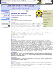
Salt Relief Map of Virginia
Fourth graders create a salt relief map of the four regions of Virginia. They indentify land forms and bodies of water, and summarize how they made their project.
Curated OER
Edible Maps
First graders, in groups, identify major geographical features of Texas. They form a topographical map of Texas using edible dough, candy, etc. They present and then eat their maps.
Curated OER
Tooling Around Arizona: Reading Arizona Maps
Learners research Arizona maps. In this map lesson, students discuss map titles, scales, directions, elevation, and symbols. The class will examine topography, landforms, and rivers found on an Arizona map.


