Curated OER
Historical Indian Treaties and Aboriginal Population
Sixth graders navigate an online atlas of Canada and compare the land area of of historical Aboriginal peoples in Manitoba to present-day figures.
Curated OER
Leaping Lemurs! How far can you jump?
Students watch a segment of the PBS video which show the lemurs' ability to jump. In pairs, students collect measurement data involving each other's length of a standard step, a standing broad jump, and a long jump. They record their...
Curated OER
How Was the Inside vs. Outside Paradigm Created?
Students, after listening to a lecture, examine Nigeria from slave trading to the Civil War as well as listen to the Arrested Development song about slavery. In addition, they create a circle diagram for essay #1.
Curated OER
Google Earth Virtual Vacation
Young scholars explore different areas of America by using the internet and the "Google Earth" website in this interactive, social studies instructional activity for late elementary students. This instructional activity includes a...
Curated OER
Where Oh Where on the Playground, Do I Love To Be?
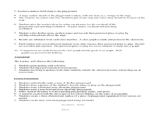
Students listen to poem, Where Oh Where On the Playground, Do I Love to Be?, and practice reading, interpreting, and making maps, charts, and graphs in surveying classmates and discussing their favorite places to play in school playground.
Curated OER
Teaching the Five Themes of Geography Through Picture Books
Read the story Make Way for Ducklings and introduce little ones to the five themes of geography. Reread the story, while displaying transparencies to reinforce the five themes. In groups, learners view pictures and identify the themes on...
Curated OER
Social Studies: Countries and Technology
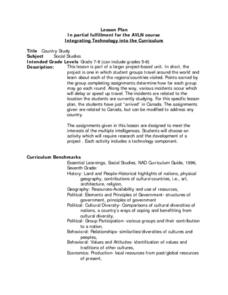
Young scholars participate in a travel simulation and have just arrived in Canada. After choosing activities to research, they define their methods of exploration and development on plan sheets. Among the scenarios from which they...
Curated OER
The Most Important Equation in Astronomy!
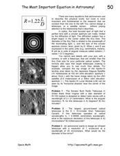
For this astronomy optics worksheet, students calculate the angular resolution and maximum resolution for given telescope specifics. This worksheet has 3 problems to solve.
Curated OER
Waves Lesson Plan
Students demonstrate an understanding of tsunamis and possible causes. In this investigative lesson plan students view a video and explore earthquakes and movement of tectonic plates.
Curated OER
America the Beautiful
Students listen to a read-aloud discussing the landmarks of the United States. In pairs, they use the internet to research a landmark of their choice. They create a visual aid to be given with a presentation sharing the information...
Curated OER
A Picture Is Worth A Thousand Words
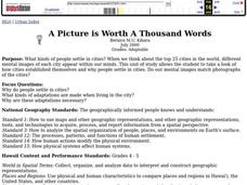
Students complete a population pyramid for a city they are studying. They may complete a population pyramid for their city and another one for the country in which the city is located. They compare and contrast the results of the two...
Curated OER
Come With Me To Africa
Pupils are introduced to the geography of the continent of Africa. They conduct Internet research, explore maps and identify animal species and a variety of human cultures for a sampling of African countries. Students create graphs, maps...
Curated OER
Who We Are: To Know the Characteristics of a Population Within Certain Domains
Students, through research, discover the characteristics of the population of Quebec and compare them to those of Canada as a whole. They create a class presentation about information they found.
Curated OER
Colors Crackle, Colors Roar
First graders engage in a reading of poems in colorful language. They become with the interrelation of using Spanish and English words interchangeably in a text. The lesson also builds multicultural appreciation for young students.
Curated OER
Alaska Trade
Young scholars spend two days traveling throughout Alaska, trading as they go. They explore universal principles related to trade and commerce while studying about Alaska's geography and indigenous people. At the end of the lesson,...
Curated OER
Stratigraphy -- Layers of Time in the Earth
Students are introduced to the process of stratification. Using the internet, they read about the Richard Beene archeological site near San Antonio. Using a map, they color code the different layers present at this site and answer...
Curated OER
Discovering the Past Using the Future: Remote Sensing and the Lost City of Ubar
Students identify and locate specific locations on the Arabian Peninsula, the Rub al Khali Desert, and present day Oman. They identify other names for the lost city of Arabia as Ubar, the Atlantis of the Sands, Iran, and the city of towers.
Curated OER
Discovering the Past Using the Future: Remote Sensing and the Lost City of Ubar
Students use a video, maps, worksheets and Internet research to explore the role that sensing played in locating Ubar - the lost city of Arabia.
Curated OER
Rivers And Capitals
Students become familiar with the use of GIS for research and become aware of the importance of rivers to cities. They also analyze the placement of cities and learn the names of rivers in the United States.
Curated OER
Geography of the Silk Road And the Tokaido Road
Students examine the geographical features of the Silk Road and the Tokaido Road in this introductory lesson on Chinese geography. Small group learning is emphasized and encouraged.
Curated OER
Geography of Korea
Students are introduced to the geography of Korea. Using the internet, they identify the weather and climate in the country and create a week weather chart for Korea's four seasons. They complete an interview with a local weatherman...
Curated OER
"Czech It Out" - A Look at Eastern Europe
Students research several countries in Eastern Europe. Students compare and contrast several Eastern European countries and then choose a specific country to research and prepare a class presentation with their findings.
Curated OER
Go West My Class
Learners find data that can be mapped on the Factfinder Web page. They analyze the data from the web site and state recommendations on whether a person should live in Illinois or not based on their preferences.
Curated OER
Historical Research on Explorers of Canada
Eighth graders study an online atlas of Canada to research an early explorer.


