Curated OER
Egg Carton Stories
Students create stories with better structure when they are able to focus on its characters, setting, and plot. Teacher creates settings, character, and problem cartons with information written on strips of paper.
Curated OER
Shake It Up with Scatterplots
Students identify how to use a scatterplot to compare two sets of data to determine if they are related. Then they identify and describe the definition of regression line (the "line of best fit"). Students also identify how scientists...
Curated OER
Mystery of the Megaplume
Read through the extensive background information and then lead your geology or physical oceanography class through an investigation of actual temperature anomaly data from the Juan de Fuca ridge. They translate the data onto a plot,...
Curated OER
Virtual Earthquake
Students visit a website that features online interactive geology and biology simulations. They observe and estimate the amplitude of the largest wave and transfer the information to a nomogram. Based on the nomogram students will...
Curated OER
Laurence Yep's, Dragonwings
Students discuss vocabulary words and compare definitions. They read chapters 6-9 of the novel, Dragonwings, and discuss point of view, and complete a plot diagram. Then they review the four types of conflict and identify the conflicts...
Curated OER
Marine Animals: Stranded on the Coast
Students identify marine animals that could become stranded due to coastal features and currents. They plot data on worksheets for locations of sea turtles actually beached or stranded. After plotting their points, they hypothesize...
Curated OER
Earthquakes
Students observe the melting of ice. In this phase change lesson, students observe ice as it melts. They discuss the process and create a Venn diagram comparing water and ice.
Curated OER
Lemony Snicket Series Comes to an End (Unfortunately)
An informational text about Lemony Snicket leads to a discussion of the books class members have read in the Series of Unfortunate Events series. Children then compare and contrast the settings, plots, and characters in the different...
Science 4 Inquiry
Edible Plate Tectonics
Many people think they can't observe plate tectonics, but thanks to GPS, we know that Australia moves at a rate of 2.7 inches per year, North America at 1 inches per year, and the Pacific plate at more than 3 inches per year! Scholars...
Curated OER
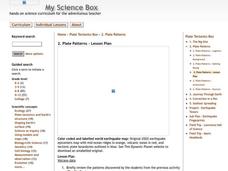
Plate Patterns
Students read about a volcano and use the latitude and longitude information to plot and describe the volcano on the map. They discuss patterns seen on the map. In addition, they color code a map according to zones, plates, etc.
Curated OER
Mapping Plate Boundaries
Students discover plate boundaries based on the uneven geographic occurrence of geologic hazards. After discussing geologic hazards, students plot different sets of earthquakes and volcanic eruptions on maps.
Curated OER
Volcano's Deadly Warning
Students view a video clip on volcanoes. They work together to discover the concept of sine waves. They plot points on a chart and connect them to create the complex wave. They answer questions to complete the lesson.
Curated OER
Plate Tectonics Writing Assignment
Students complete a writing assignment focused on the use of data to support the theory of plate tectonics. They access data using the "Our Dynamic Planet" CDROM, capture images of the data plots, and incorporate them into their writing. T
Curated OER
What in the World?
Eighth graders plot points of longitude and latitude on a world map. In groups, they create a model of the earth's interior and label the parts,
Curated OER
Mapping Natural Disasters
Students use Cartesian coordinates to plot current natural disasters. They relate location of natural disasters to their specific major project countries. Students tie in geometry within this instructional activity as connected to...
Curated OER
The Northern Lights
Sixth graders view photos of Northern Lights and discuss where Northern Lights are usually seen. They examine the colors of light they see and how these colors/lights occur. They use a circular coordinate grid to plot zones of auroral...
Curated OER
Glacial Climbing
Students plot the current distribution of glaciers around the Earth and see if there any major trends where glaciers appear to be either growing or shrinking at abnormally high rates.
Cornell University
Constructing and Visualizing Topographic Profiles
Militaries throughout history have used topography information to plan strategies, yet many pupils today don't understand it. Scholars use Legos and a contour gauge to understand how to construct and visualize topographic profiles. This...
Curated OER
The Tell-Tale Plume
High schoolers examine hydrothermal vents. In this ocean lesson plan, students identify changes in physical and chemical properties of sea water caused by hydrothermal vents.


