Curated OER
U.S. Political Map
Students explore the symbols found in a map legend. In this map skills lesson, students locate the legend on a political map and explain what each of the symbols mean. Students locate and identify several symbols on the map.
Curated OER
Mending the Rift
Students determine what factors identify a country's political borders. After reading an article, they investigate questions surrounding the Great Rift Valley. On a map, they trace the valley from Asia through Africa and research the...
Curated OER
Fourth Grade Social Studies
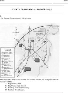
In this social studies worksheet, 4th graders answer multiple choice questions on state maps, city maps, road maps, political maps, and more. Students complete 25 multiple choice questions.
Curated OER
Changing Borders
Students explain that the boundaries between countries are not permanent, then analyze current events and stories as examples of cooperation and conflict. They describe a place using physical and human characteristics.
Curated OER
Basic U.S. Geography
Provide your 11th graders with a basic understanding of U.S. Geography. They label the state, regions, and boundaries found in the contiguous U.S. as well as Hawaii and Alaska. Then, they complete two Internet related activities.
Curated OER
California Map
In this California blank outline map worksheet, students examine the political boundaries of the state and then mark the state capital, other cities, and other state attractions on the map.
Curated OER
Tennessee Map
In this Tennessee outline map, learners examine the political boundaries of the state. Students mark the state capital, major cities, and other state attractions.
Curated OER
Siting Wind Power
Students analyze a variety of curves that describe the power extracted from the wind by a variety of commercially produced wind turbines. They utilize site specific topographic maps and political boundary data to evaluate and make...
Curated OER
Book: Spain
Students, after reading Chapter One in the book, "Spain," design and re-create the political boundaries as well as the physical features of nation of Spain. They utilize play-doh or salt dough to illustrate and create their three...
Curated OER
Canada Outline Map
In this blank outline map worksheet, students study the political boundaries of the North American country Canada as well as those of the provinces located there. The capital cities of the provinces are listed.
DocsTeach
Cultural Diplomacy and Propaganda During the Cold War
There's a fine line between diplomacy and propaganda. Young historians consider that boundary by examining documents from the Cold War, including memorandum about the lunar program and Peace Corps in addition to a propaganda film. Using...
Curated OER
Boundaries
Pupils are introduced to the term of mental mapping. Individually, they develop their own mental map of Washington state and discuss as a class what makes a boundary. They draw their mental map on paper and compare it with their...
Curated OER
Redistricting: How Our Representatives Select Voters
Young scholars examine the practice of redistricting. In this American politics lesson, students read the provided articles "The Gerrymander," and "Reforming the Gerrymander." Young scholars respond to the provided discussion questions.
Curated OER
The Sands of Arabia
Sixth graders apply geographic information to the study of World History. In this Geography lesson, 6th graders create a political/physical map of the Middle East, develop questions and answers about the culture of the Middle East, and...
Curated OER
United States Regions
In this United States political map worksheet, students examine regional census boundaries of the US. State boundaries are also included.
Curated OER
States: United States Map
For this United States political map worksheet, students examine state boundaries. The map is labeled with the names of each of the 50 states.
Curated OER
United States Map
For this United States political map worksheet, students examine national and state boundaries. The map also highlights the location of each of the state capitals and the national capital.
Curated OER
USA Capitals Map
In this United States political map instructional activity, students examine state boundaries and locations of each of the state capitals.
Curated OER
South America Map
In this South American political map learning exercise, students examine both national boundaries and national capitals.
Curated OER
US: Midwest Region
In this United States political map worksheet, students examine the state boundaries of the Midwestern Region. The map also highlights each of the state capitals denoted by stars.
Curated OER
South America Map
In this South America political map worksheet, students examine the country boundaries. The map also labels each of the countries and their capitals.
Curated OER
Central America: Unlabeled Map
In this Central American political map worksheet, students examine the boundaries of the countries and capital cities located in this region of the world.
Curated OER
Central America Map
In this Central American political map learning exercise, learners make note of national boundaries and capitals in this region of the world.
Curated OER
Europe Labeled Map
In this Europe political map worksheet, students examine the national boundaries. The map also highlights each of the nation's capitals with a star. The countries and capital cities in this map are labeled.


