Curated OER
What You Can Learn From a Map
Students discover how to interpret maps. In this geography skills lesson, students explore geographic themes as they complete worksheet activities regarding road maps, shaded relief maps, and topographic maps.
Curated OER
What a Relief Map
Students create a map using cookie dough. In this geography lesson plan, students research the physical features of a country, draw a diagram and design and create a map out of cookie dough.
Curated OER
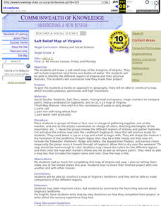
Salt Relief Map of Virginia
Fourth graders create a salt relief map of the four regions of Virginia. They indentify land forms and bodies of water, and summarize how they made their project.
Curated OER
Student Exploration: Building Topographic Maps
In this earthquake exploration worksheet, students complete 2 prior knowledge questions, then use "Building Topographic Maps Gizmo" to conduct several activities, completing short answer questions when finished.
Curated OER
Introduction to Maps
Young scholars investigate a variety of maps to explain what each one is used for.
Curated OER
Worksheet 19 - Topographical Maps
In this map worksheet, students use information from given topical maps and locate the maxima and solve one dimensional wave equations. This two-page worksheet contains four problems.
Curated OER
Relief Maps
Learners study geographical maps and their functions. In this geography lesson students work in groups to build a map to scale.
Curated OER
Explorers’ Experience
Students investigate the Exploration Age. In this research skills lesson, students discover the impact of exploration as they locate information about selected explorers. Students design and create relief maps that feature exploration...
Curated OER
Waldseemuller's Map: World 1507
Students investigate the 1507 word map. In this world geography activity, students examine the details of each section of the map and then draw conclusions about how the people of 1507 understood the world. Students are evalated on...
Curated OER
Map Analysis Worksheet
In this map analysis activity, students decipher what type of map they are using based on a complete list of criteria. Students then answer multiple questions based on their discoveries.
Curated OER
Disaster Relief - Power, Generosity and Leadership
Middle schoolers explore the concept of philanthropy. In this service learning lesson, students discover philanthropy's role in 4 economic sectors. Middle schoolers examine how organizations responded to the Hurricane Katrina devastation...
Curated OER
Waldseemüller’s Map: World 1507
Students take a closer look at historical maps. In this primary source analysis lesson, students examine the first world map produced by Martin Waldseemuller. Students complete the included map analysis worksheet and then write letters...
Curated OER
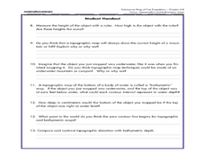
A Watered-Down Topographic Map
Eighth graders explore the ocean floor. In this topography instructional activity, 8th graders compare topographical maps to bathymetric charts. They will create a topographic map and note landmarks and other land features.
Curated OER
Worksheet for Analysis of a Map
For this primary source analysis worksheet, students respond to 6 short answer questions that require them to analyze the maps of their choice.
NET Foundation for Television
1850-1874 Homestead Act Signed: The Challenges of The Plains
Start a whole new life in a land known as the Wild Wild West! Learners analyze maps, personal accounts, the Kansas-Nebraska Act, songs, and video clips to uncover life under the Homestead Act. Using their new skills, class members role...
Curated OER
Volcanoes: Sixth Grade Lesson Plans and Activities
Bring a set of pre-lab, lab, and post-lab lesson plans on volcanoes to your earth science unit. Sixth graders explore the three types of volcanoes found on Earth, plot the specific locations of these volcanoes on a map, and investigate...
Curated OER
Our Land Lesson 2: Song Mapping
Students study the meaning of philanthropy as giving of time. talent, and treasures. They sing This Land Is Your Land while locating five of the places on a map of the United States showing that relief office are everywhere. They decide...
Curated OER
Exploring Hawaiian Mountain Zones
Fourth graders watch a video that describes the climate and vegetation zones of Hawaii. They describe the different physical conditions that create vegetation zones from the sea to the mountains. In groups, they create an illustrated...
Curated OER
From the Heights to the Depths
Students create a relief map of Asia and Australia. They work in small groups on sections of the map to make one complete map of the continents.
Curated OER
Getting to the Core of World and State Geography
Students create topography relief maps. In this geography skills lesson, students review geography core knowledge skills, design and make a state relief map, and compile a student atlas.
Curated OER
Road Map Relief - Mixed Media painting
Learners use road maps to create non-objective artwork.
Curated OER
From Maps to Models
Fourth graders study topography maps and learn the importance of their contour lines. In this map instructional activity students create their own topography map.
Ocean Explorer
The Volcano Factory
The tectonic processes that have resulted in the formation of the Marianas Arc, and the Marianas Trench are explored. Groups of pupils access websites that give them a wealth of information about these formations. Each group must prepare...
School Rack
Westward Expansion Project Choices
What a great list of brief research projects for reviewing the era of westward expansion in the United States! Learners are directed to choose and complete three of the projects on the given list, which includes opportunities to design...
Other popular searches
- Elevation Relief Map
- Geographic Relief Map
- Ancient Greece Map Relief
- Elevation Relief Map Asia
- Topographic and Relief Maps
- Elevation Relief Map Florida
- Geographic Relief Map Ca
- India Relief Map
- Salt Dough Relief Maps
- Maps Costa Rica Relief
- Relief Map of Greece
- China Relief Map


