Curated OER
Creating a 3d Model and Corresponding Topographic Map
Students create a landform model and topographic map. In this topography lesson, students use a real landform to create a model and topographic map to scale.
Curated OER
Mesoamerican Carving Project
Third graders are introduced to the use of glyphs and relief carving by Mesoamerican cultures. They complete worksheets, view PowerPoint presentations, participate in a Webquest and create an original glyph carving in sandstone.
Curated OER
Rivers Run Through It
In this mapping practice activity, 5th graders read an informational paragraph and answer 7 questions about the parts of a map along with places shown on a given map.
Curated OER
Waldseemuller's Map: World 1507
Seventh graders analyze various maps. In this Geography lesson plan, 7th graders create a large map as a whole class. Students write a letter to Mr. Waldseemuller.
Curated OER
Tracing Highs and Lows in San Francisco
On a topographic map, pupils identify the scale bar, north arrow, and contour interval. They then locate a hill on the map and make note of the contour lines. Students then locate other places with similar contour line patterns....
Curated OER
The Edge of the Lake
Second graders explore the geography of Nevada. In this map-making lesson, 2nd graders use salt dough to create a relief map of Nevada. Students label the landforms and bodies of water that are studied and specified in the lesson.
Curated OER
Mapping Where Animals Live
In this animal mapping worksheet, students read a short passage about amphibians and reptiles in New York State, then use a set of maps to answer related questions.
Curated OER
Watersheds: The San Francisco Bay Watershed
Sixth graders make a model of a watershed. In this geography lesson, 6th graders view a shaded relief map of California and locate landmarks. Students examine the San Francisco Bay Watershed by following the journey of water through the...
Curated OER
Modern Japan: Tsunami Relief
Students participate in a lesson that is concerned with modern day tsunami relief in Japan. They conduct research and chart the regional alert centers. Students also note the worldwide effort to help those in need.
Curated OER
MAP UNIT
First graders investigate how maps are used to identify different locations. They will also appreciate how there are different types of maps for their purposes. Finally students study how maps contain symbols that represent real places.
Curated OER
Plate Tectonics: Sixth Grade Lesson Plans and Activities
Here is a set of pre-lab, lab, and post-lab lesson plans on plate tectonics. After completing the previous labs on volcanoes and earthquakes, sixth graders use the gained knowledge to explore plate boundaries and the movement of Earth's...
Curated OER
I Can Find that Where? - A Study of Landforms
First graders make landform maps of the United States. In this landform lessons, 1st graders participate in a discussion of local landforms and make a landform map of the United States. They follow the teacher's directions to add plains,...
Curated OER
Salad Tray 3D Topographic Model
Pupils explore the characteristics of topographical maps. They examine the relationship of contour lines and vertical elevation. Students create a three-dimensional model of a landscape represented by a topographic contour map.
Curated OER
Ping!
Using "mystery bathymetry" shoeboxes, young explorers simulate sonar action to map out the topography of an un-viewable landscape. This classic activity helps physical oceanography learners understand how sonar works. It would be...
Science Matters
Slip Sliding Along
The San Andreas Fault is the largest earthquake-producing fault in California. In the seventh instructional activity in the 20 part series, pupils create maps of California, focusing on the San Andreas Fault system. The comparison of...
Curated OER
This Land is Your Land: Volunteering in the Community
Young scholars discover what a Relief Office does. In this volunteer lesson, students investigate what a Relief Office does, and who helps run it. Young scholars discuss ways he/she could become a volunteer.
Curated OER
Exploring Ancient Greece
Sixth graders use play dough to create a relief map of Greece and through personal investigation and class discussion, draw conclusions about the impact of the geography of Greece on daily life and culture in Ancient Greece.
Curated OER
Fun With Pacific Northwest Cities and Towns
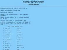
Intended for fun only, learners play with the names of cities common to their region or state. This lesson includes a list of cities in Oregon and not much else. What you and your class choose to do with your list of cities is up to you.
NET Foundation for Television
1850-1874 The Kansas-Nebraska Act
How the Kansas-Nebraska Act created Bleeding Kansas is complicated—until scholars research and examine documents from the time. After completing activities that include mapping, photo, document analysis, and discussion, learners...
Mr. E. Science
Introduction to Earth Science
From the layers of Earth's spheres to latitude and longitude to looking at topographic maps, learners discover the elements of Earth's systems.
NET Foundation for Television
1850-1874 Homestead Act Signed: Who were the Settlers?
Life in the great, wide-open spaces of the West! Scholars analyze the reasons behind the vast movement to the Great Plains after the passing of the Kansas-Nebraska Act and the Homestead Act. Using photographic, document, map, video, and...
Curated OER
Aegean Art Cycladic Art 3200-1050 BC, Minoan Art 3000-1100 BC, and Mycenaean Art 1600-1100 BC
So exciting, art from the ancient mediterranean! Get ready to divulge interesting facts about the art and culture of the Minoans, Mycenaeans, Aegeans, and Cycladians. Each slide provides a map, images of art, and the cultural...
NET Foundation for Television
1850-1874 African American Settlers
Go West, young man! Scholars investigate the impact of African American settlers moving to the Nebraska territory, following the passage of the Kansas-Nebraska Act in the mid 1800s. Using primary sources, timelines, maps, and...
Curated OER
News Broadcasts
Learners create a news broadcast after studying example broadcasts about disaster relief organizations. In this broadcast news lesson, students research disaster relief organizations and then write a news broadcast related to a disaster....
Other popular searches
- Elevation Relief Map
- Geographic Relief Map
- Ancient Greece Map Relief
- Elevation Relief Map Asia
- Topographic and Relief Maps
- Elevation Relief Map Florida
- Geographic Relief Map Ca
- India Relief Map
- Salt Dough Relief Maps
- Maps Costa Rica Relief
- Relief Map of Greece
- China Relief Map


