Curated OER
Under the Ice: Imaging Glacier Bases with Sound
Students investigate with radio waves that are used to remotely sense the topography beneath the ice sheet. They experiment with travel time of waves and convert data to distance and depth. As a result, they develop a profile of the...
Curated OER
Going to Extremes
Learners recognize that our ability to explore the extremes of the ocean is directly related to the technology of remote sensing. Students will recognize the deep submergence vehicle, Alvin, and the advanced sensors on board as tools for...
Curated OER
Roaming Biomes
Students use the Internet to research the capabilities of earth-observation satellites. Using the information, they write a report on how remote-sensing technology is used to measure the impact of climate change. They identify the...
Curated OER
Pixel Transmission
Students develop code systems to transmit information between groups. They explore, explain and apply techniques used to transmit remote sensing data to better understand remote sensing images.
Curated OER
Going Through A Phase
Young scholars are introduced to remote sensing equipment used to gather information about the moon. They learn basic facts about the moon such as size, landforms, temperature and gravitational influence on the earth's tides.
Curated OER
The Measurement of All Things: Atmospheric Detectives
Students identify the characteristics of aerosols. Using remote sensing, they participate in an experiment in which they determine how the sun's radiation and elements in the atmosphere interact with one another. They also research the...
Curated OER
Science Excursion: Cover Mapping Land
Young scholars study remotely sensed images and topographic maps to classify land cover types in their watershed area. They take samples in the watershed area to interpret the images.
Curated OER
Map Coordinate Bingo
Students play a bingo-type game to locate cities by coordinates. They explain the use of orientation on a map and identify cities in the western hemisphere. They compare road maps, shutttle images, and a CIR image and obtain an...
Curated OER
Exploring the Aral and Salton Seas
High schoolers investigate the environments of the Aral and Salton Seas. They use images taken from the space shuttle, the U2 spy planes, and remote sensing satellites to learn more about what is happening in each region. Students...
American Museum of Natural History
Optical Illusions and How They Work
Illusions are what your mind makes them. Learners view several optical illusions. After each illusion the resource describes what is seen and the potential connection to evolution of the brain. Illusions include seeing different objects...
American Museum of Natural History
Fighting Dinos
A famous fossil of fighting dinosaurs holds as many questions as answers. Scholars first analyze the fossil itself by virtually highlighting the specific bones of the dinosaurs and read about their function and importance. They then test...
Curated OER
Making Sense of a Round World on a Flat Surface
Students explain the world in spatial terms
Curated OER
The Robot Explorer
High schoolers design a robotic vehicle to explore underwater caves. In this robot technology lesson, students brainstorm, research, and report about a robotic vehicle design capable of sensing objects and taking appropriate actions to...
Curated OER
Indirectly Direct
Students use prior knowledge of angle and lines as they conduct an experiment with a rolling marble to determine the shape of a mystery object located under a metal pie tin.
Global Change
Impact of Climate Change on the Desert Pupfish
A fish that lives in the desert? You and your class can meet the desert pupfish as they examine its habitat, the role humans play in diminishing water supplies, and how climate change might impact this fishy friend. There are four short...
Space Awareness
Valleys Deep and Mountains High
Sometimes the best view is from the farthest distance. Satellite imaging makes it possible to create altitude maps from far above the earth. A three-part activity has your young scientists play the role of the satellite and then use...
Curated OER
Trends of Snow Cover and Temperature in Alaska
Students gather historical snow cover and temperature data from the MY NASA DATA Web site. They compare this data to data gathered using ground measurements from the ALISON Web site for Shageluk Lake. They graph both sets of data and...
Curated OER
Map-A-Buddy
Students investigate the concept of tracking and spatial movements of animals in relation to the environment in which they live. They participate in an interactive activity by tracking one another over a pre-defined region, record the...
Curated OER
Building Your Space Station
Students discuss the benefits of the International Space Station. They evaluate the challenges the designers faced when trying to design the space station. Students discuss the use of scale models when designing large structures and...
Curated OER
Solar Arrays for the Space Station
Students explore the challenges that are faced when transporting materials into space. They review the various forms of energy, including solar arrays, that are used on the International Space Station and how generating this energy calls...
Curated OER
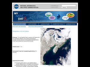
Phytoplankton in the Gulf of Maine
Students use satellite data to see the correlation between sea temperature and sunlight in the Gulf of Maine. In this phytoplankton lesson students use Excel to analyze data.
Association of American Geographers
Project GeoSTART
Investigate the fascinating, yet terrifying phenomenon of hurricanes from the safety of your classroom using this earth science unit. Focusing on developing young scientists' spacial thinking skills, these lessons engage learners in...
Polar Trec
Global Snow Cover Changes
Snow is actually translucent, reflecting light off its surface which creates its white appearance. Pairs or individuals access the given website and answer questions about snow cover. They analyze graphs and charts, examine data, and...
Space Awareness
The Big Meltdown
Explore the world (our world) of melting ice caps. Why are these caps melting? What is the effect of melting ice caps? Dive into the ever-present issue of global warming with a resource that has learners looking at data and participating...
Other popular searches
- Gis and Remote Sensing
- Remote Sensing Instruments
- Remote Sensing Satellite
- Gus and Remote Sensing
- Id Remote Sensing
- Sally Ride Remote Sensing
- Remote Sensing Technology
- Idi Remote Sensing
- Remote Sensing and Water


