Association of American Geographers
Project GeoSTART
Investigate the fascinating, yet terrifying phenomenon of hurricanes from the safety of your classroom using this earth science unit. Focusing on developing young scientists' spacial thinking skills, these lessons engage learners in...
International Technology Education Association
Pixel This!
Did the image I drew match the image you saw? By simulating a satellite and a ground station, teams of two transmit data in the form of pixels in order to recreate an image. They use four different levels of brightness, creating slightly...
Curated OER
When Trees Are Red, Color in Remote Sensing
Student learn about "chromatography" in a hands-on experiment. Young scholars make a chart showing what the colors represent.
Curated OER
Sensing Somethong
Students are taught that they can gather information about objects using the five senses of vision, touch, smell, taste, and hearing. They are told that some sensing, like sight, is done remotely. Students observe how a camera can...
Teach Engineering
Air Pollution in the Pacific Northwest
Scholars investigate levels of nitrogen dioxide in the Pacific Northwest by examining the role of nitrogen in air pollution and how remote sensing can be used to measure nitrogen levels. An Excel spreadsheet calculates the difference...
Space Awareness
Oceans on the Rise
Temperature rises and land disappears! Through a lab exploration, learners understand the effect of temperature increase on water similar to the effect of global warming on our oceans. As they heat the water in a flask, they measure the...
Curated OER
Reflections on Earth: Exploring Planet Earth from Space
Students examine satellite images of Earth and contrast images at different scales. In this exploring Earth from space lesson plan, students use satellite images to contrast images at different scales, calculate distances from the scale...
Curated OER
What Color is the Ocean?
Students view satellite pictures of the ocean, and discuss the presence of phytoplankton and the colors of the ocean. Students compare/contrast ocean satellite images with maps and globes, then color world maps to replicate the satellite...
Space Awareness
Valleys Deep and Mountains High
Sometimes the best view is from the farthest distance. Satellite imaging makes it possible to create altitude maps from far above the earth. A three-part activity has your young scientists play the role of the satellite and then use...
Curated OER
Remote Sensing and the Electromagnetitc Spectrum
Fifth graders conclude that each color of the spectrum has a different amount of thermal energy by measuring temperature with a thermometer. They infer that there is an invisible band of the spectrum by measuring temperature beyond the...
Curated OER
Satellite Sense
Students look at data to understand how it is interpreted by scientists. In this satellite sense lesson plan, students complete worksheets based on radar and satellite images. Students work in groups of two to diagram a landform.
Curated OER
Can You See What I See?
Students gain an understanding of the methods used to explore the earth's surface. Students create a time line leading to the first satellite image of the Earth that includes the various methods utilized to observe the earth's surface.
Curated OER
Interpreting Satellite Images
Students identify differences between photography and satellite imagery space.
Curated OER
How Do Satellites Work?
Students model how satellites transmit data by using numbers not images.
Curated OER
and and Ocean Views of Earth by Remote Sensing
Students explain how satellites help scientists to see more than with the unaided eye and how Landsat technology works. Students identify vegetation and fire sites in the rainforest and detect erosion along rivers. They are able to use...
Curated OER
Roaming Biomes
Students use the Internet to research the capabilities of earth-observation satellites. Using the information, they write a report on how remote-sensing technology is used to measure the impact of climate change. They identify the...
Curated OER
Science Excursion: Cover Mapping Land
Young scholars study remotely sensed images and topographic maps to classify land cover types in their watershed area. They take samples in the watershed area to interpret the images.
Curated OER
Keeping Watch on Coral Reefs
High schoolers investigate the dangers Coral Reefs face by investigating satellite images. In this environmental protection lesson, students utilize the Internet to discover the types of satellites and sensors used to provide...
Curated OER
Trends of Snow Cover and Temperature in Alaska
Students compare NASA satellite data observations with student surface measurements of snow cover and temperature. They practice data collection, data correlations, and making scientific predictions.
Curated OER
Measuring Distance and Area in Satellite Images (College Level)
Students are able to download, install, and use Image J image analysis software to quantify change over time in satellite images. They access and download satellite images for specific locations and times. Students set a scale (spatial...
Curated OER
Exploring the Aral and Salton Seas
Students investigate the environments of the Aral and Salton Seas. They use images taken from the space shuttle, the U2 spy planes, and remote sensing satellites to learn more about what is happening in each region. Students discuss the...
Curated OER
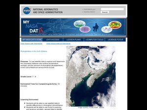
Phytoplankton in the Gulf of Maine
Students use satellite data to see the correlation between sea temperature and sunlight in the Gulf of Maine. In this phytoplankton lesson students use Excel to analyze data.
Curated OER
The Adventure of Echo the Bat
Students compare different habitats based on satellite imagery. They identify land features in the satellite imagery.
Teach Engineering
Backyard Weather Station
Challenge young meteorologists to apply their knowledge of weather to build their own weather stations. The resource provides the directions to build a weather station that contains a wind vane, barometer, thermometer, and rain gauge....


