Curated OER
Hawk in Flight
Students use information gathered by satellites to explore the migration of the Swainson's hawk from the western border of Minnesota to the southern portion of South America.
Curated OER
A Comparison Study of Water Vapor Data to Precipitation over North America
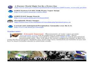
Students use NASA satellite data to compare water vapor over the United States. In this data analysis instructional activity students use an Excel spreadsheet to map their data.
Curated OER
Environment: Just Around the Bend
Students decipher landforms on a map and corresponding satellite imagery. They consider the impact of pollution on agriculture and water. They draw diagrams demonstrating how pollution works its way into the food source.
Curated OER
EWOC2006-Make your own weather forecast - WEST
Students explore making their own weather forecast. They view and discuss a forecasting PowerPoint presentation. Students analyze radar and satellite imagery. They compile many ways to observe clouds.
Curated OER
So, What's it Doing Today?
Students describe short-term variations in oceanographic parameters in the Gulf Stream. In this ocean habitats lesson students use satellite imagery to obtain information in the Gulf Stream.
Curated OER
Scientist Tracking Network
Learners correlate surface radiation with mean surface temperature of several geographic regions. They observe how these parameters change with latitude and construct an understanding of the relationship of solar radiation to seasonal...
Curated OER
NIGHT AND DAY: DAILY CYCLES IN SOLAR RADIATION
Students examine how Earth's rotation causes daily cycles in solar energy using a microset of satellite data to investigate the Earth's daily radiation budget and locating map locations using latitude and longitude coordinates.
Curated OER
Seasons and Cloud Cover, Are They Related?
Students use NASA satellite data to see cloud cover over Africa. In this seasons instructional activity students access data and import it into Excel.
Curated OER
Using Maps To Make Public Health Decisions Case Study: Wildfires in Mexico 2000
Students study environmental health. Using actual NOAA satellite imagery, students investigate the basic concepts of mapping. They explore the relationship between monitoring satellite images and public health decision making.
Curated OER
Going for the Green
Students use satellite imagery to obtain information on chlorophyll concentration at selected locations in the Earth's oceans.Students explain the relationship between chlorophyll concentration and primary production.Studen
Curated OER
Global Greenup
Students utilize satellite images to track the life cycle of vegetational growth over a large area. Animal migratory patterns are compared to this cycle.
Curated OER
Quad Squad
Students pretend they have visited a forest research station on an overnight field trip. They study forest fires, use compass directions, read maps, interpret imagery, and think about the impact of fire on ecosystems.
Curated OER
Tracking a Hurricane
Students use knowledge of what satellite imagery tells to create a descriptive hypothesis of the ground phenomenon during a hurricane.
Curated OER
Salmon Run
Students examine the life cycle of the Pacific salmon and the impact of humans on salmon migration. They watch a Powerpoint presentation, trace migration routes on satellite imagery, and complete mock calculations of salmon energy...
Curated OER
You Decide
Fourth graders, who live on a Native American reservation, investigate how land management is addressed at Tribal Council meetings. They participate in a simulation of a meeting as the discover the workings of tribal government. They...
Curated OER
Landscape Diversity in the Yukon Territory
Learners review and analyze a satellite image of the Yukon territory.
Curated OER
Deer Tracks
Students use satellite images to track to movement patterns of deer and examine deer behavior. They write stories about a day in the life of a field scientist.
Curated OER
Two Ways About It
Students take an imaginary hike in two opposite directions along a lake. They view and interpret satellite images and discuss the pros and cons of hydroelectric dams.
Curated OER
When is Dinner Served? Predicting the Spring Phytoplankton Bloom in the Gulf of Maine (College Level)
Students are able to explain the ecological importance of phytoplankton. They describe the components that influence a phytoplankton bloom. Students interpret satellite images in order to correlate buoy data.
Curated OER
Sea Surface Temperature Trends of the Gulf Stream
Learners use authentic satellite data to produce plots and graphs of sea surface temperature as they explore the seasonal changes of the Gulf Stream.
Curated OER
Sea Surface Temperature Trends of the Gulf Stream
Students explore the importance of the Gulf Stream. Using a NASA satellite images, they examine the sea surface temperature. Students collect the temperature at various locations and times. Using spreadsheet technology, they graph the...
Curated OER
Volcanic Wrath
Students observe volcanic action using an internet Web site of satellite photographs. Stuents create a portfolio of observable features.
Curated OER
Using My Nasa Data To Determine Volcanic Activity
Learners use NASA satellite data of optical depth as a tool to determine volcanic activity on Reunion Island during 2000-2001. They access the data and utilize Excel to create a graph that has optical depth as a function of time for the...
Curated OER
Geography: Snow Cover on the Continents
Students create maps of snow cover for each continent by conducting Internet research. After estimating the percentage of continental snow cover, they present their findings in letters, brochures or Powerpoint presentations.
Other popular searches
- Infrared Satellite Imagery
- Aerial and Satellite Imagery
- Science Satellite Imagery
- Satellite Imagery Weather Maps


