Polar Trec
Global Snow Cover Changes
Snow is actually translucent, reflecting light off its surface which creates its white appearance. Pairs or individuals access the given website and answer questions about snow cover. They analyze graphs and charts, examine data, and...
Curated OER
Charting Neptune's Realm:
Students explore how to construct and interpret maps and globes and find information about people, places, regions, and environments.
Curated OER
THE GULF STREAM
Students explore how to describe the Gulf Stream, how Benjamin Franklin charted it, and correctly plot it on a map.
Curated OER
Volcanoes in Space
Young scholars research volcanoes on the Internet to compare/contrast the volcanoes on Earth to the ones found on Io, a moon of Jupiter. Students list the similarities and differences in science journals, and illustrate pictures of the...
Curated OER
The Map Cartouche
Students discuss the history and purpose of cartouches. They examine examples of cartouches and design an original example with symbols of their choosing.
Curated OER
Chart Making for Navigators
Students discuss the importance and function of nautical maps for sailors. They, in groups, take soundings of a simulated bay in a shoebox and develop a nautical chart that enable them to navigate the shoebox safely.
Curated OER
Hurricanes
Students research the formation and life-span of hurricanes and, after analyzing statistics, try their hand at plotting and predicting the course a hurricane.
Curated OER
Charting Neptune's Realm: Profiles
Students identify and describe the importance of nautical profiles in early navigation. They draw a profile of a street or mall and explore the effectiveness of different types of directions.
Curated OER
Latitude
Students examine the theory of finding latitude and discuss the uses of an astrolabe, cross-staff and octant. They determine an Astronomical Table for their classroom.
Curated OER
Compass Deviation
Students identify and describe the difference between the magnetic north pole and true north. They consider why sailors could not steer a straight course to the New World from the Old.
Curated OER
Upwelling - Cold One Day, Warm Another?
Discuss with your oceanographers what forces cause nearshore upwelling and downwelling. Display a line of wind vectors alongside a graph of the temperatures so that they can discover whether or not they are related. Discussion questions...
Curated OER
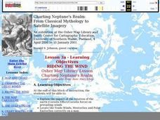
RIDING THE WIND
Students locate the Trade Winds, Westerlies and Polar Easterlies on a map, explain the impact of the rotation of the Earth, and plot a route for a round trip voyage from New York to London.
Curated OER
Remote Sensing
Students research the Earth's ocean systems. They examine the impact of global warming on the oceans and the world as a whole.
Curated OER
Migration of the Neo-Tropical Songbirds
Fifth graders plot the migration of birds using Google Earth. In this lesson on bird migration, 5th graders work in groups to plot the migration of a group of birds using Google Earth. Students present and discuss their findings and look...
Curated OER
Comparison of Snow Cover on Different Continents
Students use the Live Access Server (LAS) to form maps and a numerical text file of snow cover for each continent on a particular date and analyze the data for each map, corresponding text file to determine an estimate of snow cover for...
Curated OER
Plate Tectonics Day 3 Sea Floor Spreading: Evidence for Continental Drift
Young scholars are introduced to Sea Floor Spreading and how it provides evidence for Hess's and Deitz's theory of Continental Drift. They use paleomagnetic data to calculate the rate of Sea Floor Spreading.
Curated OER
Snow Cover by Latitude
Students create graphs showing the amount of snow coverage at various points of latitude and compare graphs.
Curated OER
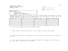
Who's Range is it?
Students investigate the habits of panthers by analyzing radio transmitted data. In this animal life lesson, students utilize computers to view the range of different statistics dealing with Florida panthers. Students complete a...
Curated OER
Pixel Mosaic
Young scholars discuss current knowledge of pixels. They listen as the teacher explains their importance in picture clarity. Students view the "Pixel Mosaic Animated Movie." Young scholars receive pieces of pictures and matching tiles...
Curated OER
How Can We Locate Specific Places On Earth?
Second graders discover how to use longitude and latitude to locate specific sites on Earth. They compare old and new ways of locating specific places, and discover how latitude and longitude coordinates are used to locate places on Earth.
Curated OER
Urban Changes
Students explore how landscapes undergo constant changes with urban development. They plan and build their own "city" by including features that have minimal resource demands to sustain the city itself.
Curated OER
Making Thunderstorms
First graders investigate the causes of thunderstorms and create the sounds of a thunderstorm.
Curated OER
CHARTING NEPTUNE'S REALM
Students design a twenty-first century book cover based on the concepts and designs of the eighteenth century.
Curated OER
SURFACE CURRENTS
Students identify five major ocean currents and identify the correlation between ocean circulation and prevailing winds.
Other popular searches
- Infrared Satellite Imagery
- Aerial and Satellite Imagery
- Science Satellite Imagery
- Satellite Imagery Weather Maps


