Curated OER
Ecosystems and Remote Sensing
Young scholars obtain remote sensing data to compare and contrast global biomass data with global temperature data.
Illustrative Mathematics
Global Positioning System II
Intricate details of a modern technology that many of us take for granted in our phones, computers (and some cars) are laid bare in a short but deeply investigative activity. The math behind a seemingly simple GPS device is...
Curated OER
Measuring Precipitation
A little engineering design is mixed into this lesson plan on precipitation measurement. Groups plan and construct a rain gauge, and use it to collect precipitation. As part of the PowerPoint presentation, learners view a satellite map...
Curated OER
Our Eye in the Sky: The TIROS Weather Satellite
Students investigate the political context of the creation of a weather satellite. For this technology and society lesson, students explore the historical, technological, and political context of the TIROS weather satellite. They write a...
Curated OER
Reflections on Earth: Exploring Planet Earth from Space
Students examine satellite images of Earth and contrast images at different scales. In this exploring Earth from space lesson plan, students use satellite images to contrast images at different scales, calculate distances from the scale...
Curated OER
Cities and Seasons
Students explore how satellite images show seasonal changes in seven cities in North and South America. Through a sequence of images, they study the green-up and brown-down of the seasons and how seasons change over time. Afterwards,...
Curated OER
What Color is the Ocean?
Learners view satellite pictures of the ocean, and discuss the presence of phytoplankton and the colors of the ocean. Students compare/contrast ocean satellite images with maps and globes, then color world maps to replicate the satellite...
Curated OER
The Use Of Satellites
Students use the Internet to do research. They organize information and make a presentation on a satellite to the class. They discuss the capability of the leading edge of technology for a given time.
International Technology Education Association
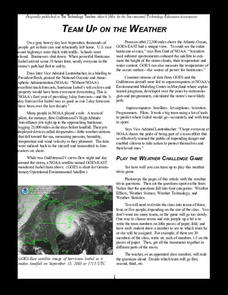
Team Up on the Weather
There's a little bit about every aspect of weather in this trivia game. The lesson resource provides 36 questions and answers pertaining to four different topics related to weather: effects, science, technology, and statistics. Groups...
NASA
Speaking in Phases
Hear from deep space. Pupils learn how satellites transfer information back to Earth. They learn about three different ways to modulate radio waves and how a satellite sends information with only 0s and 1s. Using sound, class members...
International Technology Education Association
Pixel This!
Did the image I drew match the image you saw? By simulating a satellite and a ground station, teams of two transmit data in the form of pixels in order to recreate an image. They use four different levels of brightness, creating slightly...
Curated OER
Where Am I: Navigation and Satellites
Students explore the concept of triangulation that is used in navigation satellites and global positioning systems designed by engineers. They determine ways these technologies can help people determine their position or the location of...
Curated OER
Growing Plants Using Space Technology
Learners explain why delivering planet nutrients to crops at the correct time and amount is important. Students list possible negative effects of improper nutrient delivery. Learners descrive two problems that farmers are now able to...
Curated OER
TE Lesson: Navigating at the Speed of Satellites
Students study the basic concepts of the Global Positioning System and how it increases the accuracy of navigation. They examine trilateration and how the speed of light is used to calculate distances.
Curated OER
Satellite Images- Night Time
Fourth graders study the geography and population distribution of various places on earth. They utilize actual satellite images of the night sky (lights showing heavily around area of dense population) to study and make observations...
Curated OER
WEATHER SATELLITE PREDICTION PROJECT
High schoolers compile weather satellite data from three satellites for one month, obtain weather reports and data from professionals, then create a document with predicted results.
Curated OER
Satellite Mobiles
Students discuss satellites and their functions. They design and construct their own satellite out of readily available materials. Students are taught the definition of a satellite. They discuss the two main purposes of satellites:...
Curated OER
Keep in Touch: Communications and Satellites
Students investigate how satellites help people communicate with others far away and in remote areas. They discuss a scenario of someone travelling to an area with no mode of communication, observe a teacher demonstration, and create a...
Curated OER
Satellite Tracker
Young scholars use satellite tracking software to monitor different satellites. They predict and graph the motion of the space station. They create a 3-D display of its path and share it with the class.
Curated OER
Satellite Eyes
Students explore the ways in which satellite images provide details of the Earth's surface and how they are capable of taking digital images of the Earth from space they vary in resolution and breadth. They view how cameras and lenses...
Curated OER
The Relationship Between Science and Technology
Learners explore the problem that scientists face when attempting to manipulate a satellite's attitude control. They participate in a demonstration using a swivel chair and a bicyle wheel with handles and then discuss their observations.
NASA
Keeping Nine Eyes on the Weather
Take a look at climate change from another angle. Readers learn about the MISR instrument on the Terra satellite and how it studies Earth. Pupils experience how the multiple cameras give scientists multiple views so they can better study...
NASA
The Heat is On: Urban Heat Islands, Detection Strategies, and Mitigation Solutions
It's sure getting hot out there! Scholars analyze satellite data on land use and surface temperatures, and then learn how to ground truth satellite data through an activity. They apply technology to identify urban heat islands and...
Annenberg Foundation
Reading Maps
Can you read a map? Scholars use an interactive technology tool to analyze maps of various kinds to gather evidence and data to better understand their meanings and usefulness. Using newly obtained knowledge, they form an interpretation...


