CK-12 Foundation
Seafloor: Sonar Boats
An interactive that teaches about sonar sure sounds like fun! Junior oceanographers study the uses of sonar, past and present, in an engaging interactive. The content demonstrates how sonar works, why sound waves are a great tool for...
Curated OER
Seafloor Spreading
In this seafloor spreading worksheet, students use 12 given terms to complete sentences about the layers of the Earth and the components of the layers of the Earth.
NOAA
Mud is Mud...or is it?
We know that the type of soil varies by location, but does the seafloor sediment also vary, or is it all the same? Scholars compare photos of the seafloor from two different locations: the Savannah Scarp and the Charleston Bump. Through...
Curated OER
Plate Tectonics Vocabulary
For this plate tectonics worksheet, students match 9 terms with their definitions. Topics include the types of boundaries, the layers of the Earth's crust, plate tectonics and continental drift.
Curated OER
Diatom Ooze
High schoolers explore seafloor sediment. In this ocean environment lesson plan, students describe the characteristics of different types of seafloor sediment and oozes. They compare and discuss locations of sediments and oozes by...
Curated OER
Seeing the Seafloor Using Sound - Multibeam Sidescan Sonar
Students are told that sound is not just stuff that our ears hear. They are explained that it is a tool for measuring and looking at objects in a new way. Students are introduced to sound waves and sonar imaging. They are explained...
Curated OER
Sea Floor Spreading
Students recreate sea-floor spreading and the pattern of magnetic stripes that are created by different configurations of plate boundaries. They see how transform faults work.
Curated OER
Sonar Mapping
Students use a shoe box to create a seafloor model and use cardboard for layering inside of the shoe box to simulate the ocean floor. They probe the ocean floor to simulate sonar echoes. Finally, students graph their data to get a...
Curated OER
Tomography
In this tomography instructional activity, students read about how tomography is used to help oceanographers learn more about the Earth's surface below the ocean. Students complete 3 short answer questions based on the reading.
Curated OER
Seafloor Block Model
Young scholars construct a 3-D block model of the ocean floor to study fundamental earth processes. This is a preconstructed cut out that allows the students to put it together but then to add their own colors as well. There is an...
NOAA
A Moving Crust
Young scientists piece together the geological puzzle that is the earth in the third and final lesson of this earth science series. With the help of numerous multimedia resources and a series of engaging hands-on activities, students...
Curated OER
The Galapagos Spreading Center
Young scholars explore the basic concept of seafloor spreading. They describe the processes involved in creating new seafloor at a mid-ocean ridge. They investigate the Galapagos Spreading Center system.
Curated OER
Sea Floor Spreading Demonstration
Students examine the Earth's boundaries, the ocean floor, and the types of plate boundaries. In this sea floor lesson students fill out worksheets on the ocean floor and observe a demonstration.
NOAA
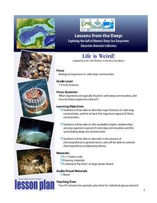
Deep-Sea Ecosystems – Life is Weird!
A pool of brine in the deep sea can be up to four times as salty as the surrounding sea water. The deep sea ecosystem relies on chemosynthesis and the organisms that live there are often strange to us. The lesson plan focuses on...
Curated OER
Plate Tectonics
Help young scientists piece together the theory of plate tectonics with this comprehensive collection of materials. Whether your are looking for worksheets, hands-on activities, or assessments, this resource has everything a science...
CK-12 Foundation
CK-12 Earth Science Concepts for Middle School
Explore a variety of science concepts in an interactive textbook created for middle school scholars. A lengthy table of contents takes readers to pages comprised of a subject overview, outline, and summary. Follow links further to find...
Curated OER
At the Edge of the Continent
Students study how to interpret a bathymetric map. They study the main features of the continental margin. They plot and graph bathymetric data. They think about and discuss the bathymetry of the edge of the cont
Curated OER
Video: The Birth of a Theory
In this plate tectonics worksheet, students answer questions from a video about how the theory of plate movement came about along with questions about earthquakes, faults, seafloor spreading and other geological events.
Curated OER
Earth Structure and Processes
Students classify different rocks according to their types. In this earth science lesson, students explain how plate tectonics created Earth's landforms. They explain the continental drift theory and sea floor spreading in their own words.
Curated OER
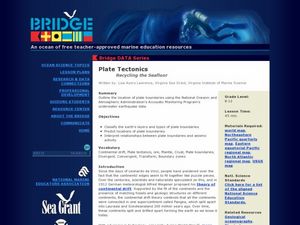
Plate Tectonics: Recycling the Seafloor
Students classify earth's layers and plates using Ocean Seismicity data. In this plate tectonics lesson, students outline where the plate boundaries are on the world map. They then compare these predicted boundaries with USGS map of the...
Curated OER
Sea Floor Spreading II
Students import ocean bathymetry data from text files. They then graph these observations along with model predictions to assess the model's ability to simulate observed topographic features of the North Atlantic. Students use Excel to...
Curated OER
Sea Floor Spreading II
Students import ocean bathymetry data form either the topex web site or text files. They then graph these observations along with model predictions to assess the model's ability to sumulate the observed topographic features of the North...
Curated OER
How Deep is the Ocean
Students predict and then analyze the layout of the tectonic plates that form the ocean's floor using mapping skills and Inquiry based problem solving, They compare the depth of various regions in the ocean with the geologic age to...
NOAA
A Quest for Anomalies
Sometimes scientists learn more from unexpected findings than from routine analysis! Junior oceanographers dive deep to explore hydrothermal vent communities in the fourth lesson in a series of five. Scholars examine data and look for...
Other popular searches
- Seafloor Spreading
- Sea Floor Spreading
- Sea Floor Spreading Lab
- Seafloor Features
- Sea Floor Spreading
- Seafloor Spreading Model
- Sea Floor Spreading Ppt
- Seafloor Spreading Worksheet
- Science Sea Floor Spreading
- Marine Seafloor
- Measuring Seafloor Spreading
- Rate of Seafloor Spreading


