Curated OER
US Geography: The Midwest
Learners investigate the geography and agricultural products of the Midwestern United States. In this US geography lesson, students watch and discuss a video that depicts the Midwest of the US as the breadbasket of the country. They make...
Curated OER
Names and Places
Students explore where jobs are done. In this careers and geography lesson, students locate places in Canada on a map and list jobs that are done in their area of Canada. Lesson includes extension and differentiation ideas.
Curated OER
Desert Fever: A Student-Centered Approach to Learning About the Middle East
Explore the exciting and diverse geography, people, history, governments, and economies of the Middle East. Curious minds develop a basic vocabulary of Arabic terms and work with various materials to create an aesthetically pleasing,...
Curated OER
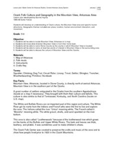
Ozark Folk Culture and Geography in the Mountain View, Arkansas Area
Upper grade through early high schoolers develop an understanding of Ozark culture, and the geography of the Ozark Plateau. They study place, location, human environmental impacts, and movement. This interesting plan incorporates muic,...
Curated OER
Geography/Current Events Project
Using the Balkan region as an example, fourth graders review the five themes of geography as a class. They identify the physical and human characteristics of a region before labeling the countries and landforms on a map. They then...
Curated OER
US City Quality of Life Analysis and Comparison
Students analyze US census data and criteria to compare and measure the quality of life in the country's fifty largest cities. After accessing the 2005 quality of life world report online, students conduct their study to compare three...
Public Schools of North Carolina
Democratic Republic of Congo - Map Skills
Work on your map skills with a packet of activities about the river basins in the Democratic Republic on Congo. Learners study the maps provided before answering the geography questions and writing an acrostic poem about the region.
US Mint
Symbols in My Eyes
Explore the hidden meanings behind the images on US currency with this elementary school lesson on symbolism. Starting with a class discussion about symbols, children go on to brainstorm different objects that represent the Unites States...
Curated OER
California's Golden History: 1848-1880
Using a variety of online resources, learners study life and society in California during the gold rush. They use a map to identify area where gold was located, explore pre-selected websites, describe mining practices, and create an...
Curated OER
European Elevation Sort
Given a prepared database of European countries, sixth graders sort the countries in ascending order by elevation and identify the five countries with the highest elevations. This cross-curricular lesson combines elements of computer...
Curated OER
N is for Natural State
For any pupils who live in the state of Arkansas, this would be a fabulous educational experience to help them get to know their state better. Through the use of activities in literature, art, mathematics, science, social studies, and...
Curated OER
Discovering American Symbols
Help youngsters get to know their states and capitals, explore their own country, and study American symbolism. They take a "trip" across America collecting symbols, images, and information about each state as they go (through text and...
Curated OER
Arkansas is Our State: Differentiating Between a State and a Country
An ambitious geography lesson is geared toward kindergartners. They discover what the differences are between states and countries. They look at maps of Arkansas, and learn what the shapes and lines mean. Additionally, they create a...
Curated OER
U.S. Geography: The West
Students explore the national parks of the American West. In this geography skills lesson, students watch "U.S. Geography: The West," and examine print and Internet sources about the national parks found there. Students feature their...
Curated OER
The Ethics of Outsourcing to China
After viewing clips from a documentary on factory work in China and US outsourcing, learners have a fishbowl discussion. They work in groups to build both personal points of view and strong arguments on the effects of outsourcing in...
Institute for Geophysics
Understanding Maps of Earth
Here is your go-to student resource on primary geography concepts, including facts about the surface of the earth and its hemispheres, latitude and longitude, globes, types of maps, and identifying continents and oceans.
Curated OER
social Studies: Yesterday, Today, and Tomorow
Sixth graders take an Internet trip back in time to explore ancient cultures. Working in teams, they assume the roles of theologian, cartographer, economist, political analyst, and anthropologist. The same groups then create time...
Curated OER
Abigail Adams: Integrating Social Studies and Language Arts
Third graders increase reading strategies while learning about Abigail Adams and her role in history. In this Abigail Adams lesson, 3rd graders read about the American Revolution and Abigail Adams using all the balanced literacy...
Curated OER
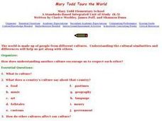
Mary Todd Tours the World
Pupils analyze how distinguishing another culture encourages us to respect each other. They research culture and all its avenues, recognizing and comprehending the relationship between people and geography. Ultimately, they can apply...
Curated OER
Beyond Demographics
Students study the Dominican Republic through watching and discussing a video about the country and its people. They explain life in the Dominican Republic and describe the emerging picture of the Dominican Republic as viewed through...
Curated OER
Maps Can Help Us
First graders explore the geography of Montana by analyzing geographic maps of the area. In this Native American reservation lesson, 1st graders discuss the similarities and differences between reservations in the state of Montana....
Curated OER
US Policy In Somalia
Students investigate the US policy for the country of Somalia. They conduct research using a variety of resources. They locate the country and then discuss major geographical features of the areas. Students discuss the present US...
Curated OER
California Geography
Fourth graders explore geography of four distinct regions of California: mountains, coast, central valley, and desert. They locate California on map, identify state's boundaries and borders, and explore agriculture, a major economic...
Curated OER
Hip Hop and Geography
Students study the various geographic regions of the U.S. and discuss how popular music is influenced by cultural/regional factors. Groups choose East Coast, West Coast, Midwest, or South in rap/hip hop music and create a PowerPoint or...


