Curated OER
Dos mapas de Florida, el Caribe y parte de Sur America
What can maps tell us about the past? Find out with a Spanish lesson that incorporates geography. After examining maps individually, comparing two old maps of Spanish Florida and writing notes in the provided Venn diagram, pupils pair up...
Curated OER
US City Quality of Life Analysis and Comparison
Students analyze US census data and criteria to compare and measure the quality of life in the country's fifty largest cities. After accessing the 2005 quality of life world report online, students conduct their study to compare three...
Office of the New Jersey State Climatologist
Play Ball! – Or Not…Making a Decision Using Weather Data
Should the game go on or not? An engaging lesson asks small groups to make a decision using weather data. After analyzing a map, an updated forecast, and radar information, groups have to decide whether to cancel a baseball game. They...
VT FEED
The Origins of Civilization and Agriculture: Integrating the Study of Food
What role has food played in the rise and changing nature of civilizations? Here you'll find a fantastic set of lessons and materials on such topics as where food is grown in the United States, the food of ancient peoples,...
Curated OER
From There To Here...
Students find out where some of the products in hour homes come from, then become aware of our local trash, landfills and incinerators. They chart and graph data and use maps for different purposes.
Curated OER
How Much Water is in That River?
Young scholars practice measurement using the Hudson River. They calculate the discharge measurement at a location on the Hudson River using ingenuity and a topographic map.
Curated OER
Maps: U.S, Time Zones
Students perform various activities to demonstrate knowledge of time zones. They connect with an interactive map to discover what time zone they are in. They create clocks out of paper plates and simulate different time zones.
Curated OER
Using Non-Text Features
Second graders examine graphs and charts from their local newspaper. As a class, they discuss what the data means and how it relates to the article. In groups, they are shown two sets of graphs or charts and they practice explaining...
Curated OER
Distinguishing Between Levels of Government
Twelfth graders study confederal, federal, and unitary governments. They compose an essay that compares and contrasts the purpose of state/local government with that of the national government in the American federal system.
Curated OER
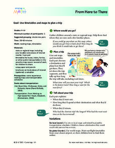
From Here To There
Students plan a trip while using maps and times tables. In this trip planning lesson plan, students work in pairs, and complete problems about gas, travel time, and more.
Curated OER
Creating a Virtual Tour of Oregon City
Fifth graders research a famous person or building associated with Oregon City. In this local history lesson, 5th graders work in groups to research and create a poster board about a famous person or building found in Oregon City.
Curated OER
Maps: Latitude and Longitude
Young scholars visit interactive sites focusing on latitude and longitude. They participate in activities about the prime meridian, time zones, and equator. They view the coordinates of states and cities.
Curated OER
Why Vote? A Public Awareness Campaign
Students examine the structure of local government and determine why citizens vote. In this civics instructional activity, students listen to a lecture about the structure of local government and then encourage others to exercise their...
Curated OER
Zoo-Goers Ready to Greet Baby Panda
The Smithsonian's National Zoo, also known as the Washington Zoo, is one of the oldest zoos in the United States. Youngsters read and discuss a news article about Tai Shan, baby panda that was one of the zoos most famous residents. They...
Houghton Mifflin Harcourt
Let’s Count!: Challenge Activities (Theme 5)
Challenge young scholars with a counting-themed series of activities. Your counters will write invitations to a feast, create books about dinner parties and animals, design posters, draw pictures of their favorite peaceful places, and...
Curated OER
ESOL Government and Commmunity Resources
Students study vocabulary words associated with community services. They label each community service on an index card and match a phrase with the service. They identify community service buildings in the area on a local map.
Curated OER
The Water Around Us
Students discuss importance of reading maps and knowing about the geography of the United States, and locate bodies of water on different types of maps and examine how they are used in the state or local community.
Curated OER
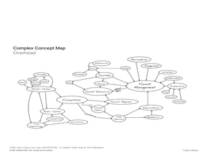
Project Jukebox
Students analyze an interview with the Climate Change Project Jukebox in order to help them undertand how to use a concept map. For this writing and climate change lesson, pairs of students log onto the Internet site for Climate Change...
Curated OER
History of the West using the Digital Atlas
Students navigate the digital atlas of Idaho. They research the unique features of south central Idaho and the geological events which have shaped it over the past 17 million years. Afterward, they write an essay on an aspect of changes...
Curated OER
Facts, Fictions and Perceptions of Regions
Students examine the different characteristics of the regions of the United States. They discuss places they have visited in the U.S., and in small groups conduct research on a selected region of the U.S. Each group labels a map of...
Curated OER
Know Your Area
Students investigate transit by analyzing their school surroundings. In this local geography lesson, students identify their school in relation to the rest of their state, country and globe. Students discuss their personal travel habits...
Curated OER
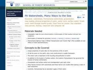
PA Watersheds, Many Ways to the Sea
Students examine the water cycle and the factors that interact with watersheds. In this watersheds instructional activity students describe the purification process, trace the flow of infiltrate water through aquifers, and research the...
Curated OER
Hemingway Hangouts
Students use printed maps and websites to estimate driving distances and plan routes to Hemingway's home. They visit several locations online and record facts about each location.They calculate, distances, driving time, and other factors.
Curated OER
Expanding the Mission: Historical Parks
Students explore U.S. geography by viewing a documentary in class. In this national parks lesson, students view video clips of individual national parks and locate them using Google Earth software. Students create a persuasive...


