Curated OER
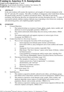
Coming to America: U.S. Immigration
Students study immigration in the late 19th and early 20th century. In this immigration lesson plan, students participate in activities including creating maps, responding to non fiction text, memorizing and analyzing poetry, and...
Curated OER
Tibet and the U.S.
Students study the Tibetan situation. In this global issues lesson, students listen to a lecture regarding Tibet, its location, and its ties to China. Students then create political cartoons or write letters to their Congressperson about...
Curated OER
Journey Across the USA with Oliver K. Woodman
Challenge your class with this lesson focusing on the fifty states. Learners use ArcMap to show the route the main character in the story Journey of Oliver K. Woodman took across the United States. Then, they write journal entries about...
Curated OER
U.S. History: de Soto's Alternate Route
Eighth graders examine various maps associated with Hernando de Soto's expedition. By comparing their textbook maps with newer maps, they answer a battery of focus questions. Using Microsoft Word, 8th graders answer the questions...
Curated OER
Culture Regions of the U.S.
Young scholars identify the location of different cultural groups within the United States (agricultural, retirement, urban, etc.) They map these areas and analyze the correlation between the landscape of a given region and the type of...
Curated OER
Philadelphia and the Constitutional Convention "Heat Up"
Students explore the Constitutional Convention of 1787. In this U.S. Constitution lesson, students role play the parts of delegates in a simulation of the convention.
Tennessee State Museum
An Emancipation Proclamation Map Lesson
Did the Emancipation Proclamation free all slaves during the Civil War? Why was it written, and what were its immediate and long-term effects? After reading primary source materials, constructing political maps representing information...
National Museum of the American Indian
The A:Shiwi (Zuni) People: A Study in Environment, Adaptation, and Agricultural Practices
Discover the connection of native peoples to their natural world, including cultural and agricultural practices, by studying the Zuni people of the American Southwest. This lesson includes examining a poster's photographs, reading...
Curated OER
Where We Live
Students forecast future population growth of the U.S. Virgin Islands. In this U.S. Census lesson plan, students explain the factors that influence population density on the U.S. Virgin Islands, including geography and economic activity.
Curated OER
Reshaping the Nation
Young scholars learn why the census makes a difference. In this U.S. Census lesson plan, students learn how to read and use a cartogram while they explore new ways to represent data.
Curated OER
Introduction to Symbols
Learners study the concept of picture symbols as a way to express ideas without using words. In this picture symbol instructional activity, students place symbols on a U.S. map according to meaning. Learners then review various symbols...
Curated OER
U.S. History: What Happened Here?
Students apply the global positioning system to create maps of local historical sites. By collaborating with local historical groups, they research events and relate them to broader, national history. In addition to writing essays...
Curated OER
Geography Puzzles
Students study the continents of the world. In this Internet geography lesson, students connect to online mapping games. Students collaborate in order to develop their understanding of world geography, including countries and capital...
Curated OER
George Washington's Revolutionary Journeys
Students take a closer look at historical maps. In this American Revolution activity, students examine the provided historical maps and documents to determine the assignments that George Washington assigned to subordinates during the...
Curated OER
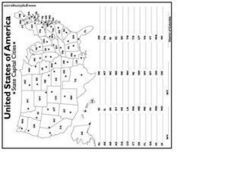
United States Capital Cities
In this identifying the United States Capital cities activity, students use a United States map and a list of state abbreviations to write each state' s and the District of Columbia's capital city. Students write 51 answers.
McGraw Hill
Study Guide for Bridge to Terabithia
Bridge to Terabithia is a story about friendship that brings magic into ordinary life. Study guides may not be magical, but the guided questions, graphic organizers, extension activities, vocabulary, and discussion questions help...
Curated OER
In Mr. Lincoln's Shoes
Learners demonstrate basic map skills. For this US history lesson, students review cardinal directions and use a compass rose while at the same time discuss what life was like for Abraham Lincoln.
Curated OER
Let's Build a Map
Students gain an understanding of maps while studying the map of the Louisiana Purchase and the trail of Lewis and Clark and the Corps of Discovery. They demonstrate understanding of maps by creating a basic classroom map.
Curated OER
Maps Can Help Us
First graders explore the geography of Montana by analyzing geographic maps of the area. In this Native American reservation lesson, 1st graders discuss the similarities and differences between reservations in the state of Montana....
Curated OER
Mapping Where Animals Live
What type of reptiles live in New York State? This instructional activity gets the class thinking about what factors determine where particular animals live. They analyze the Hudson Valley environment, identify specific reptile and...
Curated OER
The Crash Scene
Fifth graders explore geography by participating in a mapping activity. In this engineering instructional activity, 5th graders identify the differences between latitude and longitude and practice locating precise points on a globe or...
Curated OER
Mapping Districts
Students use maps to learn about the U.S. Census. In this 2010 Census lesson plan, students visualize census data on maps, use map keys to read population maps, and explore the concept of population density.
Curated OER
Across the United States- Home Learning Activity
In this home-school United States map worksheet, students work with a family partner as they study a map of the United States. They talk about the states they have visited, play a game by giving each other clues about states, and write...
Houghton Mifflin Harcourt
Surprise!: Extra Support Lessons (Theme 2)
Surprise! is the theme of a unit covering such topics as consonants, blending, short vowels sounds, high frequency words, and number words. The unit's lessons also include teachable moments covering story structure, illustrations,...


