Curated OER
The Desert Alphabet Book
Students explore world geography by researching a science book with their classmates. In this desert identification lesson, students utilize a U.S. map to locate the geographical locations of deserts. Students create an oral report based...
Curated OER
Map Scale and the Pioneer Journey
Fourth graders, using a map, ruler and calculator, determine the distance the pioneers traveled from Nauvoo, Ill. to the Salt Lake Valley.
Curated OER
How 9/11 Shaped U.S. Foreign Policy
Students discuss the U.S. foreign policy and the components they consider important. They read and discuss President George W. Bush's speech of November 10, 2001. Students locate and mark countries President Bush identified in his speech...
Curated OER
Using Map Skills
Third graders study maps. In this U.S. geography lesson, 3rd graders explore directions on a compass rose and use a map scale to determine distances between two points on a map. They listen to a lecture and use their own maps to practice...
Curated OER
Teaching Six Big Ideas in the Constitution
Students debate the constitutional principles of the United States. In this U.S. government lesson, students examine the meaning of the text of the U.S. Constitution and analyze other primary documents of the era. Students prepare for...
Curated OER
Inform the Community
Students gain an understanding of the U.S. Census. In this social studies civics lesson plan, students explore understand the link between the census and the availability of community services.
Curated OER
Biggest Cities in Each State Quiz
In this online interactive geography quiz worksheet, students examine the chart that includes the names of 50 U.S. states. Students identify the names of the two largest cities in each state in 8 minutes.
Curated OER
What Do You Know?
Students learn why the census makes a difference. In this U.S. Census lesson plan, students demonstrate knowledge and understanding of the census and its importance.
Curated OER
Voyage to Freedom - What Does It Mean?
Fifth graders investigate the Underground Railroad by creating a quilt. For this U.S. History lesson, 5th graders discuss the history of slavery through a class "word splash" and by reading an Underground Railroad map online. Students...
Curated OER
US City Quality of Life Analysis and Comparison
Students analyze US census data and criteria to compare and measure the quality of life in the country's fifty largest cities. After accessing the 2005 quality of life world report online, students conduct their study to compare three...
Curated OER
Necessity is the Mother of Invention
Students research the Industrial Revolution. In this Industrial Revolution lesson plan, students research on the Internet, with books, magazines, fill out worksheets, and more to learn about inventions that were made out of necessity or...
Curated OER
A Treaty Tail: U.S. - Indian Treaty Councils in the Northwest
Learners view a painting as a document to find out about the Indian Treaty Councils. In this artist's perspective lesson, students study the conflicts as shown in various pictures. Learners answer questions about what they learn from...
Curated OER
Mapmaker, Make Me a Map!
Students are introduced to the state quarter program and examine the Colorado state quarter. They locate Colorado on a map and create a map with a key. They discuss the state motto and examine pictures of the state's geographical features.
Curated OER
Map Literacy
Students locate their home state on a map. They differentiate between physical and population sizes of states. In two groups, students "become" states with string for boundaries. They ascertain that area does not always equal large...
Curated OER
Food on the Map
Students work together to examine the tastiest towns in the United States. After discovering the names of the equipment, they identify the seven continents. They take a survey and locate the cities and states of the foods mentioned.
Curated OER
Colonial Vacation Planner
Looking for a good lesson plan on the Colonial Period for your upper-elementary class? Then, this lesson plan is for you! They use website designs, U.S. travel publications, and maps to plan a family vacation to states which were part of...
Constitutional Rights Foundation
Refugees from the Caribbean: Cuban and Haitian “Boat People”
Should refugees fleeing poverty be allowed the same entrance into the United States as those fleeing persecution? High schoolers read about US foreign policy in the late 20th century regarding refugees from Cuba and Haiti, and engage in...
Curated OER
Traveling Cat Flown Home to Family
Learners locate Wisconsin and Belgium on a world map, then read a news article about a cat that stowed away on ship from the U.S. to Europe. In this current events lesson, the teacher introduces the article with map and vocabulary...
Constitutional Rights Foundation
Refugees From Vietnam and Cambodia
The United States may have pulled its troops from the Vietnam War in 1973, but the conflict was far from over for the citizens living in Asia at the time. An informative resource lets learners know about the wave of over 220,000...
Curated OER
Where Did My Lunch Come From? A U.S. Regional Tour
Learners explore the regions from which their food comes. In this social studies lesson, students identify the different agricultural products that are found in the major regions of the United States. Learners create a lunch menu.
Curated OER
The Oregon Trail
For this Oregon Trail worksheet, students practice their map skills while they explore the states of Oregon, Missouri, Idaho, Nebraska, and Wyoming. Students us a map of the US to plot six points on the map that show the Oregon Trail.
Curated OER
Naming the States of the U.S
Fifth graders study the 50 states on a map. In this social studies lesson, 5th graders identify the names of the states and location. Additionally, students work in small groups to name and locate as many states as they can on a blank map.
Curated OER
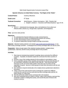
Spanish Influence on United States Currency: The Origins of the "Dollar"
Sixth graders research the Spanish influence on early colonial America and the process of establishing the present U.S. currency. They read and discuss an informational handout in small groups, and take a short quiz. Students then...
Curated OER
If I Had Been at Ellis Island
Students examine what it was like to enter the U.S. as an immigrant. They conduct Internet research, develop a concept map, list the ways children occupied their time while at Ellis Island, and create a diorama.


