Curated OER
United States Map- State Capitals
Students explore map skills. For this state capital lesson, students view a United States Political Map and identify and use post-it notes to label the state capitals.
Curated OER
Arkansas is Our State: Differentiating Between a State and a Country
An ambitious geography lesson is geared toward kindergartners. They discover what the differences are between states and countries. They look at maps of Arkansas, and learn what the shapes and lines mean. Additionally, they create a...
Constitutional Rights Foundation
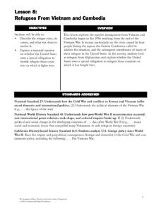
Refugees From Vietnam and Cambodia
The United States may have pulled its troops from the Vietnam War in 1973, but the conflict was far from over for the citizens living in Asia at the time. An informative resource lets learners know about the wave of over 220,000...
Curated OER
Projects For USA Units
Young scholars study different regions of the United states through interdisciplinary activities. This lesson presents very creative, artistic ways for students to explore the variety of regions found in the United States.
C-SPAN
The Electoral College and the Constitution
What is the purpose of the Electoral College? Is it antiquated, or does it have a place in today's political climate? High schoolers view a series of video clips as they analyze the parts of the United States Constitution that address...
National Geographic
Mapping the Americas
Celebrate the geography of the Americas and develop map skills through a series of activities focused on the Western Hemisphere. Learners study everything from earthquakes and volcanoes of the Americas and the relationship between...
DocsTeach
Analyzing a Map of the Louisiana Purchase
With the stroke of a pen, Thomas Jefferson roughly doubled the size of the United States. The Louisiana Purchase not only grew the new country, but also it gave rise to the legends surrounding westward expansion and accelerated the...
Curated OER
United States Map - Lesson 4: States
Young scholars use a United States Map to locate their state and use map symbols to determine the boundaries of a state. In this states lesson plan, students learn the definition of a state and identify their own on a map.
Curated OER
United States Map- Map Legend/City Symbols
Students investigate the United States map. In this map skills geography lesson, students explore city symbols on the map legend and identify them. Students use post-it notes to mark various symbols.
Curated OER
United States: Physical Features Fun
In this map worksheet, students color and trace eleven listed features on a map of the United States. Students answer six additional questions about the map. A United States map is not provided. However, websites are provided to find...
Curated OER
Mystery State # 41
Kids use their deductive reasoning skills, state knowledge, and five clues to determine mystery state #41. They'll follow the clues to locate the mystery state on a US map. Note: This is a warm-up activity, so it includes two short...
Curated OER
Settlement Patterns of the United States
Learners examine the conditions that affected the way people settled in the United States. Using maps, they examine the topography and climate of different locations and determine the factors that do and do not allow settlement to occur....
Curated OER
United States Map - Lesson 7: Four Main Directions
Students locate the North and South Poles, and learn the definitions of the four directions by using a United States Map and a globe. In this directions lesson plan, students define north, south, east, and west on a map and a globe.
Ashbrook Center at Ashland University
The Constitutional Convention
Imagine sitting down with representatives of your school to write a new student handbook. What arguments would ensue? How would compromises be made to finish the project? Scholars research the Constitutional Convention using a directory...
Statistics Education Web
The United States of Obesity
Mississippi has both the highest obesity and poverty rate in the US. Does the rest of the data show a correlation between the poverty and obesity rate in a state? Learners tackle this question as they practice their skills of regression....
Curated OER
Looking at Human Struggle Through The Language Arts Curriculum: The Faces of Slavery
Sixth graders examine the use of slavery in the United States. Using a map, they draw the route of the Tecora and Amistad voyages. Individually, they write an essay describing their opinions on whether the Africans on the ships should be...
Curated OER
Countdown Challenge: Right Angles
In this right angle instructional activity, middle schoolers observe a map of the United States of America. They indicate all right angles on the map by using a right angle symbol. Students list the names of the states and identify the...
Curated OER
Tibet and the U.S.
Young scholars examine the relationship between Tibet and the United States. They explore the political relationship between the two countries. Students identify geographical features and political boundaries of the Tibetan and Chinese...
Curated OER
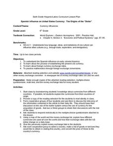
Spanish Influence on United States Currency: The Origins of the "Dollar"
Sixth graders research the Spanish influence on early colonial America and the process of establishing the present U.S. currency. They read and discuss an informational handout in small groups, and take a short quiz. Students then...
Curated OER
United States Map Lesson
Students explore basic map skills. In this United States geography lesson plan, students define "country" and "state," locate their state on a United States map, and identify and trace state boundaries defining their state and...
Artisan Global
QuakeFeed Earthquake Map, Alerts and News
Amateur seismologists explore Earth's earthquakes in real time using a variety of map styles and parameter selections.
Curated OER
Solving the Puzzle
Students create a map showing the United States borders at a specific period in history and produce three questions to be answered by examining the map. They also write a productive paragraph explaining who, what, when, where, how/why a...
Curated OER
Four Famous Faces
Each one of our quarters is embellished with a famous face or image representing the state it came from. This lesson uses South Dakota's state quarter to get kids thinking about monetary value, what the president of the United States...
New York State Education Department
US History and Government Examination: August 2016
Multiple-choice and essay questions test comprehension, writing ability, and skills with primary source analysis. The comprehensive exam covers many different subjects including the United States census, Constitution, and important...


