Curated OER
States and Capitals - Lesson 4 - U.S. Political Map
In this U.S. state capitals worksheet, students identify the capital cities of the 50 states using the latitude and longitude coordinates provided.
Curated OER
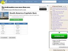
South American Capitals Quiz
In this online interactive geography quiz worksheet, students respond to 12 identification questions about the capital cities of South America. Students have 4 minutes to complete the quiz.
Curated OER
World Capitals Quiz
In this online interactive geography quiz worksheet, students respond to 195 identification questions about the capital cities of countries in the world. Students have 12 minutes to complete the quiz.
Curated OER
Asian Capitals Quiz
In this online interactive geography quiz worksheet, students respond to 48 identification questions about the capital cities of Asian countries. Students have 6 minutes to complete the quiz.
Curated OER
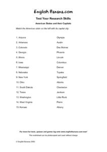
American States and Their Capital- Test Your Research Skills Worksheet
In this geography skills instructional activity, students match the American state listed on the left with its capital city listed on the right by drawing a line from one to the other.
Curated OER
Australia Cities Map Quiz
For this online interactive geography quiz worksheet, students respond to 17 identification questions regarding Australian cities. Students have 3 minutes to finish the timed quiz.
Curated OER
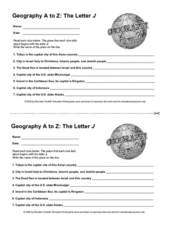
Geography A to Z: The Letter J
How many states, capitals, countries, and locations do your kids know that begin with the letter J? Hopefully they know seven of them, because that's the number of questions on the fun and fast worksheet.
Curated OER
Capital Questions
In this Canadian capitals worksheet, students answer 15 multiple choice questions regarding the capitals of Canada's provinces and their geography.
Curated OER
US: Western Region Map
In this U. S. Western Region outline map worksheet, students examine boundaries of each of the states and the placement of the capital cities. This map is not labeled.
Happy Housewife
State Notebooking Pages
When learning about US geography, it can hard to remember facts about 50 different states. Help your young scholars organize all of this information with a collection of easy-to-use note-taking guides.
Curated OER
State Notebooking Pages
Studying US states in your class? Then this note-taking page is perfect for you! Pupils can fill in information about a chosen state in the provided and labeled spaces. By the time they've filled out all the boxes, they'll know the...
Curated OER
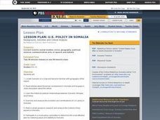
US Policy In Somalia
Students investigate the US policy for the country of Somalia. They conduct research using a variety of resources. They locate the country and then discuss major geographical features of the areas. Students discuss the present US...
Curated OER
Puerto Rico: The 51st State?
Students research the history of Puerto Rico, its culture, and geography. In this Puerto Rico lesson, students find Puerto Rico on a map and find specific regions or cities. Students discuss Puerto Rico's statehood and listen to salsa...
Curated OER
Keeping Up With Capitals
Students engage in a class discussion where they identify the situations where capitalization is necessary. They complete worksheets embedded in the plan where they capitalize proper nouns such as names, holidays, and special events...
Curated OER
Texas Worksheet
In this Texas worksheet, students examine a large color picture of the Texas state flag. After doing their own research, students fill in facts about the state: capital city, flower, tree, motto, date of statehood and what the state is...
Curated OER
Pile 'em High?
Students explore the concept of architectural heritage. In this architecture lesson plan, students visit selected websites to compare and contrast the architectural features in world cities.
Curated OER
Social Studies - State Riddle Lesson Plan
Young scholars make distinctions between the states, their cities, and capitals, and create riddles for classmates to solve.
Curated OER
Match Capitals to Their States- Internet Activity
In this state capital matching worksheet, students use a given web site to match the name of each state with its capital. They use the names of the capitals that are located in a word bank at the bottom of the page when searching for...
Freecloud Design
Stack the States™
Kids have fun learning US geography and state facts, including capitals, nicknames, major cities, and landmarks. They can choose between the game, or informational flashcards for each state.
Curated OER
California Here We Come!
A highly relevant and great cross-curricular project! In teams, your class will plot a course from the East Coast to Sacramento, California passing through all of the state capital cities along the way. As part of the journey, teams will...
Curated OER
E-mailing the Chamber of Commerce
Encourage effective internet research and e-mail correspondence as scholars investigate a US capital city they've never visited to find pertinent and relevant information. They begin by picking a city, then visit that city's chamber of...
Curated OER
The 50 States and its Holidays
Though the format of this ELL lesson is confusing (the standards listed are for plate tectonics, yet the objectives are for American geography and holidays), a teacher could glean some ideas from the main idea. Here, pupils complete a...
Curated OER
US: Midwest Region Map
In this U. S. outline map worksheet, students examine boundaries of the Midwest Region states and the placement of the capital cities. This map is labeled.
Curated OER
South US Region Map
In this United States regional outline map, students examine the state boundaries of the states in the Southern Region. Capital cities are denoted with stars.


