Curated OER
Map Coordinates: Monkey Map
Here's an engaging, meaningful, and clever lesson on map skills for elementary schoolers. Pupils combine story writing with mapping skills to create an original piece of work. They utilize a worksheet embedded in the plan to guide them...
National Wildlife Federation
Hot, Hotter, Hottest: Extreme Weather's Impact on Our Resources
How dry is it? It's so dry, the river only runs twice a week! Through an analysis of maps and discussions, pairs learn about droughts across the United States in the ninth of 12 lessons. They then read about, answer questions, analyze...
Anti-Defamation League
Impact of the U.S. Expansion on Indigenous People and Stereotypes About Native American People
The 2004 U.S. bicentennial sparks a discussion about its meaning and importance to United States history. Readings, maps, tables, and reflective writing prompt small groups to explore the westward expansion, Lewis and Clark, and how...
BrainPOP
Latitude and Longitude Differentiated Lesson Plan
Scholars warm-up their map skills with a discussion using location words to describe familiar places. An engaging video informs class members about latitude and longitude. Three leveled activities extend the learning experience for...
Space Awareness
Let's Map the Earth
Before maps went mobile, people actually had to learn how to read maps. Pupils look at map elements in order to understand how to read them and locate specific locations. Finally, young cartographers discover how to make aerial maps.
Library of Congress
Marco Paul's Travels on the Erie Canal: An Educational Voyage
Following the book, Marco Paul's Travels on the Erie Canal, readers complete an activity for each chapter, take part in discussions, and respond to several questions. To show what they know, scholars create an alphabet book using primary...
Novelinks
Where the Red Fern Grows: Graphic Organizer, Story Map
How do you grow a goal from a dream to reality? You make a plan! After reading chapters two and three of Where the Red Fern Grows, learners map how Billy earns his dogs by completing an organizer in pairs and then discussing answers in...
Kate Stickley
Reading the World: Latitude and Longitude Lesson latitude and longitude, maps, coordinates on a map, prime meridian, reading maps, equator, globes
Find five activities all about longitude and latitude! Use oranges to show the equator and prime meridian, plot birthdays on a map using coordinates, and plan a dream vacation.
Curated OER
Little House on the Prairie
Hop into a covered wagon and follow Laura Ingalls Wilder through the Midwest. A series of lessons based on Little House on the Prairie encourages young pioneers to see the world through Laura's eyes as they map her journey, discuss the...
National Gardening Association
Migration Mishaps
Elementary ecologists pretend to be migratory hummingbirds. They fly between wintering and nesting grounds, trying to reach a habitat haven. In a musical-chair fashion, some birds will miss out, and are removed from the game. To further...
Curated OER
Integrated Lesson Plan
An ambitious and engaging lesson plan on the Westward Movement for your students to enjoy! Groups of learners rotate between learning tasks such as learning about the Chislom Trail, Lewis and Clark, and the Gold Rush. A WebQuest is also...
Public Schools of North Carolina
Democratic Republic of Congo - Map Skills
Work on your map skills with a packet of activities about the river basins in the Democratic Republic on Congo. Learners study the maps provided before answering the geography questions and writing an acrostic poem about the region.
Curated OER
Examining Character Traits through Character Mapping
Some of what we know about a character is directly stated. Some of what we know is inferred by events in the story. Character maps help primary learners recognize the difference. After modeling with a story your class has read, pupils...
Edgate
Journal Maps
Inspire your class to look at their environments as if they were seeing them for the first time in order to gain a better understanding of the concept of perspective. After exploring their communities and keeping a journal of major...
Tennessee State Museum
An Emancipation Proclamation Map Lesson
Did the Emancipation Proclamation free all slaves during the Civil War? Why was it written, and what were its immediate and long-term effects? After reading primary source materials, constructing political maps representing information...
National Geographic
Mapping the Shape of Everest
With Mount Everest as the motivator, your earth science class learns about topographic maps. Begin by showing a film clip from The Wildest Dream: Conquest of Everest, featuring fearsome virtual imagery of a path up world's tallest peak....
Houghton Mifflin Harcourt
Nature’s Fury: Extra Support Lessons (Theme 1)
Earthquakes, hurricanes, volcano eruptions, and more. To enrich their study of nature's big events, kids map tectonic plates and major earthquake locations, identify emergency response agencies, and storyboard a film about volcanos.
Curated OER
Using Old Maps as Tools to Explore Our World
Learners explore historical maps. In this primary source analysis instructional activity, students uncover the meanings in selected historical maps as they use them to enhance lessons on historical events. Samples for classroom use are...
Curated OER
Lesson 1: Map Data and the Census
Students learn about the history of the census. In this U. S. Census lesson plan, students develop an understanding about how the United States Constitution grants and distributes power and discover how the spatial organization of...
Curated OER
Play Doh Map of Your State
Students create a state map using Playdoh. In this hands-on state geography instructional activity, students work in groups to form a three-dimensional map of their state using Playdoh made at home following a (given) recipe. Students...
Alabama Learning Exchange
Coordinate Geometry
Where do the coordinates lead? As children brainstorm ways to find the location of different buildings, they learn about coordinate points and how to use them to locate areas on a grid or map. They practice using ordered pairs by playing...
Curated OER
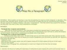
Map Me a Paragraph
There are so many great reading strategies. For this lesson, learners practice decoding. They break down two paragraphs to analyze and determine main ideas and details. They each observes ways to model as they map their paragraphs.
Curated OER
Mapping Out the Story
Discuss the reading comprehension strategy of summarization with your elementary schoolers! They read a chapter from their social studies textbook, Regions Near and Far, and create a map, or word web, for the chapter. They identify...
Curated OER
French and Indian War: Make A Map
Fifth graders create a map of the battles that occurred during The French and Indian War. In this history lesson plan, 5th graders read about the war in their text books, then divide into groups to create a detailed map of a famous...


