Curated OER
Map Activity: Place Name
In this map worksheet, students locate given words on a map of the United States, then answer a set of 4 related short answer questions.
Curated OER
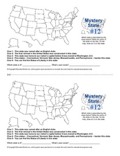
Mystery State #12
What's better than learning about US geography? Having fun while your doing it! After reviewing each of the five given clues, learners attempt to name the mystery state. A great way to reinforce geography skills and deductive reasoning...
Curated OER
Map Work: Using the Index and Grid References
In this maps worksheet, students use the Oxford First Atlas to answer 20 questions about cities in Great Britain. Students will need to use the index and grid references to locate cities or countries.
Curated OER
Blank Map: The United States of America
In this map worksheet, students use the blank outline map of the United States to label the 50 states or for any other study purpose. Each state boundary is shown with no name labels.
Curated OER
States/Capitals L-N: Matching
In this geography practice learning exercise, students match the 17 listed states to the appropriate 17 listed capital cities located in the United States.
Curated OER
United States Map: March 31
In this calendar dates worksheet, students learn that March 31st was the day the first map of the United States was published. Students then create a map of either their classroom or school.
Curated OER
U.S. Geography for Children: Michigan
For this Michigan map activities worksheet, students observe an outline map of the state of Michigan, locate and label specific places and areas, and create a map key. Students complete 5 activities.
Curated OER
Do You Know Your 50 States?
Learners use the names and abbreviations of the 50 states to label a blank map of the United States.
Curated OER
Lewis & Clark: The Louisiana Purchase
In this facts about the Louisiana Purchase and the Lewis and Clark expedition online interactive activity, students read information and observe a map of the Louisiana Purchase to answer questions showing their comprehension skills....
Curated OER
United States Map Quiz
In this online interactive geography quiz worksheet, students respond to 50 identification questions about the shapes of countries shown. Students have 5 minutes to complete the quiz.
Curated OER
Freeform Rhode Island Map
In this free form Rhode Island map learning exercise, students study, locate and memorize key cities, physical attributes and surrounding states for a quiz. Students fill out the major cities on a blank map of Rhode Island.
Curated OER
Freeform Pennsylvania Map
In this Pennsylvania map worksheet, students research, study and label twenty important cities, physical attributes and the neighbors that surround Pennsylvania on a Pennsylvania map.
Curated OER
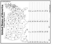
United States Capital Cities
In this identifying the United States Capital cities activity, students use a United States map and a list of state abbreviations to write each state' s and the District of Columbia's capital city. Students write 51 answers.
Curated OER
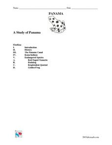
A Study of Panama
In this worksheet on Panama, students read an introduction about Panama, then read about its history, The Panama Canal, the Kuna Indians and the Endangered Species of Panama. After each selection, students answer a set of related questions.
Curated OER
United States Capitals Map Quiz
In this online interactive states and captials quiz learning exercise, students examine the 50 pictured states and try to name all of the state capitals.
Curated OER
World Continents Map Quiz
In this online interactive geography quiz worksheet, students respond to 7 identification questions regarding the continents of the world.
Curated OER
Finding Your Way Around Wookey Hole Caves and Papermill
In this social studies learning exercise, students examine a detailed map of a place called Wookey Hole Caves and Papermill. Students answer 8 questions about the map. It is not clear if the place on the map is real.
Curated OER
River Clyde, Scotland Pictoral Map
In this River Clyde, Scotland geography worksheet, students study a detailed pictorial map. Students learn that the river is used for work and pleasure as they study locations on a labeled map. There are no questions.
Curated OER
The River Forth-- Pictorial Map of Scotland
In this River Forth in Scotland geography worksheet, students learn of important industries and settlements by studying the pictorial map. There are no questions to answer.
Curated OER
Historical Map - United States: The Changing Frontier
In these United States frontier worksheets, students study the map of the United States frontier for various sections of time in the history of the United States. Students then finish a crossword puzzle using the various parts of the...
Education World
Mystery State #29
In this United States mystery worksheet, learners determine which state is described by the 5 clues listed on the sheet and then mark it on the outline map of the United States.
Curated OER
Physical World Map
For this world map worksheet, students practice their geography skills as they label the 7 continents and 5 oceans. Teachers may use this physical map for various classroom activities
Curated OER
The UK and the Republic of Ireland
In this maps worksheet, students label the cities and countries of the United Kingdom and the Republic of Ireland and answer a short answer questions. Students complete 4 activities.
Curated OER
U.S. geography for Children: New York
In this geography worksheet, 5th graders study the state of New York. Students follow the given directions to complete 5 tasks on the state map that is given.


