T. Smith Publishing
48 Contiguous States
What do your pupils know about the United States? This resource asks learners to respond to 10 questions about certain states and landmarks. Useful for a geography lesson and to help familiarize your learners with the continent. An...
Curated OER
Dig Into Ireland
Students study Ireland and its distinctive culture. In this exploring Ireland instructional activity students view a program on Ireland, answer questions then divide into groups and research the Irish connection.
Curated OER
Growth in A City Neighborhood
Students take the "role" of city planner. They overlay a map of one area of the city in the past, present, and projected future project. Students discuss reasons for selecting the special features of the area. The lesson refers...
Curated OER
Where in the World Am I?
Students are introduced to geography skills. They answer questions on a worksheet using the internet and maps. They examine the area of Japan as well.
Curated OER
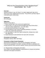
What Are The Characteristics of Your Neighborhood?
Middle schoolers make a mental map of their neighborhood. Using a software program, they make an aerial and digital map of their school and locate their school on given maps. In groups, they calculate the distances to various locations...
Curated OER
Context for Exploration
Young scholars examine watershed maps from the Columbia River. They practice using maps and create their own watershed map. They share their map with the class.
Curated OER
Exploring Our Community
Students identify nonprofit and profit organizations in their community. They discuss why it is important to have both types of organizations. They create a land use map of their community.
Curated OER
Making A New Nation
Eighth graders read standard road maps and topographical maps, and examine the lives of pathfinders who opened the trails to the West. They develop Living History presentations, role-playing a character from the past.
Curated OER
Lost Roman Treasure
Students simulate what it would be like to be archeologists. They evaluate a quadrant area of a lost Roman treasure map. They generate their findings on the map into specific categorizes.
Curated OER
Africans in Mexico
Students read case studies to examine the role of Africans in Mexico. Using maps, they research the areas that are discussed in the text and map out movement maps of Africans to and from Africa. They research the history of the Mexico...
Curated OER
Friends of the Desert
Students examine the climate map of Africa with emphasis on the desert regions. They work together in groups to play the role of different delegations preparing for a conference. They present their information to the class.
Curated OER
Students Become Mapmakers
Young scholars practice making a map of a continent and correctly plotting five cities on that map. They place latitude and longitude lines on a map, determine the need for various map projections and explain why map scales are necessary.
Curated OER
The Olympics
Students study about the ruins of Ancient Olympia along with telling about what games are traditional in the Olympics. With the teacher using a PowerPoint to the sites, students label a map of their own. For the final project, they...
Curated OER
Exploring Native Americans
Students use the MapMaker¿¿¿s Toolkit program to accurately label animals, crops, and habitats associated with their particular tribe of Native Americans. They print out a copy of their map and add it to their book on Native Americans.
Curated OER
Orienteering II
Students name the parts of a compass and comprehend the function of each part. They define paces and tallies and use them in a real world situation. Students are shown the proper use of radio terminology. They use a map and compass to...
Curated OER
Balinese Music As An Aspect Of Art In Southeast Asia
Students listen to music from Southeast Asia, study the place on a map, and are exposed to the culture.
Curated OER
Return South Migration Lesson Plan
Students study the reasons so many immigrants returned to the South following the Civil Rights Movement. They examine how the former slaves influenced the cultural life in the Northern cities.
Curated OER
Cultural Comparison - A Look at Vietnam and the USA
Students identify a map of Vietnam and locate it in Asia. They find the three countries that surround Vietnam. Using a CIA Fact Web site and photographs from Vietnam, students list differences and similarities of these two cultures.
Curated OER
The Expansion of The United States, 1846-1848
Students interpret historical maps,identify territories acquired by the United States in the 1840s. Also they identify states later formed from these territories. The primary sources for the lesson are the maps found in the lesson's...
Curated OER
Tobacco: Exploring Tobacco Culture
Eighth graders are introduced to the tobacco planting process. Using primary sources, they identify the steps necessary to grow the popular crop. They create a flow map to organize the process graphically. They discuss the...
Curated OER
Let's Go to Nagano!
Students, individually and in groups, utilize Internet sites to access maps, scales, and information to assist them in calculating distances. They research modes of travel from their homes to Nagano, Japan, and write a travel agenda for
Curated OER
The Arctic and Taiga Ecozone of Canada
Young scholars examine the various sub-regions of the Arctic and Taiga zones in Canada. Using the online Canadian Atlas, they locate and describe the characteristics of each zone. They organize their information into a chart and share...
Curated OER
CASTLE ROCK PUEBLO: A TRIP THROUGH TIME
Pupils use a map to respond to a series of questions. They determine how much time it would take to travel to Castle Rock Pueblo from different pueblos and locate modern pueblos on the Indian Country map.
Curated OER
Oak Ridges Moraine: Southern Ontario's Sponge
Students examine the characteristics of the Oak Ridge Moraine in Canada. Using a map, the locate the moraine and present and defend a position on how the resources found there should be used. They must use proper geography terminology...


