Curated OER
Glacial Groundwater
Young scholars study glacial deposition and groundwater in Dutchess County, new York. They identify the permeability rates in different glacial deposits and relate this information to ground water capacity of sediments found in Dutchess...
Curated OER
Determining the Geologic History of Rocks from a Gravel Deposit
Students apply the scientific method to identify rocks from glacial deposits, hypothesize how they got there and then test their hypothesis. They are given the experience of active, hands-on inquiry.
Curated OER
Oceanography Worksheet #1
If you are teaching physical oceanography to middle school earth scientists, here is a terrific multiple choice worksheet. Learners look at a diagram of a landscape created by glacial sediment deposition and the resulting ocean floor....
Curated OER
Glaciers Worksheet #2
A map of the Hudson River Valley is exhibited here. Arrows representing glacial striations are spread across the map for learners to analyze. They answer five multiple choice questions in response. The worksheet is a compact review of...
It's About Time
Paleoclimates
How do scientists know what the Earth was like in the past? This second installment of a six-part series focuses on paleoclimates and provides an overview of how geologists determine information about past climates using fossil pollen,...
Curated OER
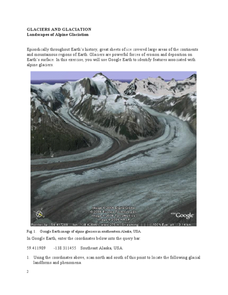
Landscapes of Alpine Glaciation
In this glaciers worksheet, students use Google Earth to look for examples of different glacial landforms and phenomena. Students complete 2 short answer questions.
Curated OER
Geography: examining the Glacial Features of Cape Cod
Students examine satellite images of the glacial features of Cape Cod. They analyze where human activity is located in terms of those features. Students make models of the features, including kettle holes. They also use contour maps...
Curated OER
Glacial Geology in the Field
Students examine the origin of glaciers, how glacial sediments are deposited, and what sedimentary records of glaciation provide about source and process of glaciers in a field lab.
Curated OER
Erosion and Deposition
Fifth graders study the processes of erosion, transportation, and deposition in soil. They walk outside the school to see examples and then accurately create a physical model which shows each type of soil movement and allows them to...
Curated OER
Assembling a Geologic History
Students combine information from several field labs to construct an overall geologic history of the local region. They are able to use published reports of the geologic history as they compile their own version.
Polar Trec
What Can We Learn from Sediments?
Varve: a deposit of cyclical sediments that help scientists determine historical climates. Individuals analyze the topography of a region and then study varve datasets from the same area. Using this information, they determine the...
Curated OER
Factors That Shaped Indiana
Fourth graders construct a model of Indiana which displays the effects of the glacial period on the state's physical structure. Students work in groups to plan and execute their model based on an established rubric.
Curated OER
Gliding Glaciers
Glaciers are the star of the show in this Earth science lesson. In it, learners gain an understanding of how glaciers are formed, how they move, and what types of landforms they create. This lesson plan is written in the classic format,...
Curated OER
You're as Cold as Ice!
Students study the movement of glaciers and how they have affected the Earth. In this geology lesson plan students simulate the effects glaciers have on landscape and watch video segments.
Curated OER
Glacial Geocaching
Eighth graders measure strike and dip of given land features and explain the difference between them. They also look at rock and mineral samples for indentification, along with calculating the density. Finally, information is analyzed...
Curated OER
Glaciers Leave Their Imprint
Students study various types of glaciers and the landforms they create. Working in pairs, they research a type of glacial landform and construct a calendar page illustrating and describing it. The pages be compiled to create a class...
Curated OER
Developing a Local Stratigraphy
Students examine rock strata for the distribution, deposition, and age of sedimentary rock. They describe rock types in a variety of outcrops and construct a regional stratigraphy.
Curated OER
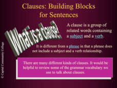
Clauses: Building Blocks for Sentences
Colorfully animated and packed with engaging examples, this PowerPoint encourages to employ clauses to create a variety of sentence structures. Peer editing of sample paragraphs would provide an opportunity for guided practice with...
Curated OER
Lesson 4: Fire, Rock, and Water
You can demonstrate the destructive force of volcanic mudflows to your early earth scientists using this lesson plan. Messy, but memorable, the two demonstrations require some preparation. Use one or both! Included is a link to activity...
Curated OER
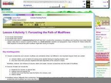
Forecasting the Path of Mudflows
Learners watch a demonstration to introduce them to the consistency of mudflows and how they move. In groups, they compare and contrast volcanic avalanches and mudflows. They create their own model of a volcano, simulate how it erupts...
Curated OER
Volcanoes!: Forecasting the Path of Mudflows
Young scholars construct a mockup of a volcano by crumbling up newspapers and piling them into the shape of a volcano. They place a tarp over the newspapers making sure the tarp is large enough to simulate a flat area at the volcano's...
NorthEast Ohio Geoscience Education Outreach
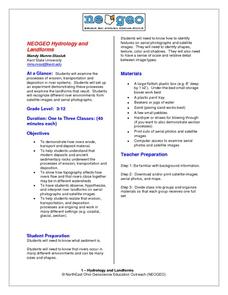
Hydrology and Landforms
Three days of erosion exploration await your elementary geologists. Learners begin by examining rivers via Google Earth, then they model water flow in sand, and finally, they identify resulting landforms. This lesson is written...
Curated OER
Forcasting the Path of Mudflows
Pupils visualize consistency of mudflows and how they move down stream valleys away from a volcano's summit. They use topographic maps of Mount St. Helens before the 1980 eruptions to forecast the path mudflows might take during an...
Curated OER
Nature Rules In The Great Flood of 1993
Students examine the event of the Great Flood of 1993. Using the internet, they research the economic, social and ecological changes that impacted the area. They conduct a town meeting in which they debate the positives and negatives of...


