NOAA
Mapping the Deep-Ocean Floor
How do you create a map of the ocean floor without getting wet? Middle school oceanographers discover the process of bathymetric mapping in the third installment in a five-part series of lessons designed for seventh and eighth graders....
University of Wisconsin
Noting Notable Features for Rain Gardens
Eight groups in your class are each responsible for a different aspect of surveying the campus for a suitable rain garden location. Features to consider include water flow, topography, sun/shade patterns, land surface, vegetation,...
Curated OER
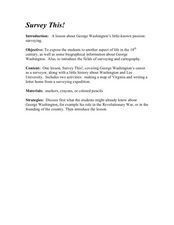
Survey This!
Students examine biological information about George Washington focusing on his love of surveying. They explore cartography and field of surveying. They write a letter and make a map of Virginia.
Curated OER
Surveying our First President
Students act as surveyors. In this George Washington lesson, students read transcriptions from Washington's surveying journal and then try surveying skills on their own.
Curated OER
This Land is Your Land - Delaware
Pupils determine how land was divided and marked for boundaries in the early days of settlement in Delaware. Students mark out land on the playground according to the methods used by the early settlers. Pupils write a description of a...
Curated OER
Coastal Surveys
Students investigate the human impact on coastal land. In this coastal surveys lesson plan, students choose a coastal area and complete a survey sheet about the area. They choose a topic about a sea side village called Dunwich to prepare...
Curated OER
Geometry of Exploration: Eyes Over Mars
Learners research how engineers and scientists generate linear and angular measurements with geometry to survey the Earth and Mars. They assess how geometric shapes affect navigation. A surveyor comes to the classroom and explains how he...
Curated OER
Science: Draining the Land - the Mississippi River
Students use topographic maps to identify parts of rivers. In addition, they discover gradient and predict changes in the channels caused by variations in water flow. Other activities include sketching a river model with a new channel...
Curated OER
Follow the Falling Meteorite
Students use triangulation method to locate meteorite landing site on the map. In this earth science instructional activity, students participate in a meteorite treasure hunt set up by the teacher. They explain how this method is used by...
Curated OER
A Thoreau Look at Our Environment
Sixth graders write journal entries o school site at least once during each season, including sketched and written observations of present environment. They can use sample topographical maps and student's own maps. Students can use...
Curated OER
SUBMARINE MOUNTAINS
Students create a two-dimensional contour map of a submerged area from a simulated survey using sounding techniques.
Curated OER
Navigating by the Numbers
Students observe how math is important in navigation and engineering. They study how surveyors use math and science to calcute, count, measure, label, and indicate distances on a map. They estimate specific distances.
Curated OER
GPS Art
Students design their own logo or picture and use a handheld GPS receiver to map it out. They write out a word or graphic on a field or playground, walk the path, and log GPS data. The results display their "art" on their GPS receiver...
Curated OER
Water Walk
Students follow the appropriate sampling protocol and take two measurements of a local water source. These measurements are Transparency and Temperature. This info about local land use and/or water chemistry issues may require further...
Curated OER
I Know Where You Are!
Students study what a GPS is and use it to challenge themselves and find positions on a map. For this investigative lesson students find various points on a map using a GPS system and answer questions on a worksheet.
Curated OER
Get Out in the Field
Students visit a shoreline--of an ocean, a lake, a pond, a riverbank, etc., survey it and record what they find there. They map the shoreline and surrounding area and conclude where potential waterfront projects could occur.
Curated OER
Location
Students explore the tools used by Columbus to chart his latitude. They study the change of a location over time.
Curated OER
Reading Comprehension/history: George Washington
In this George Washington activity worksheet, students read a one page information sheet about George Washington. Students put 10 events from his life in correct order. Then students answer 4 critical thinking questions.
Curated OER
The Earth Moves Under My Feet
Middle schoolers study earthquakes, monitor seismic activity using the Web, and plot real-time activity. They examine movement of the Earth's tectonic plates. They create an earthquake preparedness project.


