Curated OER
Across the United States- Home Learning Activity
In this home-school United States map worksheet, students work with a family partner as they study a map of the United States. They talk about the states they have visited, play a game by giving each other clues about states, and write...
Curated OER
United States Map
In this United States outline map worksheet, students make note of the political divisions of 50 states of the nation. This map may be used in a variety of classroom activities.
Curated OER
United States of America Map
In this United States of America map worksheet, students examine boundaries of each of the 50 states in the nation. This map not is labeled.
Curated OER
United States Map: Capitals
In this United States outline map worksheet, learners make note of the political divisions of 50 states of the nation. This map is labeled with the 50 state capitals.
Curated OER
United States Outline Map
In this United States outline map worksheet, students note the political boundaries of the states that are labeled with state capitals.
Curated OER
United States of America Map: Capitals
In this United States outline map worksheet, students note the political boundaries of the states that are labeled with postal abbreviation codes as well the labeled state capitals.
Curated OER
USA Postal Abbreviations Map
In this United States political map worksheet, learners examine the postal abbreviations of each of the states.
Curated OER
United States of America: 1860
In this United States historical map worksheet, students examine the boundaries of the states and territories of the nation in 1860. This map is unlabeled.
Curated OER
United States of America: 1860
In this United States historical map worksheet, students examine the boundaries of the labeled states and territories of the nation in 1860.
Curated OER
North America: Political Outline Map
In this North America political map activity, students examine the state and province boundaries of Mexico, Canada, and the United States.
Curated OER
Blank US Map
In this blank outline map worksheet, students study the physical boundaries of the 50 states that make the United States. This outline map may be used for a variety of geographic activities.
Curated OER
South US Region Map
In this United States regional outline map, students examine the state boundaries of the states in the Southern Region. Capital cities are denoted with stars.
Curated OER
US: Northeast Region Map
In this United States political map worksheet, students examine the state boundaries of the Northeast Region. The map also highlights each of the state capitals denoted by stars.
Curated OER
Washington, D.C. Map
Here is an outline map of Washington, DC. Some of the points of interest in the city are labeled, as are Maryland, Virginia and Arlington. There are plenty of important monuments and locations not identified, making for a good project.
Curated OER
Mystery State #31
In this United States mystery worksheet, students determine which state is described by the 5 clues listed on the sheet and then mark it on the outline map of the United States.
Curated OER
Mystery State #23
In this United States mystery worksheet, students determine which state is described by the 5 clues listed on the sheet and then mark it on the outline map of the United States.
Curated OER
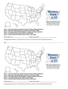
Mystery State #35
In this United States mystery worksheet, learners determine which state is described by the 5 clues listed on the sheet and then mark it on the outline map of the United States.
Curated OER
Mystery State #36
In this United States mystery worksheet, students determine which state is described by the 5 clues listed on the sheet and then mark it on the outline map of the United States.
Curated OER
Blank Map: The United States of America
In this map worksheet, students use the blank outline map of the United States to label the 50 states or for any other study purpose. Each state boundary is shown with no name labels.
Curated OER
Mystery State #38
For this United States mystery worksheet, learners determine which state is described by the 5 clues listed on the sheet and then mark it on the outline map of the United States.
Curated OER
US: Midwest Region
In this United States political map worksheet, students examine the state boundaries of the Midwestern Region. The map also highlights each of the state capitals denoted by stars.
Curated OER
US: Northeast Region: Unlabelled
In this United States political map worksheet, students examine the Northeast Region state boundaries. The map also highlights each of the state capitals denoted by stars.
Curated OER
Name the States Worksheet 4
In this name the states instructional activity, students examine 6 state map outlines and identify each of them by writing the state names and postal abbreviations.
Curated OER
Name the States Worksheet 2
In this name the states worksheet, students examine 6 state map outlines and identify each of them by writing the state names and postal abbreviations.


