Curated OER
United States Map- Land Elevation
Students explore a physical map. In this map skills lesson, students discuss examples of elevation and investigate the symbols used to identify elevation on a map. Students use the map to identify various land elevations.
Curated OER
Maps
If your students are just starting a unit on Geography this could be the introduction you're looking for. This PowerPoint presents a clear and organized overview of the different types of maps people use and why each is important. Tip:...
Academy of American Poets
Teach This Poem: "Maps" by Yesenia Montilla
After examining a physical map of the world, learners conduct a close reading of Yesenia Montilla's poem "Maps." They note the interesting words and phrases, the way the poem is structured, and list questions they might have. After...
Curated OER
The Influence of Physical Geography
Students explore the limits and demands of their physical world and how it relates to the survival and well-being of people.
Curated OER
Facts, Fictions and Perceptions of Regions
Students examine the different characteristics of the regions of the United States. They discuss places they have visited in the U.S., and in small groups conduct research on a selected region of the U.S. Each group labels a map of...
Curated OER
States and Capitals Activity
Students explore states and capitals. In this U.S. geography instructional activity, students practice locomotor skills playing Freeze Tag. Students generate the matching capital when given a specific state name in order to continue the...
DocsTeach
Lewis and Clark's Expedition to the Complex West
Lewis and Clark's famous expedition is a prime example of the United States' westward expansion. Aspiring historians examine maps from Lewis and Clark's journey, as well as discuss their interactions with Native American tribes. The...
DocsTeach
Red Record of Lynching Map Analysis
Long before the civil rights movement, leaders were working to secure equal rights. An informative activity explains the 1922 anti-lynching campaign with a map. Scholars analyze the map, complete a worksheet, and participate in group...
Curated OER
U.S. Geography: The Northeast
Young scholars investigate U.S. Geography by creating a map in class. In this natural resource lesson, students create a map of the United States and research the Northeast based on their resources and recyclable materials. Young...
Curated OER
My Summer Vacation
Students study the United States geography using Google Earth. In this U.S. geography instructional activity, students create travel journals about five U.S. geographical locations. Students research the human and physical...
Curated OER
Our Country's Geography
Third graders study geography. For this United States landforms lesson, 3rd graders create a map of the U.S. made out of dough. They use various edible treats to mark the country's capital, the plains, the mountains and the rivers &...
Curated OER
Lights On ! Lights Off! Exploring Human Settlement Patterns
Third graders write informational paragraphs based on the settlement patterns of the United States. In this settlement lesson plan, 3rd graders read about population and how it affects where people settle next.
Curated OER
Geography of the United States
Students examine the population growth of the United States. In this Geography lesson, students construct a map of the fifty states. Students create a graph of the population of the USA.
Curated OER
The Physical Geography of Australia, Oceania, and Antarctica
Pupils access information from the United States Geological Survey's Web site This Dynamic Earth to research the Ring of Fire. They answer four questions and then apply what they have learned to create a bulletin board display.
Curated OER
Take Me Out To the Ball Game
Students use a map to graph and locate major league teams of different sports. In groups, they analyze the population data of the United States and compare it with the amount and location of the major league teams. They share their...
National Geographic
Mapping the Americas
Celebrate the geography of the Americas and develop map skills through a series of activities focused on the Western Hemisphere. Learners study everything from earthquakes and volcanoes of the Americas and the relationship between...
Curated OER
Human Migration in the United States
Students investigate the factors involved in human migration in the United States. Students analyze maps of different regions in the United States to determine how a variety of factors influence human settlement and development.
Curated OER
Regions of the United States
Students explore the regions of the United States. In this geography lesson, students read the text When I Was Young in the Mountains and compare the setting of the story with their geographical setting. Students use a physical map to...
Curated OER
The World (With an emphasis on the United States)
Fourth graders recognize the different continents. They are introduced to longitude and latitude and how to find locations using these measurements. This series ends with an emphasis on the fifty states of the United States and their...
Curated OER
Virginia State Map
In this geography of Virginia worksheet, students color the map and label major cities and physical features. Students also study a second map showing the location of the state of Virginia in the United States.
Curated OER
California State Map
In this geography of California worksheet, students color the map and label major cities and physical features. Students also study a second map showing the location of the state of California in the United States.
Curated OER
Georgia State Map
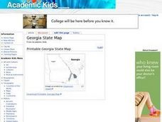
In this geography of Georgia worksheet, students color the map and label major cities and physical features. Students also study a second map showing the location of the state of Georgia in the United States.
Curated OER
Florida State Map
For this geography of Florida worksheet, students color the map and label major cities and physical features. Students also study a second map showing the location of the state of Florida in the United States.
Curated OER
Social Studies: Looking at Regions
Quiz your 3rd graders on why we have regions. This regions quiz includes 16 questions on why and how we group areas into regions based on physical features, culture, politics or religion. A class discussion on technology completes this...


