Curated OER
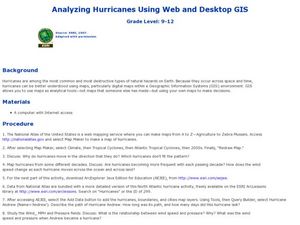
Analyzing Hurricanes Using Web and Desktop GIS
Young scholars analyze hurricanes. In hurricanes lesson, students use the Internet and GIS to analyze hurricanes. Young scholars view the National Atlas of Maps to discuss the direction hurricanes move. Students study the wind and...
Curated OER
Basic Geography of Canada
Students identify different geographical locations in Canada by using an Atlas. In this geography of Canada lesson plan, students locate features such as rivers, lakes, cities, provinces, and more.
Curated OER
NATO Geography & Language
The class receives background information on NATO, an atlas, and a blank world map. They color the original 1949 countries in red, the 1952 additions in green, and the 1990 additions in blue. This exercise would be a good starting point...
Curated OER
Clouds & Condensation
Students use the digital atlas of Idaho to study different weather patterns. They use the Climatology section of the Digital Atlas of Idaho to explore concepts such as relative humidity, dew point, condensation, and cloud formation.
Curated OER
Welcome to My World!
Learners use maps to locate information. They read the story, "It Looked Like Spilt Milk", view images of the continents and discuss the various continents. Afterward, they make their own Atlas to record information that they can later...
Curated OER
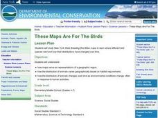
These Maps are for the Birds
Learners identify and study New York State Breeding Bird Atlas maps to learn where different bird species nest and how their distributions have changed over time. They also identify how maps serve as representations of a geographic...
Curated OER
What a Relief Map
Students create a map using cookie dough. In this geography lesson plan, students research the physical features of a country, draw a diagram and design and create a map out of cookie dough.
Curated OER
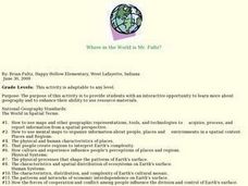
Where in the World is Mr. Fultz?
Young scholars use maps and other geographic resources to learn about their world while problem solving. They read clues each day and use classroom resources to narrow down where the prize is located.
Curated OER
Discovering the Northwest Territories Through the Five Themes of Geography
Students use the Atlas of Canada to find basic geographical information about the Northwest Territories.
Core Knowledge Foundation
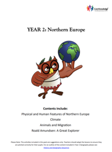
Year 2: Northern Europe
How is life in Northern Europe different from other areas of the world? Historians journey through the various regions of Northern Europe discovering what type of climate, animals, and lifestyles exist in that section of the world. They...
Curated OER
Beginner's World Atlas: oo Words
In this beginner's World Atlas worksheet, students observe the oo = foot picture and use it to darken in circles of words with that sound and that best complete the sentences. Students choose seven words to complete the sentences.
Curated OER
My Own Private Idaho; Using Social Studies to Explore Idaho
Students engage in several activities to explore Idaho and Social Studies themes. Using an variety of media, students become familiar with Idaho's geography and geology.
Curated OER
Using Old Maps as Tools to Explore Our World
Students explore historical maps. In this primary source analysis lesson, students uncover the meanings in selected historical maps as they use them to enhance lessons on historical events. Samples for classroom use are provided in this...
Curated OER
The American Civil War: A Nation Divided (1861-1865)
Intended for use with atlases, this presentation details the causes and effects of the Civil War. It includes historical pictures of battles and discussion points about the technology which emerged during (and for) the war. The final...
Curated OER
Searching the Digital Atlas
Students become familiar with the tools of a digital atlas. They use a digital atlas of Idaho to located specified information. Students identify national forests, locate butterfly families, find examples of resident fish, and explore...
Curated OER
Historical Atlas
Sixth graders evaluate how revolutions have affected the world throughout history (i.e. boundaries of nations, culture, economics, etc...) through the research for and creation of a historical atlas for assigned countries.
Curated OER
Map Work: Using the Index and Grid References
In this maps activity, students use the Oxford First Atlas to answer 20 questions about cities in Great Britain. Students will need to use the index and grid references to locate cities or countries.
Owl Teacher
Imaginary Nation: Constructing a Map
Your young geographers will combine what they have learned about the five themes of geography and their inner creativity to design a physical map for an imaginary nation.
Royal Geographical Society
An Introduction to Maps
First graders are introduced to a variety of maps such as globes, street maps, atlases, and different types of floor plans. The focus of the lesson plan requires individuals to create their own plan of the classroom using the PowerPoint...
PBS
Make a Balloon Globe
"We've got the whole world in our hands," is what your students will be singing after completing this fun geography activity. Using the included templates for the seven continents and a balloon, they create their very own globes.
Cornell University
Too Much of a Good Thing?
Continuing their study of beneficial insects, young entomologists discover where in the world some of these bugs are. By labeling, coloring, and using the scale on a map, pupils explore the territories and arrival of the Asian lady...
Curated OER
Historical Indian Treaties and Aboriginal Population
Sixth graders navigate an online atlas of Canada and compare the land area of of historical Aboriginal peoples in Manitoba to present-day figures.
Curated OER
Everybody Cooks Rice
Young scholars read the book, "Everybody Cooks Rice," and they participate in activities pertaining to the book. They identify countries mentioned in the text and locate them on a world map. They use an atlas to identify the climatic...
Curated OER
How Far Away is Your College?
Eighth graders practice using atlases. In this geography skills lesson plan, 8th graders select a college they would like to attend and use an atlas to respond to questions about the geography of the place.


