Curated OER
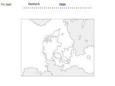
Denmark Outline Map
In this blank outline map learning exercise, students explore the political boundaries of Denmark located in Europe. This map may be used in a variety of classroom activities.
Curated OER
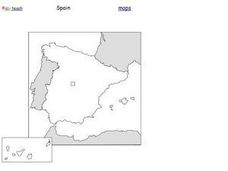
Spain Outline Map
For this blank outline map worksheet, students explore the political boundaries of Spain located in Europe. This map may be used in a variety of classroom activities.
Curated OER
Blank Europe Outline Map
In this blank outline map learning exercise, students explore the political boundaries of the continent of Europe and those of the countries located there. This map may be used in a variety of classroom activities.
Curated OER
Blank Europe Outline Map 2
In this blank outline map worksheet, students explore the political boundaries of the continent of Europe and those of the countries located there. This map may be used in a variety of classroom activities.
Curated OER
Europe Outline Map (Labled)
In this blank outline map worksheet, students study the political boundaries of the labeled European nations.
Curated OER
Europe Outline Map
In this outline map worksheet, students examine the political boundaries of the continent of Europe. The map may be used in variety of activities that individual teachers create to accompany it.
Curated OER
Europe Outline Map
In this blank outline map worksheet, learners explore the political boundaries of the continent of Europe and those of the countries located there.
Curated OER
Europe Map
In this blank outline map instructional activity, students explore the political boundaries of the continent of Europe. This map may be used in a variety of classroom activities.
Curated OER
European Map
In this blank outline map activity, students explore the political boundaries of the continent of Europe and those of the countries located there.
Curated OER
Europe Map Quiz
In this Europe map quiz worksheet, students examine an outline map of the continent and label the names of each of the countries.
Beverly Hills High School
Mapping Napoleon's Empire at Its Height (1812)
The complicated political history of Europe becomes apparent as young historians create a map of the borders of France when Napoleon's Empire was a its height in 1812.
Curated OER
Europe Labeled Map
In this Europe political map worksheet, students examine the national boundaries. The map also highlights each of the nation's capitals with a star. The countries and capital cities in this map are labeled.
Curated OER
European Country Map
In this Europe political map worksheet, students examine the national boundaries. The country names are labeled on the map.
Curated OER
Europe: Political Map
In this Europe political map learning exercise, students examine each country's boundaries. The map also highlights each of the nation's capitals with a star.
Curated OER
Romania
In this blank outline map worksheet, students explore the political boundaries Romania located in Europe. This map may be used in a variety of classroom activities.
Curated OER
World Map Labels
In this geography skills worksheet, students identify the countries and bodies of water labelled on the maps of the world, Africa, Asia, Canada, Europe, the Caribbean, the Middle East, North America, Australia, and South America.
Curated OER
British Isles
In this map worksheet of Britain, students study a detailed outline map of the British Isles. No labels are provided and there are no directions.
Curated OER
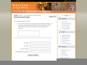
Western Civilizations, Chapter 23: Modern Industry and Mass Politics, 1870-1914
Looking for an interactive way to supplement your western civilization course? Check out this comprehensive website, designed to accompany the Western Civilizations text (although it is valuable independently). Scholars investigate...
Cool Math
Coolmath: Coolmath Games: Map Snap: Europe
You are presented with an outline map of Europe and you must place each country in its correct position. It clicks into place if you're in the right spot. You may want to start with the practice mode which has the shape outlines of the...
Curated OER
Educational Technology Clearinghouse: Maps Etc: Outline Map of Europe, 5,000 Bce
An outline map of Europe at a time when sea levels were lower than present, with Iceland, the British Isles and Scandinavian Peninsula a part of the mainland, and the Mediterranean, not connected to the Atlantic Ocean, split into two...
Curated OER
Educational Technology Clearinghouse: Maps Etc: Europe, 1810
A colored outline map of Europe in 1810, when Napoleon was at the height of his power. The map shows the European countries that were controlled by France, allied with France, or independent of France. Territories are numbered and...
Curated OER
Educational Technology Clearinghouse: Maps Etc: Europe, 1815
A colored outline map of Europe in 1815, after the Congress of Vienna. Territories are numbered and referenced on the map.
Curated OER
Educational Technology Clearinghouse: Maps Etc: Europe, 1796
A colored outline map of Europe in 1796 just after the French Revolution and the Division of Poland. Territories are numbered and referenced on the map.
Curated OER
Educational Technology Clearinghouse: Maps Etc: Europe, 1540
A colored outline map of Europe as it was in 1540, including the Holy Roman Empire, Lands of the Habsburgs, the Kingdom of the Two Sicilies, the Duchy of Milan, the Lands of the German Knights of Livonia, and several other powers of the...


