LM Digital Media
Kids World Fun: Waldo and the Desert Island Adventure [Pdf]
The ebook shares an imaginative adventure of a boy and his dog. In their imaginary voyage, they travel to a desert island.
Australian Museum
Australian Museum: Aborinigal and Torres Strait Islander
The Australian Museum Online presents the anthropology of the Indigenous people of Australia. See their collection of artifacts and read about western desert art and other historical ideas about Australia.
Science Buddies
Science Buddies: Accept a Design Trade Off Challenge Science Projects
Build a device to accomplish a fun task. Accept a design trade-off challenge of using only a set amount of simple materials, as if you were stuck on a desert island, to make your device work.
Other
Australian Landforms and Their History
A history of the formation of the Australian continent, along with descriptions of many of Australia's unique features. Links to the geographical features of Australia are provided, such as highest mountains, islands, or longest rivers.
PBS
Pbs Learning Media: Lily Pad Escape
In this video from Cyberchase, the CyberSquad uses a magic lily pad to escape from a desert island.
Geographic
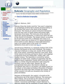
Photius: Bahrain Geography and Population
Read about Bahrain's topography. Made up of several islands, you can find out how the country is connected by causeways from one island to the next.
Houghton Mifflin Harcourt
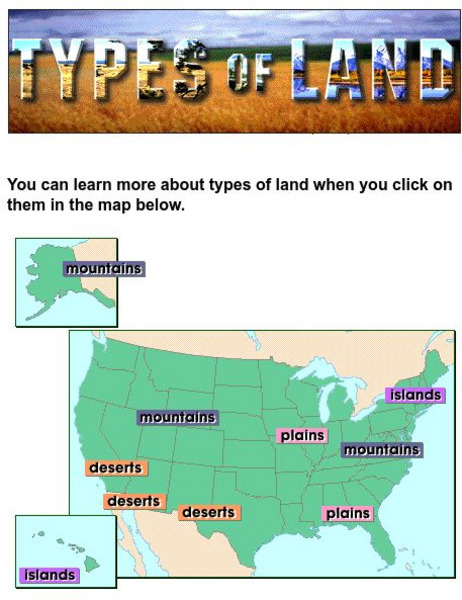
Harcourt: School Publishers: Types of Land
This clickable map of the United States defines different geographic features such as mountains, plains, islands, and deserts.
Other
Ihm School: Landforms
Student created reports on landforms. Each landform has a brief description and an example. Pictures accompany the reports. Learn more about the landforms that shape our world.
Curated OER
Educational Technology Clearinghouse: Maps Etc: Sieur De Monts, 1919
A road map of the Sieur de Monts National Monument in Maine, from the Official Automobile Blue Book (1919), showing the roads on Mt. Desert Island, Bar Harbor, and the coastal features of Frenchman's Bay and Blue Hill Bay.
Library of Congress
Loc: Earth as Art: A Landsat Perspective
A really cool site showing Satellite (Landsat 7) images of unique geographical and meteorological phenomena. Images show cloud formations to rainforest devastation.
Other
Jean Craighead George's Website
This website is about author Jean Craighead George. Offers information on her background, her books, she gives hints about becoming a writer. She also has a question and answer section where she answers questions that people most often...
eSchool Today
E School Today: Landforms
Understand the formation and geology of different landforms around the Earth.
Smithsonian Institution
National Museum of Natural History: American Mammals: Palmer's Chipmunk
Palmer's chipmunks live in a "sky island" mountains in southwestern Nevada surrounded by deserts the chipmunks cannot cross. They are common there, foraging where rocks or fallen logs provide cover. Learn more about the Tamias palmeri,...
Curated OER
Educational Technology Clearinghouse: Maps Etc: Coast of Maine, 1884
A sketch map from 1884 of the Maine coastline showing early settlements, and is keyed to show: Shows locations of: (1) Portsmouth; (2) York (Gorgiana, 1641); (3) Agamenticus; (4) Saco; (5) Richmond Island; (6) Casco; (7) Sabino (Popham's...
Curated OER
Educational Technology Clearinghouse: Maps Etc: China, 1920
A map from 1920 of China and the Empire of Japan at the time. The map shows political boundaries and foreign possessions, capitals, provincial capitals, major cities, treaty ports, existing and proposed railroads, canals, submarine...
Curated OER
Educational Technology Clearinghouse: Maps Etc: Africa, 1919
A map from 1919 of Africa showing the territorial changes made after World War I. The map shows the areas ceded by Germany, including Togo and Kamerun to be decided by British and French mandate, German East Africa under British mandate,...
Curated OER
Educational Technology Clearinghouse: Maps Etc: Pre Colonial Africa, 1858
Map of Africa in 1858, prior to the extensive European colonization of the continent established at the Berlin Conference of 1885. This map shows the European possessions of the Cape Colony, Natal, and Orange River Free State, and the...
Curated OER
Etc: Maps Etc: Political and Physical Africa, 1901
A map from 1901 of the political and physical features of Africa. The map uses color-contouring to show highlands above 2000 feet in buff tints, lowlands in greens, and the submerged part of the continental plateau in light blue. The map...
Curated OER
Etc: Maps Etc: Physical and Political Map of Africa, 1879
Map of pre-colonial Africa, showing the predominately native countries and territories of the African continent in 1879. The counties include the Barbary States of Morocco, Algeria, Tunis, Tripoli and Fezzan, the Egyptian territories of...
Curated OER
Educational Technology Clearinghouse: Maps Etc: Physical Asia, 1910
A map from 1910 of Asia, showing physical features and general elevations. This map uses color-contours to show land elevations ranging from below sea level around the Caspian Sea to over 6,500 feet, and water depths from sea level to...
Curated OER
Educational Technology Clearinghouse: Maps Etc: Physical Asia, 1916
A map from 1916 of Asia, showing physical features and general elevations. This map uses color-contours to show land elevations ranging from below sea level around the Caspian Sea to over 15000 feet, and water depths given in fathoms....
Curated OER
Educational Technology Clearinghouse: Maps Etc: Asia (Physical), 1901
A map of Asia from 1901 showing the physical features of the region including mountain systems, plateaus, basins, plains, deserts, lakes, rivers, and coastal features and islands. The map shows major ocean currents, the mean annual...
Curated OER
Etc: Maps Etc: Physical Asia With Isotherms, 1916
A map from 1916 of Asia, showing physical features, general elevations, and mean isotherms for January and July. This map uses color-contours to show land elevations ranging from below sea level around the Caspian Sea to over 12000 feet,...
Other popular searches
- Desert Island Scenario
- Desert Island Stranded
- Desert Island Survival Game
- Desert Island Survival
- Desert Island Survive
- Desert Island Dilemma
- Desert Island & Newspaper
- Desert Island Economics
- Desert Island Economy
- Desert Island Constitution
- Stranded on a Desert Island
- Desert Island Civics
![Kids World Fun: Waldo and the Desert Island Adventure [Pdf] eBook Kids World Fun: Waldo and the Desert Island Adventure [Pdf] eBook](https://d15y2dacu3jp90.cloudfront.net/images/attachment_defaults/resource/large/FPO-knovation.png)


