Other
Australian Landforms and Their History
A history of the formation of the Australian continent, along with descriptions of many of Australia's unique features. Links to the geographical features of Australia are provided, such as highest mountains, islands, or longest rivers.
Scholastic
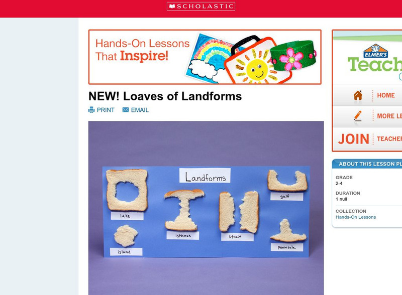
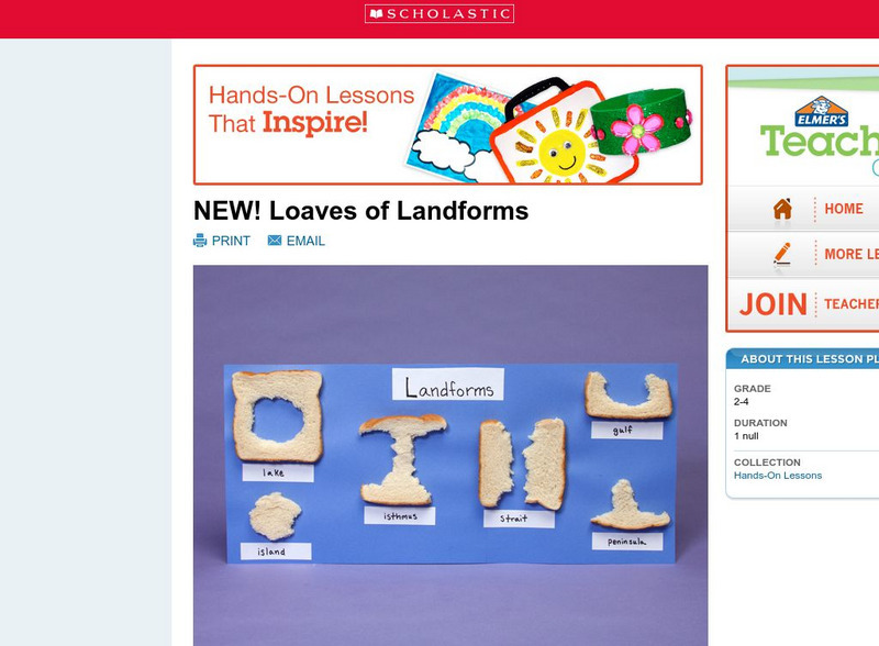
Scholastic: Loaves of Landforms!
A foundation in geography begins with an understanding of the terms geographers use to describe the features of Earth. This lesson is designed to help students grow their vocabulary and learn to recognize common landforms in a hands-on...
National Geographic
National Geographic: Mapping Landforms
Students will study landform maps of states and then create a project of their own.
National Geographic
National Geographic: Shaping the Tallest Peak on Earth
This lesson builds upon a National Geographic film covering George Mallory's effort to climb Mount Everest in 1924. It looks at the physical features of mountains, and the landform features of Mount Everest that present challenges to...
Science Struck
Science Struck: Types of Landforms
Describes different landform types and their features. includes many good quality photographs.
Scholastic
Scholastic: Loaves of Landforms
This is a comprehensive lesson plan to teach primary students about landforms. A foundation in geography begins with an understanding of the terms geographers use to describe the features of Earth. Help students grow their vocabulary and...
Enchanted Learning
Enchanted Learning: The Continents
Brightly colored printouts, maps, and graphics on the greatest land masses on earth. See how continental drift works, look up extremes, label maps, learn about latitude, longitude and other geography terms. Teachers will find a Landforms...
ClassFlow
Class Flow: How Landforms Affect Settlers' Choices
[Free Registration/Login Required] This flipchart has students engage in a research project looking at how geographical features affected the colonists' settling of the New World. Web links to aid the research process are included. An...
NASA
Nasa Earth Observatory: Changing Global Land Surface
Learn how scientists view the changes in the land surface made by humans over time. Read questions that scientists pose to answer some unknown questions about global land surface and learn several things scientists are doing to try to...
Other
Southern Kings Consolidated School: Hills
Excellent site from the Southern Kings Consolidated School explaining what a hill is and how hills are formed. Easy to understand and contains great pictures.
Geographyiq
Geography Iq
Detailed geographical information on any country is available at this site. Within the World Map section, you can get facts and figures about each country's geography, demographics, government, political system, flags, historical and...
Information Technology Associates
Geographic: Guatemala Geography
Site describes in point form the geography of Guatemala, giving land mass, major landforms, climate, terrain, and natural resources.
ClassFlow
Class Flow: Geographical Skills
[Free Registration/Login Required] In this lesson students understand how physical processes (weathering, erosion, climates, soils, and landforms) shape earth's surface patterns and systems.
Johns Hopkins University
Johns Hopkins University: Arkansas State Maps
Learn more about the Arkansas' geography through the maps at this website from the Johns Hopkins University Applied Physics Laboratory. These maps give in depth information on the landforms found in Arkansas.
Johns Hopkins University
Johns Hopkins University: Arkansas State Maps
Learn more about the Arkansas' geography through the maps at this website from the Johns Hopkins University Applied Physics Laboratory. These maps give in depth information on the landforms found in Arkansas.
Curated OER
National Park Service: What Is Beringia?
This resource provides a brief explanation of Beringia, the geographical region surrounding the Bering Strait.
Houghton Mifflin Harcourt
Harcourt: School Publishers: Types of Land
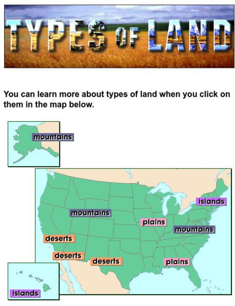
This clickable map of the United States defines different geographic features such as mountains, plains, islands, and deserts.
Other
Greatest Places: Namib
Explore the Namib Desert and learn about its location, the Skeleton Coast, mirages, and general information about this home to the highest sand dunes in the world.
Johns Hopkins University
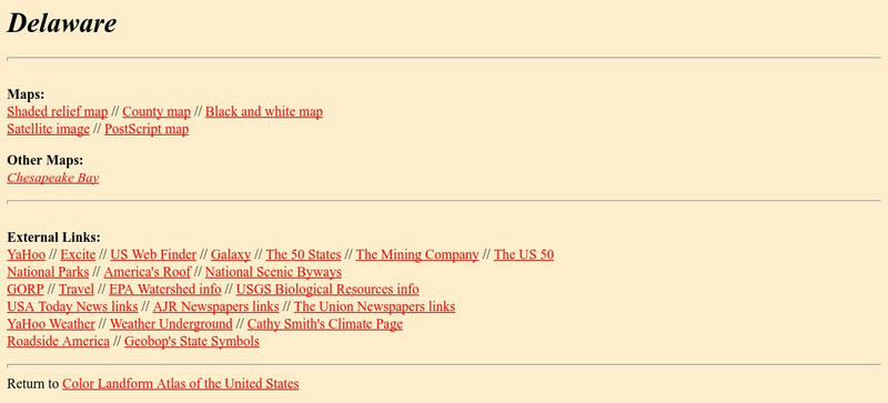
The Johns Hopkins University: Delaware State Maps
At this site from The Johns Hopkins University Applied Physics Laboratory, you can learn more about the landforms and other geographical features of the state of Delaware. Check out the different map types at this website.
Johns Hopkins University
The Johns Hopkins University: Florida State Maps
Use this site from The Johns Hopkins University Applied Physics Laboratory to find out more about Florida's landforms. This website contains several different maps highlighting different geographical features of Florida.
Other
Mr. Palm: Regions of Texas
The four major geographic regions of Texas are described in text and a slideshow, with a discussion of their landforms, climate, vegetation, animals, and resources.
Quia
Quia: Geography World: Earth's Physical Features Games
This site contains matching, concentration, flash cards, and word search games from landform vocabulary. Excellent games which contain more than one version of each game to reinforce all vocabulary taught.
NSTATE
Netstate.com: The Geography of Arkansas
Quick facts about the geography of Arkansas including land area, highest and lowest points, elevations, lakes, rivers, regions, and climate.
Other
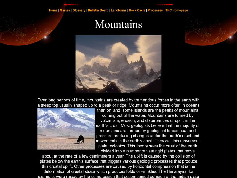
Southern Kings Consolidated School: Mountains
Site from the Southern Kings Consolidated School about mountains. Learn what mountains are and how they form.

