University of Texas at Austin
Perry Castaneda Library Map Collection: Mexico Maps
This site provides a wealth of maps relating to the country of Mexico.
Climate Zone
Climate in Mexico
Tables for the different climate regions in Mexico show the average monthly temperature, rainfall and snowfall in this North American country. General geographical information and a map are also included.
Cayuse Canyon
The Us50: New Mexico
Offers comprehensive information regarding New Mexico history, famous people, cities, geography, state parks, tourism, and historic sites. A fact sheet of information and a quiz are also available.
InterKnowledge Corp.
Geographia: Mexico Introduction
Explore the magical world of Mexico. Learn about the history and culture of this diverse country as well as tour the country through pictures.
Mex Connect
Mexconnect: Chihuahua, Mexico
This resource provides information on Chihuahua, a state in Mexico. Includes a map, pictures, and information about the state and cities.
Curated OER
Educational Technology Clearinghouse: Maps Etc: Mexico City and Vicinity, 1580
A facsimile of a map by Saverio Clavigero (1780) of Tenochtitlan (Mexico City) and vicinity around the time of the Spanish conquest in 1519. This map, according to William H. Prescott (History of the Conquest of Mexico, 1876), defies...
Curated OER
Mexico City
Tourist guide for Mexico City with street map and other useful information for visitors.
Curated OER
Mexico City
Tourist guide for Mexico City with street map and other useful information for visitors.
Curated OER
Mexico City
Tourist guide for Mexico City with street map and other useful information for visitors.
Curated OER
Mexico City
Tourist guide for Mexico City with street map and other useful information for visitors.
Mex Connect
Mex connect.com: Map of Michoacan
MexConnect offers a map of Michoacan that shows the locations of the major cities located within.
Enchanted Learning
Enchanted Learning: Mexico Map: Quiz Printout
Utilize the Mexico map quiz to test student's knowledge of geography, location of cities and capitals in Mexico.
Geographic
Mexico (Maps)
Maps of Mexico, including one with major cities, and another with the Mexican states.
Houghton Mifflin Harcourt
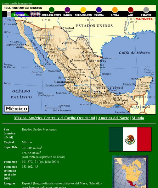
Holt, Rinehart and Winston: America Del Norte: Mexico
This site has a map of Mexico in Spanish, with informational data also presented in Spanish about the country. Land mass, population, life expectancy, literacy, industry, agriculture, minerals and resources are among the topics...
Other
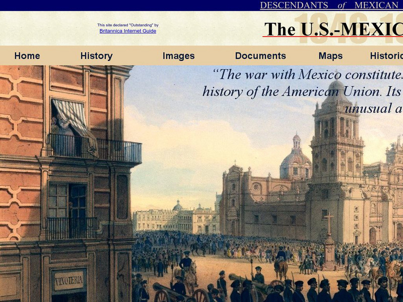
Dmwv: The u.s. Mexican War: 1846 1848
Dedicated to the memory of U.S. veterans who fought in the U.S.-Mexican War, this website provides documents, images, maps, and FAQs.
Curated OER
Etc: Vicinity of the City of Mexico, 1846 1848
A map of the area around Mexico City showing important sites of General Scott's campaign in the Mexican&ndash:American War (1846-1848). The map shows Lake Joltoca, Lake Cristobal, Lake Tezuco, Lake Xochimilco, and Lake Chalco, and...
Curated OER
Educational Technology Clearinghouse: Maps Etc: Cortes in Mexico, 1519
A map showing the expedition of Hernan Cortes in 1519. This expedition was the third to the mainland and took him all the way into Mexico. This map shows the route from the Battle of Cintla (Tabasco) to Veracruz (Villa Rica de la Vera...
Curated OER
Educational Technology Clearinghouse: Maps Etc: Cortes' March to Mexico, 1519
A map of Mexico showing the sites of the Spanish Conquistador expedition under Hernan Cortes in 1519. The map shows Juanna (Cuba), Tabasco, Vera Cruz, and Mexico City (Tenochtitlan). An inset map details the route taken by Cortez from...
Curated OER
Etc: Maps Etc: Political Divisions of Mexico, 1916
A map from 1916 of Mexico showing the political divisions of states and territories (Quinana Roo on the Yucatan Peninsula, Tepic on the Gulf of California, and Baja California) at the time, including the state capitals and the Federal...
Curated OER
Educational Technology Clearinghouse: Maps Etc: Northeast Mexico, 1846 1848
A map of eastern Mexico along the Gulf showing important battle sites during the Mexican-American War (1846-1848), including Matamoros, Monterey, and Buena Vista during the Taylor campaign, and Vera Cruz and Mexico City during the Scott...
Curated OER
Etc: Maps Etc: City of Mexico and Suburban Towns, 1899
"The city [Mexico City] is in what is called the Federal District, covering an area of some four hundred and fifty square miles - the government of the district like the District of Columbia is directed, by the national legislature,...
Curated OER
Educational Technology Clearinghouse: Maps Etc: Vicinity of Mexico, 1847
A map of the vicinity of Mexico City showing the route of General Scott from Puebla to the city during the Mexican-American War (1847), including operations and battle sites in the area.
Curated OER
Etc: Maps Etc: Mexico, Central America and the West Indies, 1852
A map from 1852 of Mexico, Central America, and the West Indies. The map shows territorial boundaries at the time, including the Mexican States, capitals and major cities and ports, railroads, rivers, lakes, mountain systems, and terrain...


