PBS
Pbs: Journey to Planet Earth: Urban Explosion
From the "Journey to Planet Earth" series, PBS takes a look at the world's exploding urban population. Includes video clips and educational resources.
Curated OER
Unesco: Mexico: Historic Centre of Mexico City and Xochimilco
Built in the 16th century by the Spanish on the ruins of Tenochtitlan, the old Aztec capital, Mexico City is now one of the world's largest and most densely populated cities. It has five Aztec temples, the ruins of which have been...
Houghton Mifflin Harcourt
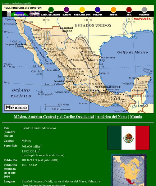
Holt, Rinehart and Winston: America Del Norte: Mexico
This site has a map of Mexico in Spanish, with informational data also presented in Spanish about the country. Land mass, population, life expectancy, literacy, industry, agriculture, minerals and resources are among the topics...
Ducksters
Ducksters: United States Geography for Kids: New Mexico
Kids learn facts and geography about the state of New Mexico including symbols, flag, capital, bodies of water, industry, borders, population, fun facts, GDP, famous people, and major cities.
Curated OER
Etc: Maps Etc: Mexico, Central America and the West Indies, 1852
A map from 1852 of Mexico, Central America, and the West Indies. The map shows territorial boundaries at the time, including the Mexican States, capitals and major cities and ports, railroads, rivers, lakes, mountain systems, and terrain...
Curated OER
Educational Technology Clearinghouse: Maps Etc: Mexico, 1904
A map from 1904 of Mexico showing the states, major cities and towns, railroads, mountains, and coastal features. An inset map shows the island of Cuba. "Mexico is divided into twenty-seven States with two Territories and the federal...
A&E Television
History.com: The States
Learn unique facts about each American state. You can also read a more in-depth history of each state, watch videos and play a game about all the states.


