Curated OER
Globe Skills Lesson 10 Apollo 11
Students develop their globe skills. In this geography skills lesson plan, students use a globe and a softball to replicate distance between the earth and its moon.
Curated OER
The Underground Railroad
Students explore the Underground Railroad routes. In this map skills and Civil War lesson, students use map and globe reading vocabulary and skills to track the routes the slaves followed from the Bahamas to the United States and from...
Curated OER
Earth Viewer
Young scholars explore the Earth. In this space lesson, students view the " Earth and Moon Viewer" web site and complete a related worksheet.
Curated OER
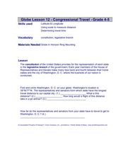
Congressional Travel
Students determine the distances traveled by the members of the legislative branch of the US Government. In this travel distance lesson, students locate Washington, DC on a globe using the longitude and latitude of the city. They...
Curated OER
An Early American Culture
Young scholars identify the locations of the Hopewell culture. In this map skills lesson plan, students use a globe to mark several locations of the Hopewell culture.
Curated OER
Globe Skills Lesson 7 The Transcontinental Railroad
Students explore the Transcontinental Railroad. In this geography skills lesson, students use map skills in order to locate legs of the Transcontinental Railroad on globes.
Curated OER
Post Roads
Students locate the major cities in the colonies during the Revolutionary War. In this map skills instructional activity, students use a globe to locate cities such as Charleston and Boston using latitude and longitude coordinates.
Curated OER
Civil War Naval Strategy
Students apply critical thinking skills to war strategy. In this Civil War map instructional activity, students use their knowledge of latitude and longitude as well as scale to respond to questions regarding Civil War battle strategies.
Curated OER
States and Capitals - Lesson 4 - U.S. Political Map
In this U.S. state capitals worksheet, students identify the capital cities of the 50 states using the latitude and longitude coordinates provided.
Curated OER
Globe Lesson 6 - Longitude - Grade 6+
In this longitude activity, students read a 3-paragraph review of longitude and respond to 13 short answer questions.
Curated OER
Globe Lesson 7 - Parallels and Meridians - Grade 6+
In this parallels and meridians learning exercise, students read a 2-paragraph review of parallels and meridians and respond to 7 short answer questions.
Curated OER
Globe Lesson 9 - Around the World - Grade 6+
In this geography skills worksheet, students read 5-travel scenarios and use their problem solving skills to respond to 9 short answer questions.
Curated OER
The Global Grid System-World Map Activity
Young scholars demonstrate how to use the global grid system. In this map skills lesson, students use a world map to locate various locations. Young scholars identify locations based on the global grid system. Students complete a...
Curated OER
Longitude
In this globe worksheet, students learn how longitude is measured on a globe. Students read the information before answering 5 questions. A globe will be required.
Curated OER
Globe Lesson 5 - Latitude - Grade 6+
In this latitude worksheet, students read a 3-paragraph review of latitude and respond to 12 short answer questions.
Curated OER
Lesson Design Archaeology- USGS Maps
Students research USGS maps and identify the major features. In this map skills lesson, students identify low and high elevations on a USGS map and practice finding latitude and longitude.
Curated OER
Latitude Longitude Skills
In this latitude and longitude worksheet, students determine the number of degrees between the equator and specific latitude points. Students to the same for the longitude points from the Prime Meridian. This worksheet has 3 problems to...
Curated OER
Latitude Longitude
In this latitude and longitude activity, students place a dot on a graph that represents each latitude and longitude location given. The activity has 46 locations to graph.
Curated OER
Latitude Longitude
In this latitude and longitude instructional activity, students plot 39 latitude/longitude locations on a graph, connecting the dots as they go along.
Curated OER
Latitude Longitude
In this latitude and longitude worksheet, students plot 34 latitude/longitude locations onto a graph, connecting the dots as they go along.
Curated OER
Plotting Earthquakes
In this earthquakes worksheet, learners access a website to gather information about the magnitude and location of earthquakes for 5 days. Then students complete 7 short answer questions.
Curated OER
Google Earth
In this Google Earth worksheet, students access the Google Earth website and find the latitude, longitude, and elevation for their house and school. Then they do the same for a variety of world locations. This worksheet has 10 fill in...
Curated OER
Earth's Features
In this geography worksheet, students label a map of the world with the Arctic Circle, Tropic of Capricorn, Tropic of Cancer, Equator, North Pole, South Pole, and the Antarctic Circle.
Curated OER
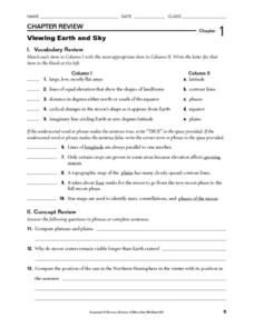
Viewing Earth and Sky
In this earth and sky worksheet, students review terms associated with map reading. Students also review topographic maps and how contour lines represent elevation. This worksheet has 5 matching, 5 true or false, 5 fill in the blank, and...


