Curated OER
Maryland Vocabulary
After selecting State Unit Studies and clicking on Maryland, you'll be directed to a page with several useful links! You'll get basic state facts, a map of the state, and information on the flower, capital, flag, bird, dog, cat, etc! So...
Curated OER
Blank US Map
In this blank outline map worksheet, students study the physical boundaries of the 50 states that make the United States. This outline map may be used for a variety of geographic activities.
Curated OER
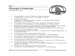
Georgia Challenge
For this multiple choice about the U.S. state of Georgia worksheet, students read factual phrases about Georgia and choose the correct who, what, or where answers. Students answer 10 multiple choice answers.
Curated OER
School-Home Link: Maps
In this atlas and parent communication form worksheet, students use an atlas to find several things: the capitol city of Japan, the number of countries in Africa, where to buy a newspaper, the names of Presidents of the United States,...
Curated OER
Connecticut: Crossword Puzzle
In this United States history worksheet, students use the 14 clues in order to fill in the crossword puzzle with the appropriate answers pertaining to Connecticut.
Curated OER
South US Region
In this United States political map worksheet, students examine the Southern Region state boundaries. The map also highlights each of the state capitals denoted by stars. The states, capitals and major landforms are labeled.
Curated OER
US: Midwest Region
In this United States political map worksheet, students examine the state boundaries of the Midwestern Region. The map also highlights each of the state capitals denoted by stars.
Curated OER
US: Northeast Region Map
In this United States political map worksheet, students examine the state boundaries of the Northeast Region. The map also highlights each of the state capitals denoted by stars.
Curated OER
US: Northeast Region: Unlabelled
In this United States political map worksheet, students examine the Northeast Region state boundaries. The map also highlights each of the state capitals denoted by stars.
Curated OER
South US Region Map
In this United States regional outline map, students examine the state boundaries of the states in the Southern Region. Capital cities are denoted with stars.
Curated OER
Wisconsin Challenge
In this Wisconsin facts worksheet, students respond to 19 multiple choice questions in order to exhibit their knowledge regarding the state.
Curated OER
Virginia Challenge
In this Virginia trivia worksheet, students respond to 10 multiple choice questions that require them to exhibit what they know about the state.
Curated OER
Ohio Vocabulary
After selecting State Unit Studies and choosing Ohio, you'll find a plethora of information on The Buckeye State. There's an information sheet, an Ohio state map, and several sheets that detail the capital, flag, flower, bird, tree,...
Curated OER
The Battle for New Orleans
In this Battle for New Orleans worksheet, students read a 3 page article on the battle and then answer 10 true or false statements referring to the article.
Curated OER
George Washington
In this George Washington worksheet, students answer short answer questions about the first president George Washington. Students complete 6 questions total.
Curated OER
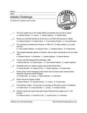
Alaska Challenge
In this Alaska worksheet, students complete 10 multiple choice questions about the state of Alaska. A reference web site is given for additional activities.
Curated OER
Barack Obama
In this online interactive Barack Obama instructional activity, students respond to 15 fill in the blank and multiple choice questions regarding the information included in the provided paragraphs.
Curated OER
Florida: U.S. Geography for Kids
In this Florida geography worksheet, students locate and label the important features of Florida and create icons for the economy and culture of Florida.
Curated OER
U.S. Commonwealths and Territories
In this Puerto Rico worksheet, students follow directions to create icons and label cities on a map of Puerto Rico. Students follow 5 sets of directions.
Curated OER
The Post Office
In this Post Office worksheet, students read a short text with information about the history of mail delivery in the United States. Students answer 4 multiple choice questions. Note: The word "congress" in question 2 is a proper noun and...
Curated OER
Exploring a Map of Canada
In this exploring a map of Canada worksheet, students find and label the capital city, bodies of water, the U.S., the provinces and the territories of Canada.
Curated OER
Georgia Vocabulary
In this Georgia worksheet, students match vocabulary words having to do with Georgia's famous people, places, and history to sentences that describe them. Students match 10 words.
Curated OER
Michigan Vocabulary
In this Michigan worksheet, students match vocabulary words that represent Michigan's history to their descriptions. Students match 10 words.
Curated OER
Michigan Crossword
In this Michigan worksheet, students answer questions about Michigan's history in a crossword. Students answer 9 questions in a crossword.


