Curated OER
"Place the State" Game
Students participate in a computer game in which they locate and place the U.S. states on a blank outline map. In small groups, they take turns dragging and dropping the states in the proper location on a map.
Curated OER
Living Swamps, Bayous and Forests
Third graders explore interesting environments by exploring Louisiana. In this wetland lesson, 3rd graders utilize the web to research the State of Louisiana, the bayous in the area, and the Gulf of Mexico. Students write a journal entry...
Curated OER
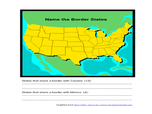
Identifying Border States of the U.S.
For this identifying border states of the U.S. worksheet, 3rd graders visually identify then write the names of the states that border Canada and Mexico; page 1 is a lesson, page 2 is the worksheet.
Curated OER
Summertime Travel
Third graders write about a summer event they participated in. For this paragraph writing lesson, the teacher models how to write about a place they have visited. Students then write their own paragraphs. Students will point out on...
Curated OER
World Map and Globe- Introduction to Symbols
Young scholars investigate picture symbols. In this symbols instructional activity, students define symbols and discuss symbols that they see in everyday life. Young scholars identify symbols on maps by using post-it notes.
Curated OER
Degree Confluence Project: At the Intersection of Geography and Technology
Students participate in a Longitude-meets-latitude project comes together on the Web!
Curated OER
Landforms By Hand: Geography, Map Skills
Students experiment with landform vocabulary by using their own hands and a bar of soap as media.
Curated OER
Geography General Space
Learners use jump ropes to form the state or country of the teacher's choice. When they finish, all students stand around the capital of the state
Curated OER
Geography: Flat Out Wird
In this maps worksheet, students answer short answer questions about comparing a map to a crumpled up piece of paper. Students answer 3 questions.
Curated OER
States And Shapes
Students work together and investigate the shapes of 50 states. They identify the states that they find hardest to recognize. The group then list the states in order from most difficult to just difficult to recognize and create a...
Curated OER
Walking the Five Themes - Your Community to Ours
Students in two classrooms share information about their communities in classrooms throughout the year. In groups, they identify the physical and human characteristics of each area and how they change through time. They also discover the...
Curated OER
Village Children in Northern Pakistan
Student use maps to answer geographic questions. They analyze Earth's surface by using a map to identify physical features that lead to different transportation routes. Student create a collage to show geographic insight into the topic...
Curated OER
Hawaii State Map
In this Hawaii state map learning exercise, students color and label important locations and physical features on the map of the 8 islands of Hawaii.
Curated OER
State Capitals Quiz- Social Studies Geography Lesson Plan Grades 3-6
Students take an online multiple choice quiz on the state capitals. There are fifty multiple choice questions. After the quiz is over, students can print out the results.
Curated OER
World: Continents
In this blank outline map worksheet, students note the political boundaries of the continents of the world on a Robinson projection map.
Curated OER
World: Continents Map
In this outline map worksheet, students note the political boundaries of the continents of the world. The map is labeled with the names of the 7 continents.
Curated OER
Geography: Why Is the Sacremento Valley a Good Place to Grow Rice?
Third graders locate the Sacramento Valley in California where rice is grown. In this rice growing location lesson, 3rd graders locate the Sacremento Valley, California on a map, and color the mountain ranges and terrain that is around...
Space Awareness
Let's Map the Earth
Before maps went mobile, people actually had to learn how to read maps. Pupils look at map elements in order to understand how to read them and locate specific locations. Finally, young cartographers discover how to make aerial maps.
EngageNY
Reading Maps: Locating the Countries We Have Been Reading About
Show your class how to read a map and decipher all of the markings and features. Start out by connecting maps to their homework from the night before and their current reading, in this case That Book Woman, and a related informational...
Curated OER
The Seven Continents Scavenger Hunt
Who doesn't enjoy an engaging scavenger hunt? Here, scholars listen to, and discuss, the informative text, Where is my Continent? by Robin Nelson. They then explore the seven continents and four major oceans using...
Curated OER
Conejito
Third graders read the story "Conejito" and write a descriptive story about the rainforest in Panama. They answer story comprehension questions, complete worksheet questions about a map of Panama, and rewrite a paragraph changing the...
Curated OER
A Touch of Green: St. Patrick's Day in the Classroom
Try these ideas to add some Irish flair to your classroom this St. Patrick's Day.
California Academy of Science
Which Way is North?
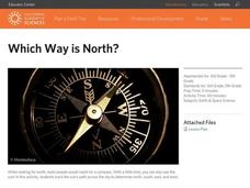
Who needs a compass to find cardinal directions? Just place a stick in the ground and record the movement of its shadow over the course of a day. Then, measure the shadow lengths in order to determine a north-south line. A simple...
Curated OER
Rivers and Streams
Students research the rivers, streams and water bodies of Hawaii. They read a variety of books, play Bingo with water-related terms, create and maintain water-themed journals, view videos, conduct Internet research and participate in a...
Other popular searches
- Five Themes of Geography
- U.s. Geography
- China Geography
- Africa Geography
- Mexico Geography
- Canada Geography
- Asia Geography
- France Geography
- Japan Geography
- World Map
- Ireland Geography
- Geography Studies


