Curated OER
Roman Archy
Third graders use Google Earth to examine Roman architecture. In this ancient Rome lesson, 3rd graders visit the noted URLs to look at examples of Roman architecture. Students work in teams to examine data about the structures.
Curated OER
Halloween Art Lessons: Explore the Mystery of Masks
Halloween art projects take a mysterious turn as students discover the mystery and magic behind mask traditions around the world
Curated OER
Know Your Boundaries: Earthquake Lessons in the Classroom
With all the recent attention on Haiti, and now Chile, it is the perfect time to teach your students about earthquakes!
Curated OER
It's Census Time: Census Lesson Plans
Census lesson plans can provide an interdisciplinary look at how the data is used, and what it means for everyone.
Curated OER
Travel Magazines in the Classroom
You can use travel magazines as a means to address a variety of standards.
Curated OER
Saving the Rainforest One Plant at a Time
Students can benefit from an exploration of the plants with medicinal properties found in the rainforest.
Curated OER
Five Summer Projects to Keep Students Learning
With the right projects, summer learning can be fun and motivating.
Curated OER
World Oceans Day in the Classroom
The ocean is a fascinating topic for students to cover.
Curated OER
Projects For USA Units
Students study different regions of the United states through interdisciplinary activities. This lesson presents very creative, artistic ways for students to explore the variety of regions found in the United States.
Curated OER
In My Own Backyard
Students explore the soil and vegetation found in their home and/or school environment and map a familiar area. Each group is assigned a section of the schoolyard. They draw maps of their assigned places and gather soil and vegetation...
Curated OER
Statue of Liberty
Students discuss aspects of the Statue of Liberty and create their own personalized statue. Students use symbols to represent themselves in their own drawings of the Statue of Liberty.
Curated OER
Ancient Egypt
Young scholars use the internet to gather information on Ancient Egypt. Using this information, they create their own name cartouche using markers and construction paper. They also make pyramid cutouts and draw pictures of the Great Sphinx.
Curated OER
Back to School Alphabet Activity
In this back to school worksheet, students arrange 20 words that pertain to the beginning of the school year in alphabetical order. Note: Although these are common nouns, the words are capitalized.
Curated OER
Students as Consumers: The Relationships Between Communities
Students survey the clothing they are wearing to determine where it was made. They work in groups to locate the countries where the clothing was manufactured, develop questions about what makes a good purchase and work with a buddy class...
Curated OER
Mummies Made in Egypt
Students use maps to locate information on Egypt, then create their own maps to display knowledge gained from the lesson plan and Web sites. They recognize, create, and describe the pyramid's geometric shape in three-dimensional forms.
Curated OER
America the Beautiful
Students listen to a read-aloud discussing the landmarks of the United States. In pairs, they use the internet to research a landmark of their choice. They create a visual aid to be given with a presentation sharing the information...
Curated OER
Learning About the Equator, The Seven Continents and the Four Oceans
Students use a globe or map to locate the equator, oceans and continents. Using the internet, they spend time surfing through predetermined websites on continents and oceans. They write facts on different parts of the globe on index...
Curated OER
Community Cartography
Learners use an inflatable globe which they wrap in plastic wrap. They use a permanent marker and outline the continents, and label major oceans and trace the equator. Students bring heir globes and use their projection for a discussion...
Curated OER
Matching the Globe with the Map
Students examine how to use a globe. In this globe and map comparison lesson, students discuss how the globe and map are alike when looking at Africa and Antarctica. Students investigate shapes and sizes of globes versus maps.
Curated OER
Reading the Landscape in Children's Literature
Students identify geographical information about landscapes found in student literature, demonstrate an organizing tool, developed around geographical themes, for the recording of information, and share uses of this approach.
Curated OER
FRED the FISH
Pupils engage in the study of the human impact on environmental systems (specifically rivers). This lesson plan enhances Students' exploration of a variety of themes or topics.
Curated OER
Seas, Gulfs and Bays
Students define gulf, bay, and sea. In this bodies of water mapping instructional activity, students locate seas, gulfs and bays and explain how they knew which body of water it was.
Curated OER
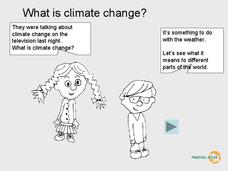
What is Climate Change?
Students research climate change. In this environmental lesson, students view a PowerPoint slideshow about climate change and identify the ways that climate change affects life on Earth.
Curated OER
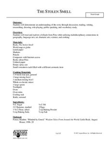
The Stolen Smell
Third graders read the story The Stolen Smell, and complete language arts activities based on the book. In this The Stolen Smell lesson plan, 3rd graders complete activities such as discussion, reading, researching, drawing, role...
Other popular searches
- Five Themes of Geography
- U.s. Geography
- China Geography
- Africa Geography
- Mexico Geography
- Canada Geography
- Asia Geography
- France Geography
- Japan Geography
- World Map
- Ireland Geography
- Geography Studies

