Curated OER
Experiencing Nature
Students create their own landscapes based on the topography of their region after studying the artwork of Cincinnati-based artist William Sonntag and other "Hudson River School" artists.
Curated OER
Women
A close study of two works of art provides the introduction to this cross-curricular writing assignment. After comparing the clothing, facial expressions, body language, setting, and color in the two 19th century paintings Tissout’s...
Curated OER
India
Take a mental trip to India with your class. But before you go, review some basics about Indian culture. Several facts, a break down of the Indian flag, and a list of words adopted from India are all provided. Tip: Adding rich images...
Curated OER
Japan
Introduce your class to the beauty, population, architecture, and special places of Japan. They'll learn about the currency, the weather, and how Japan is different or similar to New Zealand. Note: While this presentation makes...
Curated OER
When Were Houses in our Locality Built?
Take a look at the types of houses to determine when they may have been built. This UK-based slide-show shows houses common to Great Britain such as, Tudor, Victorian, 1930's, and Modern styles. This could be used as a compare and...
Curated OER
Wet World in Danger
Students investigate the reasons why wetlands are threatened especially by people. They study the wise use of water to preserve wetlands.
Curated OER
Heading South
Students study the concept of animal migration with the change of seasons. They discover that migration can be hazardous, and the distance migrated can be short or long.
Curated OER
Corn Exports Visually
Learners study imports and exports and the countries that import the most corn from the U.S. They construct mini paper corn plants and label a map with these plants to represent the amount of corn the U.S. exports to countries around the...
Curated OER
"Place the State" Game
Students participate in a computer game in which they locate and place the U.S. states on a blank outline map. In small groups, they take turns dragging and dropping the states in the proper location on a map.
Curated OER
States And Shapes
Students work together and investigate the shapes of 50 states. They identify the states that they find hardest to recognize. The group then list the states in order from most difficult to just difficult to recognize and create a...
Curated OER
Land Elevation
Students investigate land elevation. In this map skills lesson, students use a physical map to identify various elevations of the land. Students find landform features such hills and coastlines.
Curated OER
Identifying Border States of the U.S.
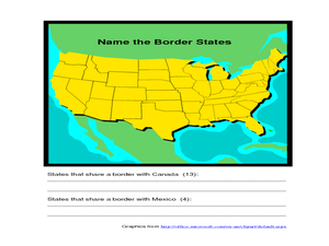
For this identifying border states of the U.S. worksheet, 3rd graders visually identify then write the names of the states that border Canada and Mexico; page 1 is a lesson, page 2 is the worksheet.
Curated OER
Mural Mania
Students research and discuss symbols and features of their state. They create a mural representing their state and design a quarter for their state.
Curated OER
Canada Geography
In this Canadian provinces activity, students research the provinces in Canada and write the names on the lines below and then write them on the map.
Curated OER
Walking the Five Themes - Your Community to Ours
Students in two classrooms share information about their communities in classrooms throughout the year. In groups, they identify the physical and human characteristics of each area and how they change through time. They also discover the...
Curated OER
Village Children in Northern Pakistan
Student use maps to answer geographic questions. They analyze Earth's surface by using a map to identify physical features that lead to different transportation routes. Student create a collage to show geographic insight into the topic...
Curated OER
Hawaii State Map
In this Hawaii state map learning exercise, students color and label important locations and physical features on the map of the 8 islands of Hawaii.
Curated OER
World: Continents
In this blank outline map worksheet, students note the political boundaries of the continents of the world on a Robinson projection map.
Curated OER
World: Continents Map
In this outline map worksheet, students note the political boundaries of the continents of the world. The map is labeled with the names of the 7 continents.
Curated OER
United States Map- Land Elevation
Students explore a physical map. In this map skills lesson, students discuss examples of elevation and investigate the symbols used to identify elevation on a map. Students use the map to identify various land elevations.
Curated OER
Let's Study Outdoors - Outdoor Classroom
Learners research native plants. They identify the plant by scientific name, size, amount of water needed and color. Pupils measure and plot an area of school property. Students create an outdoor classroom. Additional cross curriculum...
Curated OER
social studies: Life in Colonial America
Students explore the trials and tribulations early colonial life and note its successes. Through literature, Internet research, and interactive software, they engage in various activities to evaluate early social and cultural development.
Curated OER
Globe Game
Students are arranged into groups and are given a map or globe. Students select a location on the map. Students as yes and no questions to guess the specific place that was chosen.
Curated OER
Read a Fall Foliage Map
Students examine the purpose of a color key and use a color key to help them read a map.
Other popular searches
- World Geography Studies
- Geography Studies the Sea
- Geography Studies Rocks
- Elementary Geography Studies
- Geography Studies Cd Rom
- Social Studies Geography
- Social Studies Us Geography
- Social Studies and Geography
- Social Studies Maps Geography
