PBS
Make a Balloon Globe
"We've got the whole world in our hands," is what your students will be singing after completing this fun geography activity. Using the included templates for the seven continents and a balloon, they create their very own globes.
Curated OER
Geography Awareness Week: Practice Mapping Skills
You won't get lost, after learning map skills during Geography Awareness Week.
Curated OER
Japan: Images of a People
Students learn the geography of Japan and its location in reference to the United States.
Curated OER
Traveling on the Sea of Gold: An Adventure in Japan Through Literature
Learners explore the geography and culture of Japan through the story "Sea of Gold" by Yoshiko Uchida. They draw a travel poster of Japan, label a map of Japan, use chopsticks to eat Cheerios, read and discuss various books about Japan,...
Curated OER
Rice Farming in Texas
Third graders explore how rice farming came to Texas. In this rice farming lesson, 3rd graders discover the history of how farmers began to grow rice in the United States. Students color code maps and create a timeline for rice farming...
Curated OER
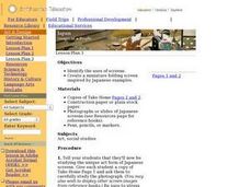
Japan and Art
Students discuss the art of Japan as it relates to Japanese culture and geography and then create individual postcards reflecting the information learned from the instructional activity. This instructional activity includes possible...
Curated OER
Yours, Mine, and Ours
Young scholars explore the five themes of geography while they conduct Internet research to compare and contrast their city, region, or country with the city and region of Nagano, Japan.
Curated OER
You Too Can Haiku
Students explore the country of Japan. In this international studies activity, students utilize their geography skills to locate Japan on a map. Students explore some Japanese customs and communities. Students use descriptive...
Curated OER
Origami Paper Fun
Students explore the art of Origami. They listen to various stories about Japan, create Origami shapes by following step-by-step directions, sing Japanese songs, locate Japan on a map, and take a quiz.
Curated OER
Country: Japan
Learners observe live Webcam views of Japan. They study its economy, government, and culture through paintings and facts. They label a map of Japan with its cities and rivers.
Curated OER
Japan: A Cultural Study
Third graders "take a trip" to Japan. They discover what life is like for a typical Japanese child and compare/contrast it to life in America. They give an oral presentation of Japanese holidays and festivals.
Curated OER
Exploring Japan Through Learning Centers
Young scholars explore the Japanese culture and literature through various learning centers. They compare and contrast story details in two stories and complete a Venn diagram. After comparing the stories, they rotate to different...
Curated OER
Children in the United States and Japan
Students locate Japan on a map or globe and describe the relative location of Japan. They use the Internet to investigate cultural characteristics of children in the United States and in Japan. They use a Venn Diagram as an...
Curated OER
Identifying Island Countries
Students discover the definition of an island and identify island countries around the world. In this geography lesson, students determine the characteristics of an island. Finally the students will identify specific island countries,...
Curated OER
Geography: Japan Project Online Lesson, Part 2
Students, in small groups, create and exchange map questions and share them with students in Japan. After examining the maps, they compare and contrast the two maps on the county Web Board. Students use a rubric to evaluate their answers.
Curated OER
Corn Exports Visually
Learners study imports and exports and the countries that import the most corn from the U.S. They construct mini paper corn plants and label a map with these plants to represent the amount of corn the U.S. exports to countries around the...
Curated OER
Mapwork: A Place In the News
Students determine how to find geographic information about places they read about in the news. In this geography lesson, students look at political and physical maps to determine the difference. They access maps online to find the...
Curated OER
If These Walls Could Talk: Seeing a Culture Through Human Features
Students read Talking Walls and discuss the walls presented and their importance to the culture. In this geography lesson, students locate and label each country/continent discussed in the book on a world map. Students take a walk and...
Curated OER
Through Time: Change in Sedona
Students locate events on a timeline of Sedona, Arizona and describe human and physical characteristics of the city. In this Sedona lesson plan, students locate the city on a map and listen to stories about Sedona.
Curated OER
Island Countries
Students define the meaning of an island. In this island mapping lesson, students identify islands on the map. Students discuss the sizes of various islands.
Enchanted Learning
Enchanted Learning: Activities on Japan
This collection of K-3 activities about Japan includes an English/Japanese Picture Dictionary, the colors in Japanese, a Zoom School feature on Japan, Japanese origami, Japanese artists, maps, coloring pages, and more.
Japanese Ministry of Foreign Affairs
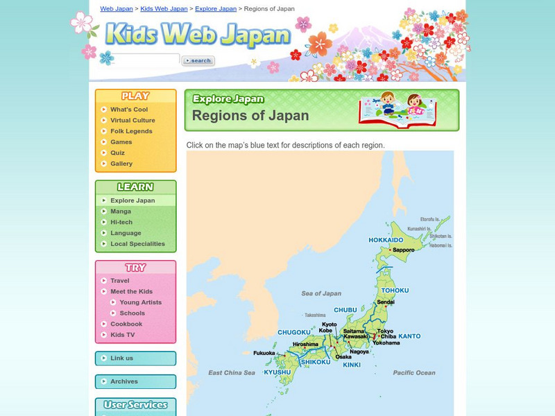
Web Japan: Regions of Japan
Here is a map showing the nine regions of Japan followed by a brief discussion of the regions and their cultures.
National Geographic Kids
National Geographic Kids: Asia: Japan
Welcome to Japan ! Follow this interactive overview of the country's history, geography, people, government, nature, and more. A map and video are included.
Other
The Wonders of Eurasia on Kamchatka
"Kamchatka, a peninsula comparable in size to Japan, is washed by the Pacific Ocean and the Bering and Okhotskoe Seas." This site provides good geographical information about Eurasia with clickable links for maps and more related pages.


