University of Texas
Let's Go to Argentina/¡Vámonos a Argentina!
Give your young Spanish language learners a lesson in culture! Focus on learning Spanish though exploring Argentinian culture. Pupils interact with maps, fill out travel journals, discuss time and food, learn and practice new vocabulary...
Curated OER
World Map and Globe - Lesson 15 (K-3)
Students discover mountain ranges and their locations in the world. In this physical map lesson, students locate and identify major mountain ranges of the world on a large physical map.
Curated OER
Continents and Oceans
Students identify oceans and continents and their locations on a map. They color-code and label their own map of the world's continents and oceans. They play the game Continents and Oceans to identify specific areas.
Curated OER
Things That Stick Out Or: How To Find Your Way Around on a Map
Students explain the meaning of and recognize the map outlines of a peninsula, an isthmus, and a cape.
Curated OER
Pets Around the World
Students communicate via e-mail with other students to learn about pets, animals of interest , and geography from different parts of the world. Vocabulary focuses on rural, urban, and suburban areas.
Curated OER
Instruments From Around the World
How much does the environment affect how and what man creates? Children explore the effect of the environment on primitive man as they research raw materials from a specific location. They use their findings to write a short essay about...
Curated OER
El Mundo Hispano
Colorful maps are clearly labeled in this PowerPoint to show viewers where different Hispanic countries are located within Central and South America. Each country is listed on its own slide with a title, the capital, close-up map, flag,...
Curated OER
Math with Maps and Globes
Students round out their math skills with these ‘round the world' ideas. In this math and geography lesson, students try out time zone sticks, a polar race, and tic-tac-globe to engage them in learning more about globes and the...
Curated OER
Continents and Oceans
In this geography worksheet, students read a paragraph and learn about the seven continents and five oceans of the world. Students study a map of the world and answer 12 short answer questions. This is an online interactive worksheet.
Curated OER
The Continents and Oceans of the World
Students explore world mapping skills. In this world geography lesson, students identify and label the continents and oceans on a world map using the Visual Thesaurus. Students generate mnemonic devices to help memorize these terms.
Curated OER
Say Hello! Around the World
Hello! Bonjour! Paivaa! Ni hao! Teach learners of all ages how to say hello in several different languages. There are project ideas for younger learners and older learners. Kids love learning a different language, even if it's just this...
Curated OER
Where in the World Is…
Students identify countries, oceans, states, and more on a globe and on a flat map. In this geography lesson plan, students also locate places around their school.
Curated OER
Maps In Our Everyday Lives
Students break into groups and complete a chart about information on maps of their hometown.
Curated OER
How Far Is It?
Students use a map key to estimate the distance from Salt Lake City, Utah, to ten other cities. Then they use an online distance calculator to see how close their estimates come!
Curated OER
China Quest
Read and research information on China. Young researchers complete a knowledge hunt about China then locate and describe each location using directional words. They recognize the word meaning through context clues and application practice.
Curated OER
Map a World of Facts
Pupils mark ten places on a world map while they follow fun facts on the included printable sheet. They research using a variety of resources to determine the location of the ten places.
Curated OER
Matching the Globe with the Map
Students examine how to use a globe. In this globe and map comparison lesson, students discuss how the globe and map are alike when looking at Africa and Antarctica. Students investigate shapes and sizes of globes versus maps.
Curated OER
Voyage to the New World
Third graders investigate the history of North America by creating a map. For this world geography lesson, 3rd graders analyze the voyage Christopher Columbus took to arrive at the new world by creating a map of his...
Curated OER
African life VS American life: Food and 3rd World and 1st World counties
Third graders explore the difference in 3rd world and 1st world countries. For this social studies lesson, 3rd graders are divided into groups and given varying amounts of food. Students discuss the unfair distribution of the food....
Curated OER
Cinderella Map Key
Students design a map key in order to show where the different Cinderella stories have taken place. In this map key lesson plan, students place symbols on a map to show the diversity of the stories.
Curated OER
Lesson Design Archaeology- U.S. Map
Students examine the U.S. map and identify cultural areas. In this archaeology lesson, students locate cultural areas on the U.S. map and fill in the proper locations.
Curated OER
Learning About Our World
Students explore their world using the book "This is the Way We Go to School." They predict information about the story based on the title and pictures. Students label a world map with the names of continents and oceans. They write a set...
Curated OER
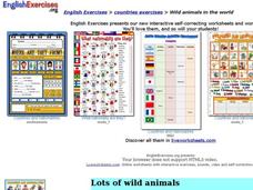
Wild Animals in the World
In this wild animals worksheet, students answer multiple choice map questions, choose the correct animal names for the pictures, and more. Students complete 4 activities.
Curated OER
Around the World in 5 Days
Students explore continents, draw map, discuss cultures, use research to learn geography, and investigate cultures.
Other popular searches
- World War Ii Map
- World War I Map
- World War 2 Map
- World War I Outline Map
- World Climate Map
- World Biomes Map
- World Outline Map
- Blank Map of the World
- World Political Map
- Ancient World Greece Map
- World Time Zone Map
- Deciduous Forests Map World


