Curated OER
International Festival: Greece
Students celebrate the culture of Greece. In this multicultural lesson, students participate in several activities which examine the culture of Greece. Students study the Greek alphabet, identify the country on a world map, and make...
Curated OER
The Great Lakes
In this geography worksheet, students read the names of the Great Lakes and then write them in the space provided. Students also answer 2 questions about The Great Lakes.
Curated OER
Continent of Africa
In this geography worksheet, learners examine a map of Africa and read about the characteristics of the continent. They use the map and information to answer 10 online fill in the blank questions.
Curated OER
United States Map- Map Legend/City Symbols
Students investigate the United States map. In this map skills geography lesson, students explore city symbols on the map legend and identify them. Students use post-it notes to mark various symbols.
Curated OER
Pack Your Bags: Explore South Carolina
Third graders investigate different counties in South Carolina. In this geography instructional activity, 3rd graders are assigned a county in South Carolina to research and identify important facts about the county. Students create a...
Curated OER
Around Your Town
Students use web sites to find information. In this geography instructional activity, students brainstorm a list of places in their community, talk about the way zoos are organized and explore the uniqueness of the fifty states in the...
Curated OER
Washington D.C.
Learners research monuments in Washington, D.C. In this geography lesson plan, students research one monument and use the Internet to gather information. Learners create a three-dimensional model of their monument.
Curated OER
Living By Water
Young scholars research a coastal community, locate it on a map and profile its physical, geography, climate, architecture and cultural characteristics. They envision this coastal community and make a detailed drawing of it by blending...
Curated OER
Can You Name the Region?
While just a picture of the Rocky Mountains, this presentation could be used as an introductory activity to a geography lesson. The series of slides begins with a piece of a complete picture which is revealed little by little, until the...
Curated OER
Geography: How do Louisiana Rice Farmers Help the Environment after they Harvest Rice?
Third graders study maps of the United States locating Louisiana, the East Coastal Plain, the Mississippi Alluvial Plain, the West Gulf Coastal Plain, and five of the main rivers. In this geography lesson, 3rd graders create a...
Curated OER
Mongolia Geography
Students examine the geography and culture of Mongolia. Individually, they cut out cut-outs of animals to place on their maps and label the grasslands and desert areas. They locate major cities and rivers along with vegetation.
Curated OER
Be a Geography Observor and Recorder
Students investigate the human and physical features of their school neighborhood. They observe the physical and man made features outside, make illustrations of their observations, and develop a class list of their observations.
Curated OER
World Map and Globe- Introduction to Symbols
Young scholars investigate picture symbols. In this symbols instructional activity, students define symbols and discuss symbols that they see in everyday life. Young scholars identify symbols on maps by using post-it notes.
Curated OER
Degree Confluence Project: At the Intersection of Geography and Technology
Students participate in a Longitude-meets-latitude project comes together on the Web!
Curated OER
Landforms By Hand: Geography, Map Skills
Students experiment with landform vocabulary by using their own hands and a bar of soap as media.
Curated OER
Geography General Space
Learners use jump ropes to form the state or country of the teacher's choice. When they finish, all students stand around the capital of the state
Curated OER
Geography: Flat Out Wird
In this maps worksheet, students answer short answer questions about comparing a map to a crumpled up piece of paper. Students answer 3 questions.
Curated OER
Village Children in Northern Pakistan
Student use maps to answer geographic questions. They analyze Earth's surface by using a map to identify physical features that lead to different transportation routes. Student create a collage to show geographic insight into the topic...
Curated OER
Hawaii State Map
In this Hawaii state map learning exercise, students color and label important locations and physical features on the map of the 8 islands of Hawaii.
Curated OER
World: Continents
In this blank outline map worksheet, students note the political boundaries of the continents of the world on a Robinson projection map.
Curated OER
World: Continents Map
In this outline map worksheet, students note the political boundaries of the continents of the world. The map is labeled with the names of the 7 continents.
Education World
Edible Resource Maps!
Young scholars discuss resource maps and examine examples from library resources. Working in groups, they create edible resource maps by drawing examples, such as popcorn on the border of Iowa and Nebraska. Then they use cookies in the...
Curated OER
Map Skills
Thirds graders reinforce that a map is a drawing that shows what a place looks like from above. They use a map key and symbols to create a map of the school and its neighborhood.
Core Knowledge Foundation
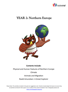
Year 2: Northern Europe
How is life in Northern Europe different from other areas of the world? Historians journey through the various regions of Northern Europe discovering what type of climate, animals, and lifestyles exist in that section of the world. They...


