Curated OER
Unit of Study Mural
Students make a mural after reading about the art of Diego Rivera. In this mural lesson plan, students read a book about Diego Rivera, discuss him and his artwork, and make their own class mural.
Curated OER
"Place the State" Game
Students participate in a computer game in which they locate and place the U.S. states on a blank outline map. In small groups, they take turns dragging and dropping the states in the proper location on a map.
Curated OER
Land Elevation
Students investigate land elevation. In this map skills lesson, students use a physical map to identify various elevations of the land. Students find landform features such hills and coastlines.
Curated OER
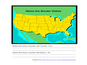
Identifying Border States of the U.S.
For this identifying border states of the U.S. worksheet, 3rd graders visually identify then write the names of the states that border Canada and Mexico; page 1 is a lesson, page 2 is the worksheet.
Curated OER
Truthfulness
Students investigate the concept of truthfulness. They practice the skill through seeing how truth is seen from other perspectives. Students are given a quotation to consider and spend time brainstorming with others about its meaning.
Curated OER
Geography: World Dynamics
Students discuss and examine how the world is changing. After reading an article, they discover the immediate changes that have taken place and how they have effected living things. They complete a worksheet identifying the changes as...
Curated OER
Japan: A Cultural Study
Third graders "take a trip" to Japan. They discover what life is like for a typical Japanese child and compare/contrast it to life in America. They give an oral presentation of Japanese holidays and festivals.
Curated OER
Edible Resource Maps
Third graders work in groups to create an edible resource map showing locations of at least five resources in the United States. Students research on the internet different regions and the resources that are found in those areas. They...
Curated OER
New Food Saves Lives, Could End Hunger
Learners locate the country of Niger, then read a news article about a new type of food that is being used to fight childhood hunger in Africa. In this current events lesson, the teacher introduces the article with map and vocabulary...
Curated OER
Fantastic Flying Journey
Third graders listen to a teacher reading of the "Fantastic Flying Journey." students research each country/continent using the Internet and creating a travel journal.
Curated OER
My Family Tree
Students create a family tree. For this ancestry lesson, students research a country that one of their ancestors is from. Students interview a grandparent and map out a family tree.
Curated OER
Michigan's Two Regions
Third graders use internet websites to compare/contrast the upper and lower pennisulas of Michigan. They read articles the characteristics of each area. Also, 3rd graders view pictures to investigatge the region, incuding the Straits of...
Curated OER
A History of the War of 1812 and The Star-Spangled Banner
Learners examine the causes and outcomes of the War of 1812, and determine the chronology of the Star-Spangled Banner. In this War of 1812 instructional activity, students learn vocabulary and read a narrative about the War of 1812...
Curated OER
A Tale of Two Towns
Students compare their community and region with other communities around the world. In small groups they complete a questionnaire about life in their community and correspond with e-pals, take digital pictures, conduct research on...
Curated OER
Bison Gone: Appreciating Natural Resources
Students examine the effects of the loss of the bison after the Europeans arrived in North America. They conduct a demonstration using beans to demonstrate the difference between the number of bison before and after the arrival of the...
Curated OER
Directions, Directions
Third graders review cardinal directions, moving around the room so that they are standing in the part of the room that is nearest the north, south, east and west. They are asked what would you do if they are lost? Pupils work as a...
Curated OER
Interdependence: A Colonial Example
Students complete a variety of activities related to Colonial America and how people lived at that time. They conduct research on a selected colonial trade and present an oral report as role-playing that craftsman, and participate in a...
Curated OER
Book: First Encounters Between Spain and the Americas: Two Worlds Meet
Students, after reading Chapter 1 in the book, "First Encounters Between Spain and the Americas: Two Worlds Meet," design and create a map of the Aztec Empire at the time of the first contract with the Spanish. They create the map from...
Curated OER
Tear the Continents
Students tear paper into representative continent shapes and configure them with world oceans through relative location, direction and latitude and longitude starting points. They recognize the shape of the continents. Students recognize...
Curated OER
New Year Celebrations Around the World
Students share their New Year's traditions, then read a news article about how people around the world celebrate the start of a new year. In this current events lesson, the teacher introduces the article with a discussion and vocabulary...
Curated OER
Can You Hear Me Now?
Students explore the industry involving communication and put communication devices into activities. In this communication lesson plan, students put items into chronological order, review primary sources, compare and contrast items, and...
Curated OER
An Honest Cigarette Ad?
Students recognize the intended audience for a certain advertisement They recognize advertising techniques aimed at the intended audience and create their own advertisements about the truth of cigarette smoking. Students begin to see...
Curated OER
My Little Island
Students engage in a lesson plan which features a video trip to the Caribbean Island of Montserrat to teach about the human and physical characteristics of place and human/environmental interactions between the two. Students create their...
Curated OER
What Do I Know About Islands
In this island research worksheet, students fill in a graphic organizer about the island of their choice. Students fill in two tables with advantages and disadvantages of living on the Rathlin Island and Hallig Oland. They write a...


