Curated OER
Physical Geography Wordsearch
In this physical geography word search worksheet, students find the hidden geographical features listed in the word bank. Students locate twelve words.
US Mint
Symbols in My Eyes
Explore the hidden meanings behind the images on US currency with this elementary school lesson on symbolism. Starting with a class discussion about symbols, children go on to brainstorm different objects that represent the Unites...
Curated OER
Body and Mind "Scapes"
Robert Harris' artwork is the focus of this interesting series. Each lesson examines his images of the land and the sea and leads into activities that center around geography and the environment. Pupils create pieces of music, and a...
Curated OER
State Capitals Quiz- Social Studies Geography Lesson Plan Grades 3-6
Students take an online multiple choice quiz on the state capitals. There are fifty multiple choice questions. After the quiz is over, students can print out the results.
Curated OER
Geography Puzzles
Students study the continents of the world. In this Internet geography lesson plan, students connect to online mapping games. Students collaborate in order to develop their understanding of world geography, including countries and...
Curated OER
U.S. Geography: The Midwest
Students research agricultural products of the Midwest. In this Midwest lesson, students watch a video about the geography of the Midwest, discuss how topographical features were formed and review the agricultural products the Midwest...
Curated OER
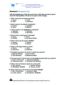
Worksheet 1: Geography Quiz
Students take a geography quiz and circle the multiple choice answer that answers each question correctly. The quiz is quite-challenging, and an atlas may be required to help the students. An answer sheet is provided.
Curated OER
Where In the World?
In this where in the world learning exercise, learners determine locations of continents on a world map. In this cut and paste learning exercise, students identify continents' locations on a world map.
Curated OER
Indiana State Map
In this state maps worksheet, students identify the state of Indiana and fill in the state capital, major cities, and other attractions in the state.
Curated OER
Our Country's Geography
Third graders study geography. In this United States landforms lesson, 3rd graders create a map of the U.S. made out of dough. They use various edible treats to mark the country's capital, the plains, the mountains and the rivers &...
Curated OER
Follow the Light
Here is another in the interesting series of lessons that use the special State Quarters as a learning tool. During this lesson plan, pupils learn about lighthouses, maps, the cardinal directions on a compass, and U.S. geography. There...
Space Awareness
How To Travel On Earth Without Getting Lost
Have you ever wanted to travel the world? Take a virtual trip with a geography lesson that uses longitude and latitude, the position of the sun, an astronomy app, and a classroom globe.
PBS
Arthur’s World Neighborhood: Bibliography for Kids
Support young learners as they expand their cultural awareness with this list of children's literature on countries from around the globe. Including both fictional and non-fictional texts. This resource will help...
Arcademics
Penguin Hop
It's a race to learn the state capitals. Using a multi-player video game, participants hop from iceberg to iceberg as penguins in response to questions about state capitals. The real-time practice lets both teacher and learner assess...
Scholastic
Volleyball Road Trip
Review coordinate mapping with your young geographers by matching cities on a volleyball team's road trip itinerary to their appropriate coordinate locations.
Curated OER
Learn the States and Postal Abbreviations
If you are preparing to cover the 50 states with your class, you don't want to miss this resource. It includes an excellent set of worksheets through which learners practice identifying states from their abbreviations and placing those...
Curated OER
Social Studies: Regions of the United States
Third graders create Powerpoint presentations of various geographic regions of the United States. They focus on the Northeast, Southeast, and Midwest regions. Students combine their individual slides into a class presentation.
Curated OER
Map Study
In this geography instructional activity, students study the United States. Students respond to 6 multiple choice questions about the map.
Curated OER
Geography With Dr. Seuss
Students read the book, The King's Stilts by Dr. Seuss and discuss the geographical information given in the book. Then they discuss and locate on a map the physical features that make up the continent of Africa. They create an original...
Curated OER
Made In...
Students investigate where their own items of clothing were manufactured. They read their clothing labels and identify the countries, and plot the locations with pins on a large world map.
Curated OER
The Mekong River
Junior geographers explore the region through which the Mekong flows, its pathway, the landscape, how people depend on the Mekong, and future uncertainties. They apply the five themes of geography to examine the region. They create a...
Curated OER
Where in the World Is Mexico?
Learners practice map-reading skills as they locate Mexico and its cities on a world map. By creating a puzzle out of a map of Mexico, students engage in a meaningful hands-on activity to help them explore that country's geography.
Denver Public Schools
Kung-hsi Fa-ts' ai! – A Chinese New Year Celebration
Looking for ideas for your Lunar New Year celebration? Check out an interdisciplinary unit of study that includes lessons in counting, calligraphy, culture, geography, literature, art, and music. Kung-hsi Fa-ts' ai! (May you...


