California Academy of Science
Guess That Spice
From medical treatments to cooking, people have been using herbs and spices for thousands of years. Perform a blind smell test of household herbs and spices to engage students in learning about ancient spice trading. Research the history...
Curated OER
How Many Ways Can You Say Merry Christmas?
Students create a multicultural holiday bulletin board map! students research and study saying Merry Christmas in different languages. They correctly locate the countries on a world map.
Curated OER
Play Doh Map of Your State
Young scholars create a state map using Playdoh. In this hands-on state geography lesson, students work in groups to form a three-dimensional map of their state using Playdoh made at home following a (given) recipe. Young scholars...
Curated OER
The High and the Flighty
Young scholars study women aviators and act out a talk show-style interview with one of them. They plot Amelia Earhart's flights on a map.
Curated OER
Crossroads of the Continent: Early Trade in Kansas
Young scholars study early Native American-European trade. They play bartering games to discover trade as an economic funtion, as well as other implications of trading one good for another.
Curated OER
Four Corners Mystery: Where In The World Are We?
Students research and describe various locations around the world using five fundamental themes of geography.
Curated OER
Putting the World in Perspective
Students work in small groups to: make a mental map of the world by tearing paper shapes of the seven continents and locating them on a flat surface in their relative positions, compare their finished mental map to a reference world map,...
Curated OER
Hide and Seek with Geocaching
Students locate objects using a Global Positioning System. In this global geography lesson, students explore latitude and longitude using a GPS in order to locate objects.
Curated OER
Reflections of Ancient Greece
Students study ancient Greek civilization. In this World history lesson, students locate Greece on a world map and review what the ancient Greeks did when they developed new ideas for government, science, philosophy, religion,...
Curated OER
Around the World
Young scholars discuss the major geographical and cultural differences in the world. In this social science lesson, students pretend they are traveling and research information about where they wish to stay by finding information about...
Curated OER
Ireland: the Emerald Isle
Third graders complete a unit of study that examines several perspectives of Ireland. They explore how climate shapes Irish culture, reference historical and political maps, compute exchange values for Irish money, complete worksheets,...
Curated OER
Day-to-Day Life in a Small African Village
Students experience just a bit of what it's like living in a village in Tanzania-from language to geography to health and hygiene issues. They compare aspects of school and home life in the United States with those in Tanzania and...
Curated OER
American Indians and Their Environment
Learners create a storyboard of the three American Indian language groups showing the geography of where they lived and how they adapted to the environment. They compare European and American Indian views of nature and explain how these...
Curated OER
Chinese Lion Dance
Students celebrate the Chinese New Year and listen to the story behind the Chinese Lion Dance. In this Chinese New Year lesson, students research the geography and culture of China. Students create puppets, dance the Lion...
Curated OER
What State Are You In?
Students identify the major U.S. cities. In this U.S. geography instructional activity, students work in pairs and use game cards to name various cities in the United States.
Curated OER
Waldseemuller's Map: World 1507
Students investigate the 1507 word map. In this world geography lesson, students examine the details of each section of the map and then draw conclusions about how the people of 1507 understood the world. Students are evalated on...
Curated OER
On the Road with Marco Polo
Young scholars follow Marco Polo's route to and from China. They explore the geography, local products, culture, and fascinating sites of those regions. They record their findings.
Curated OER
All about Greece
In this Greece worksheet, students learn and report about Greece. Activities include geography, natural resources, recipes, landmarks, history and climate. Students do their own research.
Curated OER
Establishing Borders: The Expansion of the United States 1846-48
Students investigate how the United States acquired land after the Revolutionary War ended. In this establishing borders lesson, students use maps to identify territories acquired by the US and the states that later developed. Students...
Curated OER
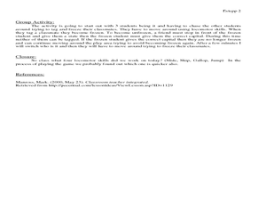
States and Capitals Activity
Students explore states and capitals. In this U.S. geography lesson, students practice locomotor skills playing Freeze Tag. Students generate the matching capital when given a specific state name in order to continue the game.
Curated OER
What is Currency?
Students study the history of currency and the monetary system of historic Akan people, who lived on the Atlantic coast of Africa. This outstanding series of lessons is multi-disciplinary and contains many activities for different...
Curated OER
Diversity
Students work in groups to research and prepare an oral report about a region. In this regions lesson plan, students find out about the geography, population, state capitals, and landmarks. Students assign attributes to the...
Curated OER
Countries of Africa
Students investigate the different countries of Africa. In this African geography lesson, students choose an African country to investigate and construct the country's flag. Students use a map of Africa to color in their country.
Curated OER
Journeys...The Voices of Change
Students trace the immigration patterns of their ancestors. They plot information on a world map, develop a timeline of target immigration patterns, research and write a report on immigration and participate in a class play.
